


Annapurna Circuit Trek


Trip Duration
16 Days Days
Group Sizes
2-16 People People
Transportation
Flight/Drive/Walk
Destination
Annapurna Circuit Trek
Max. Altitude
5416
Nature of Trip
Trekking
Best Season
Mar-May, Oct-Nov
Activities
- Trekking
- High Pass Crossing
- Cultural Immersion

Difficulty
Moderate
Meals
- Hotel/Teahouse Breakfast
- Teahouse Lunch
- Teahouse Dinner

Start & End Point
Kathmandu/Pokhara
Accommodation
- Teahouse
- Hotel
Overview of Annapurna Circuit Trek
 |
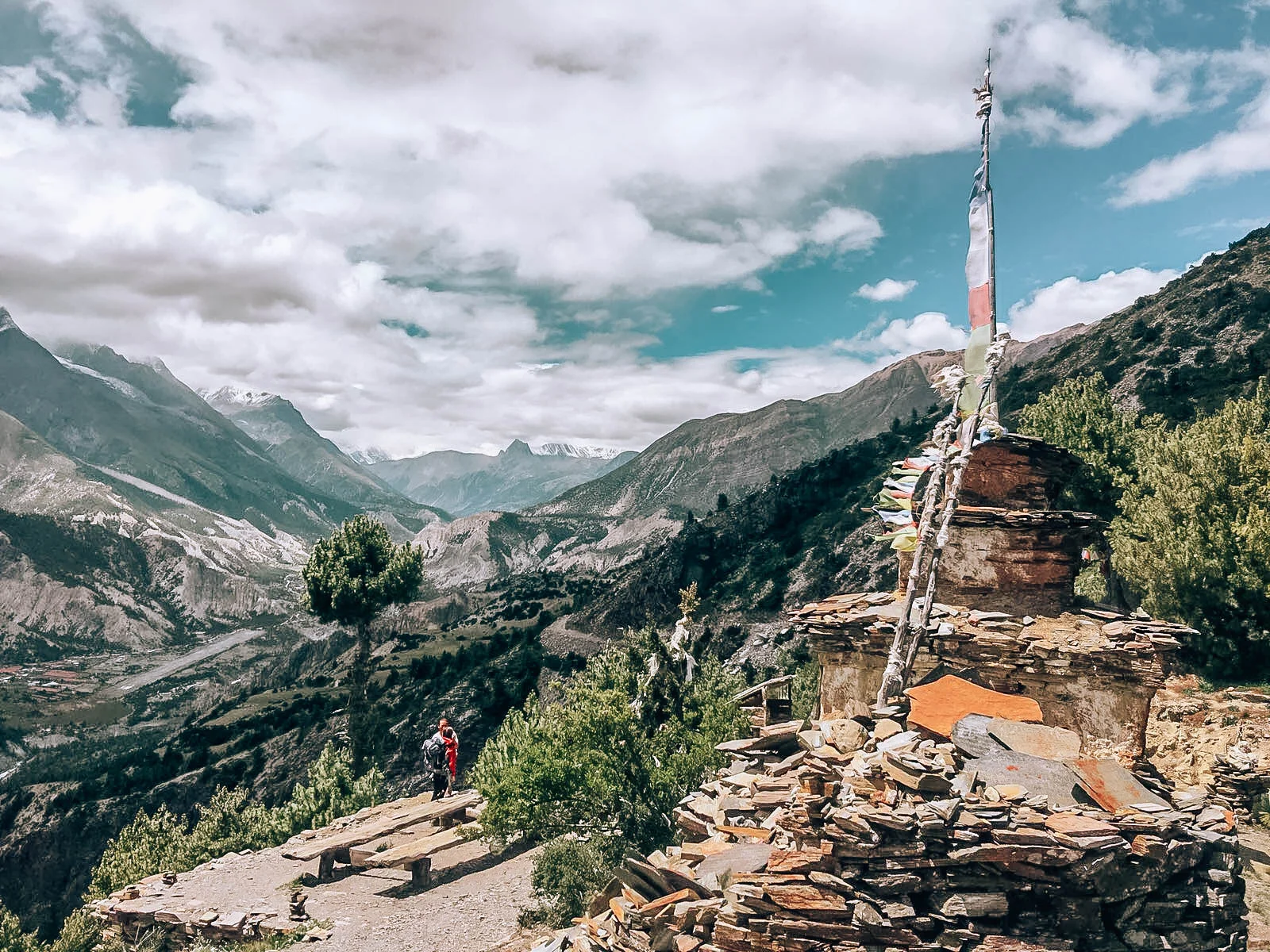 |
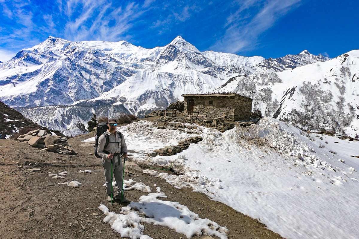
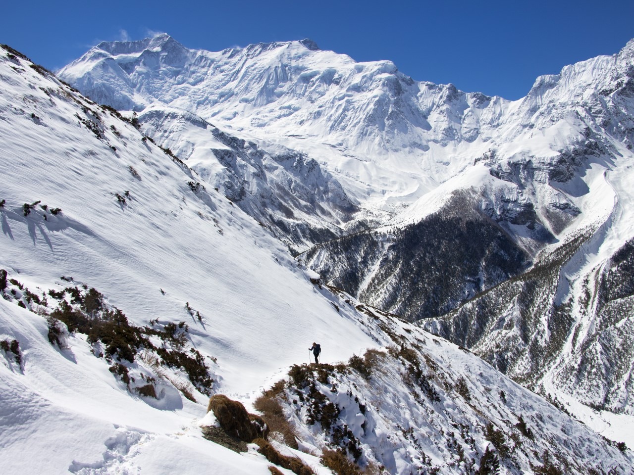
The Annapurna Circuit Trek is one of the world’s great long-distance trails, encircling the Annapurna massif through an extraordinary range of landscapes — from subtropical rice terraces and rhododendron forests to the arid high-altitude desert of the Kali Gandaki gorge and the permanent snowfields near the Thorong La pass (5,416m). The 16-day route passes through dozens of distinct ethnic communities: Gurung, Thakali, Manangi, and Tibetan-influenced Mustang border villages, each with unique architecture, cuisine, and spiritual traditions.
 |
 |
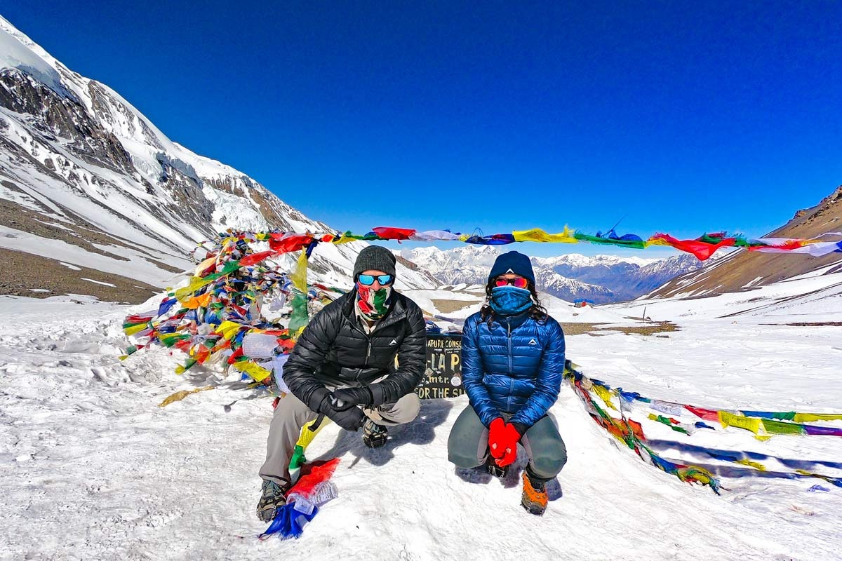
- Cross Thorong La Pass (5,416m) — one of the world’s highest trekking passes
- Walk through the Kali Gandaki Gorge — the world’s deepest river gorge
- Visit Muktinath temple, a sacred pilgrimage site for both Hindus and Buddhists
- Explore Manang village and acclimatise beneath the Annapurna III north face
- Dramatic landscape shift from subtropical jungle to high-altitude Tibetan plateau
- Descend through Marpha and Tatopani hot springs on the classic circuit finish
Itinerary of Annapurna Circuit Trek
Day 1: Fly Kathmandu to Pokhara — Drive to Besisahar (760m)
25-min flight to Pokhara then 3–4 hr drive to Besisahar, the circuit starting point.

Duration
Flight + Drive
Activity
Travel
Accommodation
Hotel/Guesthouse
Meals
L/D
Max Altitude
760mDay 2: Besisahar to Bahundanda (1,310m)
Trek begins through rice terraces and subtropical forest along the Marsyangdi river.
Duration
5-6 hrs
Activity
Trekking
Accommodation
Teahouse
Meals
B/L/D
Max Altitude
1310mDay 3: Bahundanda to Chamje (1,410m)
The valley narrows dramatically. Cross suspension bridges over the Marsyangdi and enter the gorge zone.
Duration
5-6 hrs
Activity
Trekking
Accommodation
Teahouse
Meals
B/L/D
Max Altitude
1410mDay 4: Chamje to Chame (2,670m)
Significant altitude gain through dramatic gorge scenery. First views of Annapurna II above. Chame is the district headquarters.
Duration
6-7 hrs
Activity
Trekking
Accommodation
Teahouse
Meals
B/L/D
Max Altitude
2670mDay 5: Chame to Pisang (3,300m)
The valley opens into the upper Marsyangdi. Spectacular views of the Annapurna east face and Paungda Danda rock face.
Duration
5-6 hrs
Activity
Trekking
Accommodation
Teahouse
Meals
B/L/D
Max Altitude
3300mDay 6: Pisang to Manang (3,500m)
Upper or lower trail option. Upper trail via Ghyaru offers spectacular Annapurna panoramas. Lower trail through forest to Manang.
Duration
5-6 hrs
Activity
Trekking
Accommodation
Teahouse
Meals
B/L/D
Max Altitude
3500mDay 7: Acclimatisation Day — Manang
Rest day in Manang. Hike to Praken Gompa (3,900m) or Ice Lake (4,600m) for acclimatisation. Altitude information lecture by local medics.
Duration
Acclimatisation
Activity
Rest/Hike
Accommodation
Teahouse
Meals
B/L/D
Max Altitude
4600mDay 8: Manang to Yak Kharka (4,110m)
Short but important altitude gain through open alpine meadows. Yak herds and High Himalayan scenery dominate.
Duration
3-4 hrs
Activity
Trekking
Accommodation
Teahouse
Meals
B/L/D
Max Altitude
4110mDay 9: Yak Kharka to Thorong Phedi (4,450m)
Final camp before the pass. Short walk to Thorong Phedi — the base of the Thorong La climb. Early dinner and bed.
Duration
3-4 hrs
Activity
Trekking
Accommodation
Teahouse
Meals
B/L/D
Max Altitude
4450mDay 10: Cross Thorong La (5,416m) — Descend to Muktinath (3,800m)
4am start. Climb 1,000m to Thorong La (5,416m) — one of the world’s highest trekking passes. Descend 1,600m to the sacred pilgrimage site of Muktinath temple.
Duration
8-9 hrs
Activity
Pass Crossing
Accommodation
Teahouse
Meals
B/L/D
Max Altitude
5416mDay 11: Muktinath to Marpha (2,670m)
Descend through Kagbeni and the dramatic Kali Gandaki Gorge to apple-orchard Marpha village. Sample Marpha brandy.
Duration
6-7 hrs
Activity
Trekking
Accommodation
Teahouse
Meals
B/L/D
Max Altitude
2670mDay 12: Marpha to Tatopani (1,190m)
Long descent through Jomsom, Ghasa, and Lete to the hot-spring village of Tatopani. Enjoy the thermal pools after the long trek.
Duration
7-8 hrs
Activity
Trekking
Accommodation
Teahouse
Meals
B/L/D
Max Altitude
1190mDay 13: Tatopani to Ghorepani (2,874m)
Steep climb from the subtropical river valley back into the rhododendron forest zone. Ghorepani is the gateway to Poon Hill.
Duration
6-7 hrs
Activity
Trekking
Accommodation
Teahouse
Meals
B/L/D
Max Altitude
2874mDay 14: Poon Hill Sunrise (3,210m) — Trek to Nayapul — Drive Pokhara
Pre-dawn ascent to Poon Hill for the classic Annapurna sunrise view. Descend to Nayapul then drive to Pokhara.
Duration
5 hrs trek + Drive
Activity
Trekking/Travel
Accommodation
Hotel
Meals
B/L/D
Max Altitude
3210mDay 15: Rest Day / Buffer — Pokhara
Rest in Pokhara lakeside. Buffer for weather delays. Optional boat trip on Phewa Lake.
Duration
Buffer
Activity
Rest
Accommodation
Hotel
Meals
B
Max Altitude
820mDay 16: Final Departure — Fly or Drive to Kathmandu
Fly or drive back to Kathmandu for international departure.
Duration
Departure
Activity
Travel
Accommodation
Hotel
Meals
B
Max Altitude
1400mIncludes/Excludes
What's included?
- 15 nights accommodation (2 hotel Kathmandu/Pokhara, 13 teahouse)
- Domestic flight Kathmandu–Pokhara plus ground transport
- All meals on trek
- Licensed English-speaking guide and porter
- ACAP permit and TIMS card
- First-aid kit and emergency evacuation plan
What's not included?
- International airfare and Nepal visa fees
- Travel and medical insurance (mandatory)
- Personal gear and clothing
- Tips for guide and porter
- Beverages and personal snacks
Annapurna Circuit Trek Altitude Chart
Trip Information - Good to Know
Best Time
Oct–Nov and Mar–May. Thorong La can be closed by snowfall November–March.
Permits
ACAP (NPR 3,000) + TIMS card (NPR 2,000).
Difficulty
Moderate. Thorong La crossing is the crux — 1,600m ascent on pass day (8–9 hrs). Good fitness essential.
Frequently Asked Questions
How hard is the Thorong La crossing?
The pass day is the hardest — 8–9 hours with 1,000m ascent to 5,416m starting at 4am. Well-acclimatised trekkers manage it well. Proper acclimatisation at Manang is essential.
Is the Annapurna Circuit still worth doing?
Despite road construction on sections, the trail remains one of the world’s great treks. The upper valley above Chame is largely road-free and extraordinarily beautiful.
What is the best direction?
Clockwise (described above) is standard — it gives a gradual ascent to Thorong La from the east and a direct descent to Muktinath.
What if Thorong La is closed?
Snow can close the pass, typically November–March. The guide will assess conditions. Most October–November crossings are clear.
Can I do this trek solo?
A licensed guide is not legally required on the Annapurna Circuit but is strongly recommended for safety, cultural interpretation, and navigation in remote sections.
Is the Kali Gandaki the deepest gorge in the world?
Yes — between Dhaulagiri (8,167m) and Annapurna I (8,091m), the Kali Gandaki river gorge drops over 5,500m in horizontal distance, making it the world’s deepest gorge by most measurements.
Trip Reviews
 Write a Review
- Best Price Guarantee
- Secure & easy booking
- Easy trip date changes
- Discount for groups


How to book a trip?

make free inquiry

confirm the trip
