


Dhaulagiri Circuit Trek

Trip Duration
21 Days Days
Group Sizes
2-12 People People
Transportation
Drive/Walk
Destination
Dhaulagiri Circuit Trek
Max. Altitude
5360
Nature of Trip
Trekking
Best Season
Mar-May, Oct-Nov
Activities
- Trekking
- High Pass Crossing
- Glacier

Difficulty
Challenging
Meals
- Hotel/Teahouse Breakfast
- Teahouse/Camp Lunch
- Teahouse/Camp Dinner

Start & End Point
Kathmandu/Pokhara
Accommodation
- Teahouse
- Camping
- Hotel
Overview of Dhaulagiri Circuit Trek
 |
 |
Overview
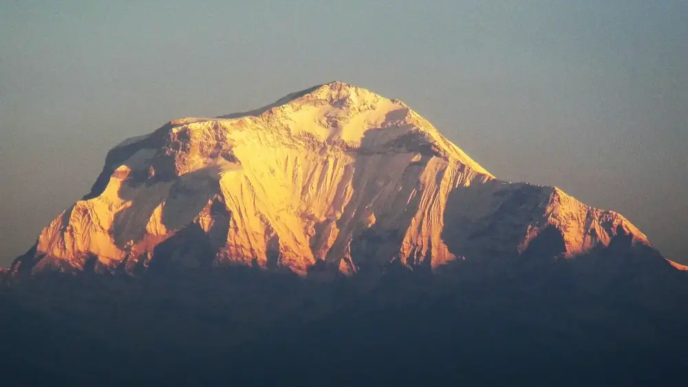
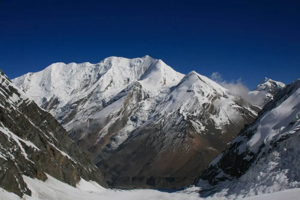
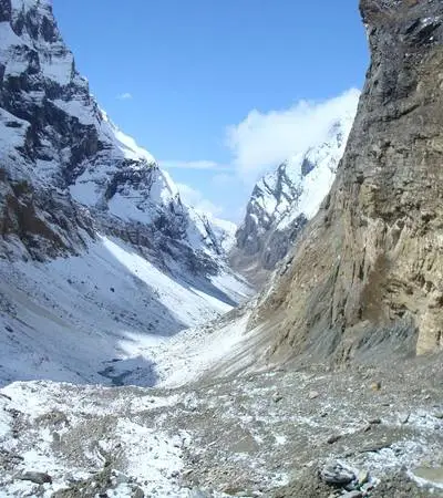
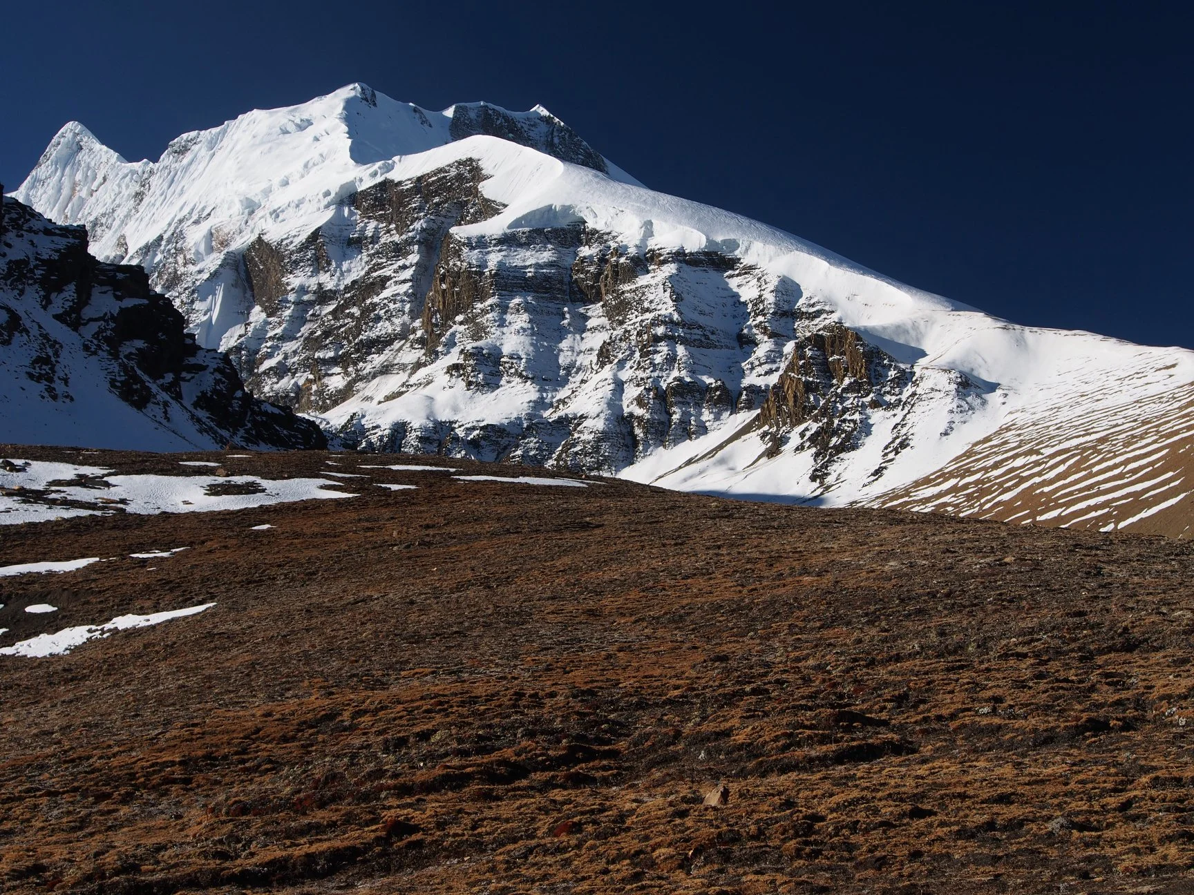
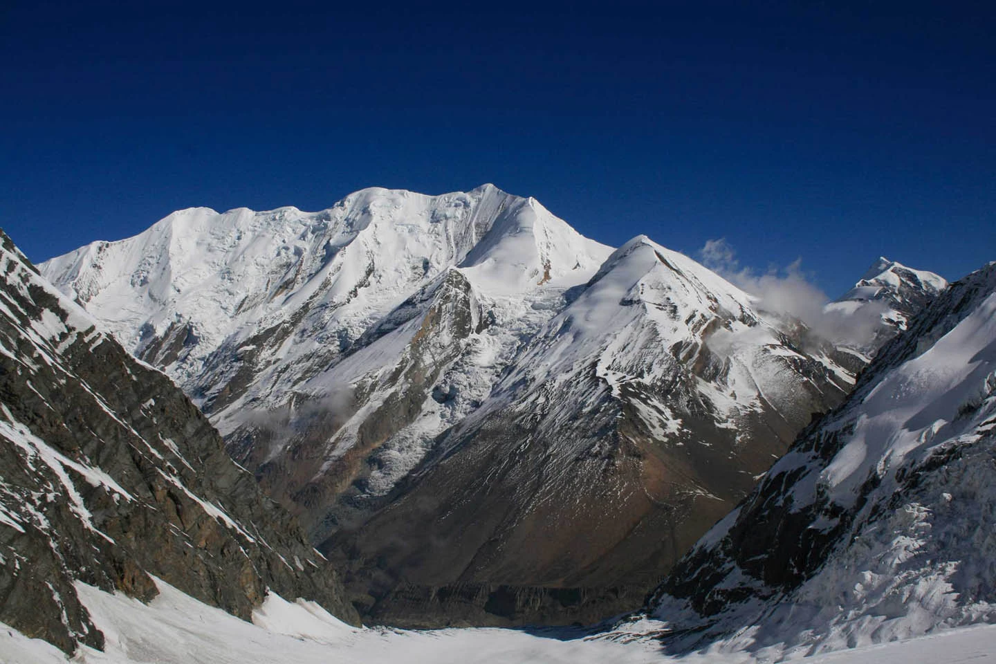
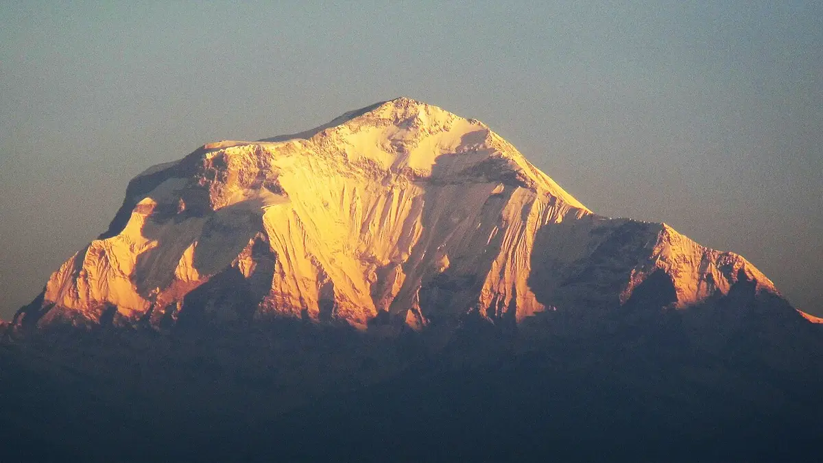
The Dhaulagiri Circuit Trek is one of the Himalayas’ most demanding and rewarding high-altitude circuits, circumnavigating Dhaulagiri I (8,167m) — the world’s seventh highest mountain — via the Italian Base Camp glacier and the French Pass (5,360m). The route crosses a dramatic glacier approach, reaches French Pass for a close-range panorama of Dhaulagiri’s full massif, and descends through the hidden Dhaulagiri icefall to the Kali Gandaki gorge. This is a true mountaineering-grade trek that demands prior high-altitude experience, full camping logistics, and excellent physical fitness.
Let us start with what most trek descriptions skip over. The Dhaulagiri Circuit is hard. Not in the way that the word gets thrown around by travel marketers trying to make a moderate hill walk sound adventurous, but genuinely, physically, and emotionally demanding in ways that will test the limits of people who are already fit, experienced, and mentally strong. You will spend two consecutive weeks sleeping in tents above 3,500 metres. You will cross two mountain passes above 5,200 metres on consecutive days, one of them at 5,360 metres with a glacier approach that requires careful footwork in the early morning dark. You will have no phone signal for most of it, no warm lodge to retreat to, and no easy exit once you are above the Italian Base Camp. The only way out is over the passes.
All of that said, people who finish this trek describe it as the most significant experience of their outdoor lives. The reason is simple: the Dhaulagiri Circuit takes you somewhere genuinely remote. Not ‘remote’ in the sense of three hours from the nearest airport, but remote in the sense of days of walking from the nearest road, through terrain that very few human beings have ever stood in. The Hidden Valley, that glacial plateau wedged between the French Pass and the Dhampus Pass at over 5,000 metres, is as close to the edge of the known world as most of us will ever get. There is nothing there. No paths worn by tourist feet, no tea stall, no signal, no safety net. Just ice and sky and the white wall of Dhaulagiri filling the southern horizon.
The route begins in Darbang, a small market town in the Myagdi district of western Nepal, and it ends at Jomsom in the Mustang district, from where a short flight brings you back to Pokhara. In between, you walk approximately 160 kilometres through subtropical forest, alpine meadow, glacial moraine, and high-altitude snow plateau. You visit three base camps used by mountaineering expeditions attacking Dhaulagiri I, the seventh-highest mountain on earth. You cross two of the highest trekking passes in Nepal. And you do all of it without ever seeing a crowd, because only a small number of trekkers attempt this route each year compared to the thousands who walk the Annapurna or Everest trails.
That is the honest version. If it still sounds like something you want to do, then read on. Every piece of information you need is in this guide.
The Trek in Numbers
| Detail | Information |
|---|---|
| Duration | 20 days from Kathmandu arrival to departure |
| Maximum Altitude | French Pass at 5,360 m / 17,585 ft |
| Second High Point | Dhampus Pass at 5,244 m / 17,205 ft |
| Trek Start | Darbang, Myagdi District (1,110 m / 3,641 ft) |
| Trek Finish | Jomsom, Mustang District (2,710 m / 8,891 ft) |
| Total Distance | Approximately 160 km / 100 miles of trail |
| Daily Walking Time | 5 to 8 hours per day, depending on the section |
| Trek Style | Full camping above Italian Base Camp, tea house below |
| Difficulty Rating | High Advanced. Prior high-altitude experience required |
| Best Season | Spring: late March to early June. Autumn: September to November |
| Minimum Age | 14 years with Guardian. 18 and above recommended |
| Permits Required | ACAP Permit and Dhaulagiri Restricted Area Permit |
| Typical Cost | USD 2,800 to USD 3,500 for a full-service package |
Why This Trek Is Unlike Anything Else in Nepal
Nepal has extraordinary trekking. The Annapurna Circuit, the Everest Base Camp trail, Manaslu, and Langtang. All of them deserve their reputations. But they also share something in common: you walk them alongside other people. On the Dhaulagiri Circuit, you might go three or four days without seeing another trekking group. The trail is poorly marked in sections. The terrain changes so radically, from steaming subtropical gorge to wind-scoured glacial plateau, that it feels less like a long walk and more like a journey through entirely different worlds stacked on top of each other.
There is also the sheer intimacy of spending this many days living with a small team. Your guide, your cook, your kitchen helpers, and your porters become genuinely important people to you. They wake before dawn to prepare breakfast in the cold. They carry loads that would buckle most people. They read the weather and the mountain in ways that no amount of training can replicate. The Dhaulagiri Circuit teaches you, among other things, how much you depend on others and how much strength those others are quietly carrying on your behalf.
The Trail’s Key Milestones
- Italian Base Camp at 3,660 m: the last point with any shelter structure, and the first place where the mountain truly reveals itself
- Japanese Base Camp at roughly 4,200 to 4,600 m: expedition terrain begins here, glacier moraine underfoot
- Dhaulagiri Base Camp at 4,740 m: standing at the base of the northwest face, looking 3,400 metres straight up to the summit
- French Pass at 5,360 m: the highest point of the trek and the gateway to the Hidden Valley
- Hidden Valley at approximately 5,100 m: one of the most remote places a non-technical trekker can reach in the world
- Dhampus Pass at 5,244 m: the final high crossing, opening suddenly onto the Annapurna panorama
- Marpha at 2,670 m: whitewashed houses, apple orchards, and the feeling of returning from somewhere very far away
- Jomsom at 2,710 m: end of the trek, start of the flight home, and a proper bed for the first time in almost two weeks
When to Go: An Honest Seasonal Guide
Timing matters more on the Dhaulagiri Circuit than on most treks in Nepal because the consequences of bad timing here are not merely uncomfortable; they can be genuinely dangerous. The French Pass in heavy snowfall is a different proposition from the French Pass in clear conditions. The lower gorge sections in monsoon conditions are prone to landslides and flooding that can make them impassable. The following seasonal breakdown is written to help you make a genuinely informed decision.
Spring: Late March through Early June
Spring is arguably the most rewarding season for this trek. The rhododendron forests in the lower Myagdi Valley are at their most spectacular from late March through April, entire hillsides shifting through red, pink, and white as you climb through them. Temperatures after the winter cold have begun to warm, which means days are comfortable for walking and nights at altitude, while cold, are manageable with the right equipment.
The snow on the passes in April and May is typically consolidated and navigable, which is actually preferable to summer conditions where daytime heat can turn late-season snow into a wet, heavy slog. May is generally regarded as the most reliable single month for weather stability on this route. The risk in spring is that snowfall can still occur in March and early April, and an unusually late monsoon onset in some years can affect the final week of treks that start in late May.
Autumn: Late September through Mid-November
After the monsoon retreats, the mountains emerge with a clarity that seems almost deliberate. October is the month most experienced guides on this route will recommend above all others. The air is crystal clear, visibility can stretch for hundreds of kilometres across the Himalayan horizon, and the temperature gradient between day and night is steep but manageable. The passes are clear of fresh snow through most of October and November, the trails are dry and firm after the summer rains, and the landscape has a golden, late-season quality that photographs beautifully.
November tightens the window progressively. By mid-November, the nights at the high camps are biting cold, and the first winter snows can arrive on the passes. Late October is probably the ideal single departure point for autumn trekkers who want optimal conditions on both the passes and the lower forest sections.
What to Avoid
The monsoon, which runs from mid-June through mid-September, makes the Dhaulagiri Circuit genuinely dangerous in the gorge sections and extremely unpleasant everywhere else. Trails become mudslides, rivers overflow their banks, and landslides are a realistic hazard in the lower Myagdi Valley. The passes can receive whiteout conditions and heavy snowfall. There are trekking companies that will offer to run this route in the monsoon if you ask them to; there are also companies that will sensibly decline.
Winter, from December through February, is not impossible but is extremely demanding in ways that go beyond the discomfort of cold. Overnight temperatures at the higher camps can drop below- 25 degrees Celsius. The passes can be buried under snow that requires mountaineering-level navigation. A handful of very experienced winter mountaineers complete the circuit each year, but it is not appropriate for the vast majority of trekkers and should not be attempted without winter high-altitude experience and specialised equipment.
 |
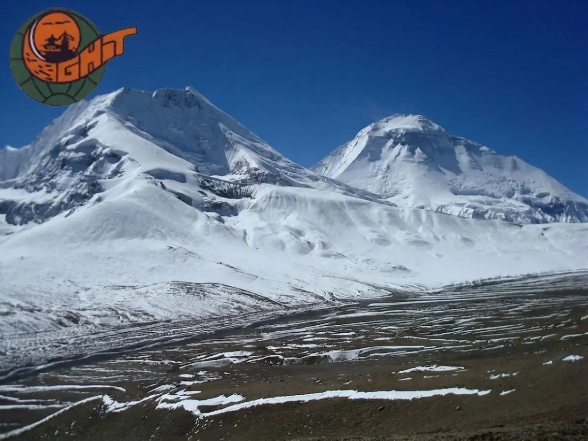 |
- Circuit of Dhaulagiri I (8,167m) — the 7th highest mountain — via two high passes
- Cross French Pass (5,360m) for an unobstructed view of the full Dhaulagiri massif
- Trek across the Italian Base Camp glacier — a rare glacier-crossing trekking experience
- Descend through the dramatic Dhaulagiri icefall to the Kali Gandaki gorge
- One of the most challenging and remote circuits in the entire Himalayan trekking system
- Combines with the Annapurna Circuit via the Kali Gandaki for an epic extended journey
Itinerary of Dhaulagiri Circuit Trek
Day 1: Drive Pokhara to Beni (830m) — Trek to Babiachaur
Drive to Beni then begin the Kali Gandaki approach. First night in the valley.

Duration
Drive + 2 hrs
Activity
Trekking
Accommodation
Teahouse
Meals
L/D
Max Altitude
830mDay 2: Babiachaur to Darbang (1,145m)
Trek along the Myagdi Khola valley through lower hill country.
Duration
5-6 hrs
Activity
Trekking
Accommodation
Teahouse
Meals
B/L/D
Max Altitude
1145mDay 3: Darbang to Muri (1,880m)
The valley narrows and altitude increases through dense forest.
Duration
5-6 hrs
Activity
Trekking
Accommodation
Teahouse
Meals
B/L/D
Max Altitude
1880mDay 4: Muri to Dhaulagiri Base Camp Trail — Camp at Sallaghari (2,500m)
Turn off toward the Dhaulagiri massif. Dense rhododendron forests and first views of the high peaks ahead.
Duration
5-6 hrs
Activity
Trekking
Accommodation
Camp
Meals
B/L/D
Max Altitude
2500mDay 5: Sallaghari to Italian Base Camp (3,660m)
Climb to the Italian Base Camp — the launch point for Dhaulagiri expeditions. Dramatic first view of Dhaulagiri I’s south face.
Duration
6-7 hrs
Activity
Trekking
Accommodation
Camp
Meals
B/L/D
Max Altitude
3660mDay 6: Rest and Acclimatisation — Italian Base Camp
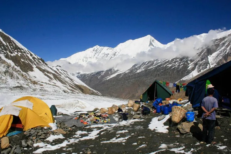
Rest day at Italian Base Camp. Explore the moraines and observe the Dhaulagiri massif. Begin equipment check for glacier crossing.
Duration
Acclimatisation
Activity
Rest
Accommodation
Camp
Meals
B/L/D
Max Altitude
3660mDay 7: Italian Base Camp to Glacier Camp (4,750m)
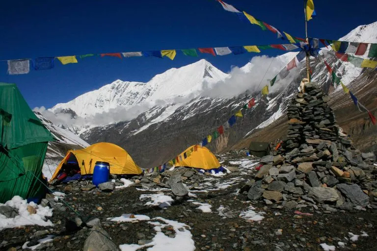
Move up onto the Dhaulagiri glacier. Crampons and rope may be needed. Camp on the glacier below the French Pass approach.
Duration
5-6 hrs
Activity
Glacier
Accommodation
Camp
Meals
B/L/D
Max Altitude
4750mDay 8: Cross French Pass (5,360m) — Descend to Yak Kharka (4,400m)
Cross the French Pass at 5,360m — the highest point of the circuit. Views of the full Dhaulagiri massif and east toward Annapurna. Steep descent to the Dhaulagiri icefall side.
Duration
7-8 hrs
Activity
Pass Crossing
Accommodation
Camp
Meals
B/L/D
Max Altitude
5360mDay 9: Yak Kharka to Hidden Valley (4,850m)
The mysterious Hidden Valley sits between the Dhaulagiri and Tukuche peaks — a remote high-altitude plateau visited by very few people.
Duration
4-5 hrs
Activity
Trekking
Accommodation
Camp
Meals
B/L/D
Max Altitude
4850mDay 10: Hidden Valley to Thapa Pass (5,200m) — Descend to Marpha (2,670m)
Cross the Thapa Pass for final views of the Dhaulagiri circuit and descend to the Kali Gandaki valley at Marpha — a dramatic change of environment.
Duration
7-8 hrs
Activity
Pass Crossing
Accommodation
Teahouse
Meals
B/L/D
Max Altitude
5200mDay 11: Marpha to Jomsom — Drive or Walk to Kagbeni
Rest in the apple-orchard village of Marpha. Continue down the Kali Gandaki.
Duration
2-3 hrs
Activity
Trekking
Accommodation
Teahouse
Meals
B/L/D
Max Altitude
2810mDay 12: Kagbeni to Muktinath (3,800m)
Climb to the sacred Muktinath temple — a fitting pilgrimage conclusion to the circuit.
Duration
4-5 hrs
Activity
Trekking
Accommodation
Teahouse
Meals
B/L/D
Max Altitude
3800mDay 13: Muktinath to Jomsom — Drive to Pokhara
Descend to Jomsom and drive through the Kali Gandaki gorge to Pokhara.
Duration
2 hrs + Drive
Activity
Travel
Accommodation
Hotel
Meals
B/L
Max Altitude
820mDay 14: Rest Day — Pokhara
Recovery day at Pokhara lakeside.
Duration
Rest
Activity
Rest
Accommodation
Hotel
Meals
B
Max Altitude
820mDay 15: Drive or Fly Pokhara to Kathmandu
Return to Kathmandu by 25-min flight or 6-hr bus.
Duration
Flight/Drive
Activity
Travel
Accommodation
Hotel
Meals
B
Max Altitude
1400mDay 16: Rest Day — Kathmandu
Recovery in Kathmandu. Expedition debrief.
Duration
Rest
Activity
Rest
Accommodation
Hotel
Meals
B
Max Altitude
1400mDay 17: Buffer Day 1
Buffer for weather and route delays.
Duration
Buffer
Activity
Rest
Accommodation
Hotel
Meals
B
Max Altitude
1400mDay 18: Buffer Day 2
Second buffer day.
Duration
Buffer
Activity
Rest
Accommodation
Hotel
Meals
B
Max Altitude
1400mDay 19: Buffer Day 3
Third buffer day.
Duration
Buffer
Activity
Rest
Accommodation
Hotel
Meals
B
Max Altitude
1400mDay 20: Buffer Day 4
Fourth buffer day.
Duration
Buffer
Activity
Rest
Accommodation
Hotel
Meals
B
Max Altitude
1400mDay 21: Final Departure
Transfer to Tribhuvan International Airport for international departure.
Duration
Departure
Activity
Transfer
Accommodation
Hotel
Meals
B
Max Altitude
1400mIncludes/Excludes
What's included?
- 20 nights accommodation (2 hotel Kathmandu/Pokhara, 18 teahouse/camping)
- All ground transport
- All meals on trek
- Senior guide, assistant guide, and full porter team
- Full camping equipment (glacier crossing sections)
- ACAP permit and TIMS card
- Basic glacier-crossing equipment (rope, crampons for ice section)
- First-aid kit, pulse oximeter, emergency communications
What's not included?
- International airfare and Nepal visa fees
- Travel, medical, and helicopter evacuation insurance (mandatory)
- Personal high-altitude gear and mountaineering boots
- Tips for guide and porter team
- Beverages and personal snacks
Dhaulagiri Circuit Trek Altitude Chart
Trip Information - Good to Know
Permits and Paperwork
The Dhaulagiri Circuit passes through two controlled zones and requires three separate permits. Your agency handles the application process, but you are responsible for carrying the documents at all times during the trial. Permit checkpoints do exist on this route.
ACAP: Annapurna Conservation Area Permit
The Annapurna Conservation Area encompasses parts of the terrain you will cross, and the ACAP permit funds conservation management and community development across the region. The current cost is approximately NPR 3,000 per person, which translates to roughly USD 22 to 25 depending on exchange rates. The permit covers the full duration of your trek and is purchased by your agency on your behalf before departure from Kathmandu.
Dhaulagiri Restricted Area Permit
The upper circuit, including the section from approximately Italian Base Camp through the Hidden Valley and down to the Mustang side, falls within a designated restricted zone. This permit is available only through registered trekking agencies and costs approximately USD 10 per person per week. Since the trek typically spends two to three weeks in or passing through this zone, budget USD 20 to 30 per person. Independent trekkers cannot obtain this permit, which effectively makes a registered agency a practical necessity on this route.
TIMS Card: Trekking Information Management System
The TIMS card registers your details with the relevant authorities and forms part of the search-and-rescue infrastructure for trekkers in Nepal. The cost for organised group trekkers is USD 10 per person. This is obtained through your agency along with the other permits and keeps a record of your presence on trail in case of emergency.
Physical Preparation: What the Trek Actually Demands
The Dhaulagiri Circuit is rated high-advanced, which is the top difficulty category used by Nepalese trekking operators. That rating reflects reality. You will spend fourteen consecutive days walking between five and eight hours per day on terrain that ranges from steep jungle paths to glacial moraine to snow-covered mountain passes. You will camp at altitudes above 4,700 metres for multiple nights. The route has no exit option above Italian Base Camp except to continue over the passes or reverse the full approach. You cannot be evacuated quickly from most of the high sections.
This does not mean the trek is the exclusive domain of elite athletes. It does mean that arriving underprepared is both unsafe and likely to make the experience miserable rather than rewarding. The training recommendations below come from the collective advice of experienced guides on this specific route.
Experience Requirements
Ideally, you have spent at least one or two nights above 4,000 metres before attempting this route and have some sense of how your body responds to altitude. If you have no high-altitude trekking experience at all, the Dhaulagiri Circuit is not the route on which to discover whether you acclimatise easily. Start with a shorter high altitude route first, note how your body behaves, and then plan the Dhaulagiri Circuit for a subsequent season.
Altitude Sickness: What to Know Before You Go
Acute Mountain Sickness, known as AMS, is a genuine risk on the Dhaulagiri Circuit, and unlike on some other Nepal treks, the consequences of ignoring its symptoms in this remote environment can escalate quickly. The medical infrastructure above Darbang is essentially non-existent: no clinic, no hospital, no rescue post within walking distance. Your guide is your first line of medical response, and helicopter evacuation is your emergency option. Understanding the symptom progression is not optional on this route.
The Three Conditions and Their Symptoms
Acute Mountain Sickness (AMS)
AMS is the mildest and most common form. Symptoms include headache, fatigue, loss of appetite, nausea, dizziness, and poor sleep. These are normal responses to altitude and often resolve with rest and hydration without requiring descent. The key rule is never to ascend further if you are experiencing AMS symptoms. Stay at your current altitude, drink water, take paracetamol for the headache, and let your body adapt.
High Altitude Pulmonary Edema (HAPE)
HAPE is a fluid accumulation in the lungs and is a medical emergency. Symptoms include breathlessness at rest, a persistent cough that may produce pink or white frothy sputum, an inability to lie flat comfortably, a rapid heart rate even at rest, and a crackling sound in the lungs when breathing. If these symptoms appear, descent is required immediately. Administer supplemental oxygen if available. Do not wait for morning. Descent begins now.
High Altitude Cerebral Edema (HACE)
HACE is fluid accumulation in the brain and is a life-threatening emergency. The defining symptom is ataxia: an inability to walk a straight line that worsens progressively. Other symptoms include severe confusion, extreme drowsiness, and, in advanced cases, loss of consciousness. This is the condition that kills trekkers who ignore the warning signs. Descent must begin immediately, and if descent is not immediately possible, a portable altitude chamber (Gamow bag) should be used while evacuation is arranged.
Prevention: The Rules That Work
- Follow the acclimatisation schedule built into this itinerary and resist the urge to rush; the rest days at Italian Base Camp and Dhaulagiri Base Camp are not optional additions
- Drink at least three to four litres of water per day above 3,500 metres, even when altitude suppresses your thirst response
- Never ascend more than 500 metres per sleeping altitude per night above 3,000 metres
- Avoid alcohol and sleeping pills above 3,000 metres: both impair the breathing response that allows acclimatisation
- Tell your guide about any symptoms immediately; do not manage symptoms privately and hope they resolve
- Discuss Diamox (acetazolamide) with your doctor before departure; it is an effective prophylactic for AMS-prone individuals and worth considering if you have had altitude problems on previous trips
What to Pack: The Practical List
On a camping trek like this one, what you carry matters in two directions: you need everything that will keep you safe and comfortable in sub-zero conditions on an exposed glacier, and you need to keep the weight manageable so that walking seven hours a day remains physically sustainable. The list below is organised to help you think through each category clearly.
Clothing
- Waterproof, windproof hard-shell jacket and trousers in Gore-Tex or equivalent laminate; this is non-negotiable
- Insulating mid-layer: a fleece or softshell jacket for camp evenings and hiking in cold conditions
- Down jacket rated to at least minus 10 degrees Celsius (provided by most agencies; confirm before packing your own)
- Thermal base layer top and bottom in merino wool, if possible, which manages moisture and odour better than synthetics over multiple days
- Three to four pairs of trekking socks plus two to three pairs of thick wool socks for camp
- Two pairs of convertible trekking trousers
- Warm hat that covers the ears, plus a sun hat for daytime use below the snowline
- Balaclava for the pass crossings where wind chill makes exposed skin a frostbite risk
- Insulated, waterproof gloves with a liner pair underneath for layered control
- Gaiters for travel in snow on and around the passes
Footwear and Equipment
- High-quality waterproof trekking boots with ankle support that have been thoroughly broken in before the trip; boots that rub at lower altitudes will destroy your feet by day eight
- Lightweight sandals or camp shoes for use around the campsite
- Trekking poles: a pair rather than a single pole; the moraine sections and the descents from the passes make poles functionally essential rather than merely useful
- Crampons or microspikes for the French Pass approach; confirm with your agency which is appropriate for your departure season
- Headlamp with spare batteries, kept warm inside your sleeping bag on cold nights to preserve battery life
- Trekking daypack of 40 to 50 litres for the items you carry yourself
- Sleeping bag rated to minus 20 degrees Celsius (provided by most agencies; confirm)
Health, Safety, and Other Essentials
- Personal first aid kit including blister plasters, ibuprofen, antihistamine, antibiotics (prescribed), rehydration sachets, and any personal medications with extra supply
- Minimum two litres of water-carrying capacity, either bottles or a hydration bladder
- Water purification tablets as a backup to the tablets provided by your agency
- Sunscreen at SPF 50 or higher: UV intensity at altitude is significantly higher than at sea level, and snow reflection amplifies the effect
- Quality UV-blocking sunglasses and a backup pair; snow blindness is a real risk on the passes
- Lip balm with sun protection, used multiple times per day above the snowline
- A portable battery bank or a small solar charging panel
- Camera with extra charged batteries and additional memory cards
- Travel insurance documents, emergency contacts, and a photocopy of your passport
- Cash in Nepali Rupees for tips, personal purchases, and emergencies; there are no ATMs above Beni
Frequently Asked Questions
Is the Dhaulagiri Circuit a mountaineering route?
It sits at the boundary between high-altitude trekking and mountaineering. The glacier approach and French Pass (5,360m) require crampon use and comfort in glaciated terrain. No rope climbing skills are needed but mountain fitness and altitude experience are mandatory.
How difficult is the French Pass compared to other Himalayan passes?
At 5,360m on a glaciated approach, it’s significantly harder than Thorong La (5,416m) on the Annapurna Circuit in terms of technical difficulty, even though the altitude is similar. The glacier approach and potential snow/ice conditions make it more committing.
What is the Hidden Valley?
The Hidden Valley is a remote high-altitude plateau between Dhaulagiri and Tukuche Peak, reached only via the French Pass approach. It was ‘discovered’ by a French expedition in the 1950s and sees very few visitors.
What gear is required?
Mountaineering boots (or sturdy crampons-compatible trekking boots), crampons, trekking poles, extreme cold-weather sleeping bag (-20°C rated), full waterproof shell, and altitude experience are all essential.
Can this be combined with the Annapurna Circuit?
Yes — exiting via Marpha–Jomsom places you directly on the Annapurna Circuit trail. Many trekkers combine the Dhaulagiri Circuit with Annapurna in a single 30–35 day expedition.
Is helicopter rescue available?
Helicopter access is very limited above the Italian Base Camp and on the French Pass section. Self-rescue planning and emergency protocols are essential. Evacuation insurance is mandatory.
Trip Reviews
 Write a Review








- Best Price Guarantee
- Secure & easy booking
- Easy trip date changes
- Discount for groups


How to book a trip?

make free inquiry

confirm the trip
