

Gokyo Lakes Trek

Trip Duration
14 Days DaysGroup Sizes
2-16 People PeopleTransportation
Flight/WalkDestination
Gokyo Lakes TrekMax. Altitude
5360Nature of Trip
TrekkingBest Season
Mar-May, Oct-NovActivities
- Trekking
- Sightseeing
Difficulty
ModerateMeals
- Hotel/Teahouse Breakfast
- Teahouse Lunch
- Teahouse Dinner
Start & End Point
KathmanduAccommodation
- Teahouse
- Hotel
Overview of Gokyo Lakes Trek
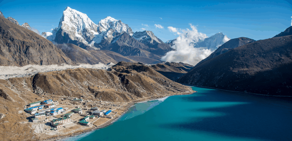
The Gokyo Lakes Trek leads to a chain of sacred turquoise glacial lakes in the Khumbu’s western valley, culminating in the summit of Gokyo Ri (5,360m) — a 360° panorama where Everest, Lhotse, Makalu, and Cho Oyu are simultaneously visible. The route follows the edge of the Ngozumpa Glacier, Nepal’s largest, through progressively more dramatic high-altitude scenery. The Gokyo valley receives far fewer trekkers than the main EBC trail, offering a more peaceful and intimate Himalayan experience.
The Gokyo Lakes Trek is the Khumbu region’s finest alternative to the classic EBC route — a 14-day journey to a chain of six sacred glacial lakes set against the backdrop of four of the world’s six highest peaks. While the Everest Base Camp trail carries tens of thousands of trekkers each year, the Gokyo valley offers an equally dramatic Himalayan landscape with far fewer crowds, a gentler altitude gain profile, and arguably the superior panoramic view from the summit of Gokyo Ri at 5,357 m.
The route shares its first two days with the EBC trail — flying into Lukla and ascending through Phakding and Namche Bazaar — before branching northwest up the Dudh Koshi valley toward Gokyo. The upper valley grows wilder and more remote with each passing day: the Ngozumpa Glacier, the longest glacier in Nepal at over 30 km, fills the valley floor, while the Gokyo Lakes — each a different shade of turquoise and jade — are revered as sacred by Hindus and Buddhists who make annual pilgrimages to bathe in their icy waters.
From the summit of Gokyo Ri (5,357 m), four of the world’s six highest peaks are simultaneously visible: Everest (8,849 m), Lhotse (8,516 m), Makalu (8,485 m), and Cho Oyu (8,188 m). This 360-degree amphitheatre of ice and rock is one of the most extraordinary views a trekker can experience, and the relative silence of the Gokyo valley makes it all the more profound.
Green Horizon’s Gokyo Lakes itinerary includes two acclimatisation days — one in Namche and one in Gokyo — ensuring a safe and comfortable ascent for trekkers of all experience levels. Our small group format keeps the experience intimate and allows our Sherpa guides to provide personalised attention and safety monitoring throughout. Environmental sustainability is central to everything we do in the Khumbu: we use only biodegradable products on trek and contribute to the Sagarmatha Pollution Control Committee on every booking.
There is a moment that happens somewhere above Machhermo, usually around day six or seven, when your legs have finally stopped protesting, and your lungs have quietly made peace with the altitude. The trail turns a corner, the Cho Oyu massif swings into view above a carpet of moraines, and you stop walking. Not because you need to rest, but because you simply cannot take another step while something that beautiful is happening in front of you.
The Gokyo Lakes trek does not announce itself the way the Everest Base Camp route does. It does not have the same foot traffic, the same famous photographs, or the same name recognition at dinner parties. What it has instead is something rarer in the Khumbu these days: a sense that you are walking somewhere that not everyone goes.
The trail northwest from Namche Bazaar through the Gokyo valley carries fewer boots per day than the main Everest Base Camp highway, and that quietness shapes the entire experience in ways that are hard to quantify but impossible to miss.
The centrepiece, of course, is Gokyo Ri itself at 5,357 metres. The summit rewards every metre of the pre-dawn slog with what many experienced Himalayan trekkers will tell you is the finest viewpoint in all of Nepal. Not the highest, not the most technically demanding, but the finest.
Standing there with Everest, Lhotse, Makalu, and Cho Oyu all within reach of a single gaze is one of those experiences that recalibrates whatever you thought you knew about scale.
This fourteen-day itinerary is built around doing the trek properly, not quickly. The acclimatisation schedule is thoughtful and conservative, the rest days are genuinely restful, and the pacing gives you time to actually experience the places you pass through rather than just ticking them off a list.
If you have come to Nepal to walk hard, sleep well, and see something extraordinary, this is the trip.
The Gokyo Lakes Trek is rated Moderate — slightly less demanding than the full EBC route — making it an excellent choice for trekkers who want a genuine Himalayan high-altitude adventure with a more manageable daily challenge. For those with more time, the Gokyo and EBC routes can be combined via the thrilling Cho La Pass into an 18-day circuit that Green Horizon also operates.
Learn more on our Everest Region page. Also see our Altitude Sickness Prevention and Best Season to Trek guides.
At a Glance
| Category | Details |
|---|---|
| Duration | 14 Days (12 trekking, 2 travel) |
| Difficulty | Moderate |
| Maximum Altitude | 5,357 m (Gokyo Ri summit) |
| Minimum Altitude | 2,610 m (Phakding) |
| Trek Start / End | Lukla (fly from Kathmandu) |
| Best Seasons | March to May and October to November |
| Total Trekking Distance | Approx. 110 km |
| Daily Walking Hours | 3 to 7 hours, depending on the day |
| Accommodation | Teahouses on trail, 3-star hotel in Kathmandu |
| Meals Included | Breakfast daily, farewell dinner |
| Group Size | Maximum 12 trekkers |
| Minimum Age | 16 years (exceptions by discussion) |
| Permits Required | Sagarmatha National Park, TIMS card |
| Physical Requirement | Able to walk 5 to 7 hours on consecutive days with a light day pack |
Itinerary at Glance
| Day | Route | Walking Time | Overnight Altitude |
|---|---|---|---|
| 01 | Fly Kathmandu to Lukla, Trek to Phakding | 3–4 hrs | 2,610 m |
| 02 | Phakding to Namche Bazaar | 5–6 hrs | 3,440 m |
| 03 | Acclimatization Day in Namche Bazaar | Optional hike | 3,440 m |
| 04 | Namche Bazaar to Dole via Khumjung and Mong La | 5–6 hrs | 4,200 m |
| 05 | Dole to Machhermo | 4–5 hrs | 4,470 m |
| 06 | Machhermo to Gokyo | 4–5 hrs | 4,790 m |
| 07 | Summit Gokyo Ri + 5th Lake Exploration | 5–7 hrs | 5,360 m |
| 08 | Gokyo to Namche Bazaar | 6–7 hrs | 3,440 m |
| 09 | Namche Bazaar to Lukla | 5–6 hrs | 2,840 m |
| 10 | Fly Lukla to Kathmandu | Travel Day | 1,400 m |
| 11 | Buffer Day 1 in Kathmandu | Rest or Explore | 1,400 m |
| 12 | Buffer Day 2 in Kathmandu | Culture and Shopping | 1,400 m |
| 13 | Buffer Day 3 in Kathmandu | Buffer or Free Day | 1,400 m |
| 14 | Final Departure from Kathmandu | Transfer Day | 1,400 m |
Itinerary of Gokyo Lakes Trek
Day 1: Fly Kathmandu to Lukla — Trek to Phakding (2,610m)
The trek begins in the air. The Kathmandu to Lukla flight is one of those aviation experiences that stays with people long after the altitude has left their legs. Tenzing-Hillary Airport at Lukla sits on a narrow shelf cut into a hillside above the Chaurikharka valley, with a runway that slopes steeply uphill and ends at a stone wall, while the other end drops off into open sky above the valley floor. The Twin Otter or similar mountain aircraft banks through the Himalayan foothills, the peaks appear impossibly large through the small oval windows, and then the pilot threads the gap, and you are on the ground at 2,860 metres before you have quite processed what just happened.
The briefing with your lead guide happens here or in Lukla itself before you set off, covering the route ahead, altitude protocols, and how the team will operate over the coming nine days. Pay attention. The mountains will not repeat themselves, and neither will this conversation.
The first hours of walking descend gently from Lukla through pine forest and terraced fields along the Dudh Koshi River. Several suspension bridges cross the river as it drops through the valley below you. The trail is easy, and the pace relaxed, and that is entirely the point. Today is about letting your body register where it is, not about covering ground. The air already smells different up here. The light is different. The sound of the river carrying up from the gorge below sets the rhythm of the next week and a half.
Phakding is a handful of teahouses gathered around the riverbank, and it is a good place to spend the first night. The smoke from the kitchen is visible from the trail as you come in, and the dining room will be warm and the food simple and exactly right. Set an early alarm. The walking gets serious tomorrow.
Overnight in a Phakding teahouse.
Duration
3-4 hrsActivity
TrekkingAccommodation
TeahouseMeals
L/DMax Altitude
2610mDay 2: Phakding to Namche Bazaar (3,440m)
Today you earn Namche, and Namche does make you earn it. The route north from Phakding follows the Dudh Koshi valley upstream through a widening gorge, passing through the hamlet of Monjo, where a park checkpost marks the entrance to Sagarmatha National Park. Your permits are checked here. Have your documents accessible. This is not the moment to be excavating the depths of a full pack while a queue forms behind you.
The Hillary Suspension Bridge comes next, a long swaying span strung high above the thunder of the Dudh Koshi gorge. The bridge itself is perfectly solid. The view straight down through the steel mesh floor is memorable in ways that some people find invigorating and others find briefly terrible. Most people cross without drama. A few take somewhat longer than expected. There is no shame either way. The far side of the gorge is what matters.
After the bridge, the trail climbs without mercy for roughly two hours through pine forest. This is the stretch that shows you whether you have packed sensibly. Keep a steady rhythm, rest when you need to, and resist the temptation to race the group ahead of you. The reward waiting on the other side of the ridge is Namche Bazaar, appearing suddenly as a horseshoe of white and coloured buildings tiered up a steep, curved bowl of mountainside. On a clear morning, which is most mornings, the distinctive dark pyramid of Everest shows itself above the ridge to the north for the first time. The first glimpse is always a small shock.
Namche is the hub of the Khumbu, and it earns that description honestly. It has a Saturday market that draws traders and yak herders from across the region, more trekking gear shops than you will have time for, a bakery whose cinnamon rolls have no business being this good at 3,440 metres, and hot chocolate in varieties that suggest someone here takes it seriously. Settle in, eat a proper meal, and sleep early. Tomorrow you are going nowhere in particular, and that matters more than it sounds.
Overnight in Namche Bazaar.
Duration
5-6 hrsActivity
TrekkingAccommodation
TeahouseMeals
B/L/DMax Altitude
3440mDay 3: Acclimatisation Day — Namche Bazaar
This day is not optional, and it is not wasted time. If you have come this far and are thinking about pushing on because you feel fine, that feeling is precisely the reason to stay. The body acclimatises on its own schedule, and that schedule is not negotiable. What you can do is support the process by going higher during the day and coming back down to sleep at the same altitude, which is the logic behind every acclimatisation day built into this itinerary.
The morning hike climbs to the Everest View Hotel at 3,880 metres, a building whose name is entirely honest and whose terrace offers one of the finest mountain panoramas available without crampons anywhere in the world. Everest, Ama Dablam, Lhotse, Thamserku, and the full northern wall of the Khumbu spread across the horizon in a sequence of summits that most people spend twenty minutes just slowly working through from left to right. Ama Dablam, with its distinctive triangular south face and hanging glacier, tends to stop people completely the first time they really look at it.
From the hotel, the route drops into Khumjung, a Sherpa village that the trekking economy has touched without quite transforming. The Khumjung monastery keeps a yeti scalp in a glass case. It has been examined by various researchers over the decades, and the conclusions have never fully settled the question, which is rather the point. The valley walls above Namche are tall, and the country is remote enough that the story does not feel entirely out of place.
The Sherpa Culture Museum back in Namche is worth an hour of your afternoon. The history of the Sherpa people and their relationship with the Himalaya, with mountaineering expeditions, and with the landscape they have inhabited for centuries is genuinely interesting, and it adds a layer of context to the walking that the walking itself cannot provide.
Check your boots, your blisters, your water intake. Eat well. Go to sleep at the same altitude you slept at last night, while your blood is quietly getting on with the job.
Second overnight in Namche Bazaar.
Duration
AcclimatisationActivity
Rest/HikeAccommodation
TeahouseMeals
B/L/DMax Altitude
3880mDay 4: Namche to Dole (4,200m)
Today, the Gokyo route separates from the main Everest Base Camp highway, and the character of the trek changes in ways that are immediately noticeable. The path northwest from Namche passes through Khumjung again before crossing the Mong La ridge, a long climb that puts the Dudh Koshi valley behind you and opens the Gokyo valley ahead. The difference in atmosphere is real. The trail carries fewer boots. The teahouses are further apart. The silence between steps is more complete.
The ridge crossing at Mong La offers one of the best retrospective views of the day, with Ama Dablam’s south face prominent to the southeast and the river valley you have been climbing since Lukla visible in miniature far below. It is worth stopping here longer than you think you need to. The descent into the Gokyo valley on the far side of the ridge is the moment the trip changes direction, literally and in terms of what is ahead.
The trail drops into the valley and then climbs again through rhododendron and birch forest that in spring runs pink and red and in autumn goes to gold. The treeline thins. The vegetation becomes sparser and lower to the ground. Thamserku and Kangtega rise dramatically to the south with the kind of muscular visual presence that makes people reach for their cameras without quite meaning to. Cho Oyu appears for the first time on the northern horizon at a scale that is genuinely difficult to process at first.
Dole sits in an open bowl above the treeline with a stream running below and the kind of evening light on surrounding peaks that makes you understand why people come back to the Khumbu more than once. The temperature drops fast after sunset at this altitude. Sleep with your water bottle inside your sleeping bag.
Overnight in Dole.
Duration
5-6 hrsActivity
TrekkingAccommodation
TeahouseMeals
B/L/DMax Altitude
4200mDay 5: Dole to Machhermo (4,470m)
A shorter day measured in hours, but a significant one measured in altitude and in the increasingly wild quality of the landscape. The trail continues north through open alpine terrain where the vegetation has simplified down to low scrub and grass and the occasional twisted juniper. The valley narrows. The moraine walls come closer. The scale of everything shifts.
Machhermo sits below dramatic cliff faces with the Ngozumpa valley opening above it, and the village has an exposed quality that is offset by the way the mountains close protectively around it on three sides. Cho Oyu’s immense northern flank fills the skyline ahead with a bulk that makes every other peak in view seem modest by comparison. The mountain has a brutal, almost architectural simplicity to it. It does not look like something that grew. It looks like something that was placed.
Machhermo appears in trekking accounts most often for an event from 1974, when a local yak herder named Lhakpa Dolma reported encountering a large bipedal creature near the village that killed three of her yaks. The account was investigated at the time and has never been conclusively resolved. You can decide for yourself how much weight to give it. The cliff faces and the empty upper valley do not make the story feel impossible.
Pay attention to how you feel this evening. You are at 4,470 metres, and this is where altitude sickness becomes a real consideration rather than an abstract one. A mild headache at the end of the day is common and not necessarily alarming. A headache combined with nausea or an unusual unwillingness to eat and drink is something to tell your guide about tonight, not tomorrow.
Overnight in Machhermo.
Duration
3-4 hrsActivity
TrekkingAccommodation
TeahouseMeals
B/L/DMax Altitude
4470mDay 6: Machhermo to Gokyo (4,790m)
The trail drops briefly to cross a glacial stream before climbing alongside the eastern lateral moraine of the Ngozumpa Glacier. The Ngozumpa is the longest glacier in Nepal, running roughly 36 kilometres from its head in the high cwms beneath Cho Oyu down to where it finally expires in the valley below Gokyo. Walking alongside it requires a revision of scale. The moraine is black and enormous and chaotic, and the ice beneath it is old and quiet in the way that things built over centuries tend to be.
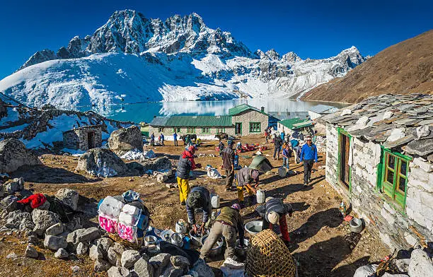
The first two of the Gokyo Lakes appear below the trail as you follow the moraine north, grey-blue and cold, and set into the lateral margins of the glacier like something the ice left behind when it retreated. The third lake, Dudh Pokhari, is the one that Gokyo village sits on, and the arrival view as you come over the final moraine ridge is one of the better arrivals in Himalayan trekking. The water is a colour somewhere between turquoise and deep aquamarine that changes with the angle of the light and the cloud overhead, and has no completely accurate name in English. The black moraine walls frame it. The white peaks stand above it. It looks designed.
Gokyo is a small permanent settlement swelled by teahouses during the trekking seasons, and the atmosphere among trekkers who have made it this far tends toward quiet satisfaction rather than celebration. Eat well tonight. Drink water steadily through the evening. Set your alarm for before dawn. The window of clear weather on summit morning opens early and does not stay open indefinitely.
Overnight in Gokyo.
Duration
4-5 hrsActivity
TrekkingAccommodation
TeahouseMeals
B/L/DMax Altitude
4790mDay 7: Gokyo Ri (5,360m) — Fifth Lake Exploration
The alarm goes off in the dark, and the cold is immediate and absolute. This is what you came for.
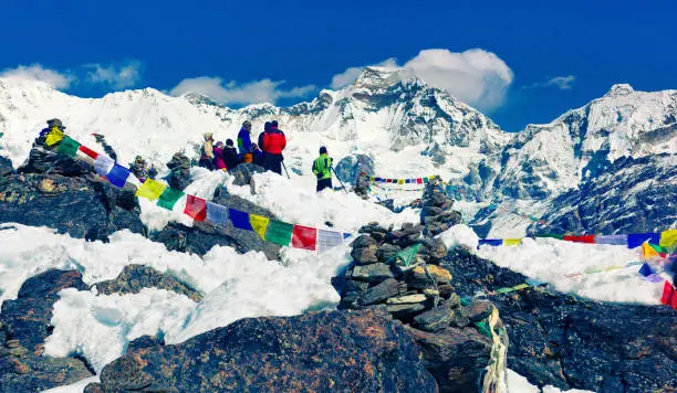
Gokyo Ri is not a technical climb. There are no ropes involved, no ice axes, no fixed lines to clip into. What there is is a sustained steep ascent up a rocky ridge starting in pre-dawn darkness with a headlamp and the sound of your own breathing for company, and stars overhead in a quantity that is genuinely startling when you stop moving for a moment and look up. The climb takes between two and three hours from the village, depending on pace and how the altitude has treated you. Go steadily. Rest when you need to. There is no prize for reaching the top first, and exhausting yourself on the way up is a poor trade for the view waiting at the summit.
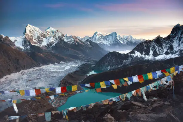
The top of Gokyo Ri is a small rocky plateau at 5,360 metres, and the view from it is, without any qualification or hedging, extraordinary. Everest stands to the southeast, its familiar dark pyramid catching the first light of sunrise from behind while the valley below is still in shadow. Lhotse and Makalu flank it in the way that secondary characters complete a scene. Cho Oyu fills the northwest horizon with its characteristic mass. The Ngozumpa Glacier stretches away below you for what seems like an impossible distance, the three main Gokyo Lakes glinting in the morning light like scattered mirrors. Four eight-thousanders in a single unobstructed gaze. This is genuinely one of the finest viewpoints in the entire range, and the people who have stood here before you and said so were not exaggerating.
Descend to Gokyo for a breakfast that will taste better than any breakfast deserves to, then rest briefly before heading north along the moraine for the afternoon’s walking. The Fourth Lake, Thonak Tsho, sits at 4,981 metres, and the Fifth Lake, Ngozumpa Tsho, at 5,000 metres. Each lake is wilder and less visited than the one before. The trail beyond the Fourth Lake is rougher and less clearly defined, which is exactly what keeps most people from going further. The Fifth Lake is the highest of the Gokyo Lakes, and on most days you will have it almost entirely to yourself, which is a remarkable thing to be able to say about anywhere in the Khumbu.
Return to Gokyo in the late afternoon. Celebrate with your guide team. You have done what you came to do.
Second overnight in Gokyo.
Duration
8-9 hrsActivity
Summit/HikeAccommodation
TeahouseMeals
B/L/DMax Altitude
5360mDay 8: Gokyo to Namche Bazaar (3,440m)
A long descending day and a satisfying one. The body that struggled upwards through this valley a week ago has made its adjustments, and the descent feels almost effortless by comparison. Lungs that were working hard above 4,500 metres now produce more than enough with every step downhill. The legs know the ground.
The route retraces the approach south through Machhermo and Dole, and it is worth noting how differently the landscape reads on the way back. The views that were tantalising goals on the ascent are now companions. The valley that was unfamiliar and demanding feels known. Stop at Machhermo for lunch and a hot masala tea that, having now been to the Fifth Lake and back, you have unambiguously earned.
The rhododendron and birch forest reappears as you drop through Dole and continues thickening on the long walk back down towards Namche. The air fills back in with every hundred metres of descent. By the time the lights of Namche appear around the ridge, the breathing that felt effortful at Gokyo has become entirely automatic again.
Namche’s bakeries, hot showers, and reliable electricity greet returning trekkers like a small but genuine kindness. Eat a full meal. Update your family. Buy whatever last-minute souvenir you have been thinking about since Day 4.
Overnight in Namche Bazaar.
Duration
6-7 hrsActivity
TrekkingAccommodation
TeahouseMeals
B/L/DMax Altitude
3440mDay 9: Namche to Lukla (2,840m)
The last walking day of the trek carries you all the way back down the Dudh Koshi valley to Lukla. The route retraces the approach through Monjo and Phakding, across the Hillary Bridge that seemed significant and slightly vertiginous at the start and now feels like an old crossing you have made a hundred times, and down through the river valley to the final climb up into Lukla.
The trail is familiar now in a way that makes the walking easy without making it boring. You notice things you missed on the way up. The mani walls and their carved prayers have a different quality when you are heading back rather than forward. The river sounds the same.
Arrive in Lukla in the afternoon, and the celebration dinner that evening will earn its name. The trekking is over. The gear is comprehensively filthy in a way that feels like evidence of something. People who were strangers nine days ago have walked through extraordinary country together and shared teahouse dining rooms and acclimatisation headaches and a summit morning that will stay with all of them for a long time. The conversation runs wide, and the Everest beer is cold, and the guides deserve whatever toast you raise to them.
Overnight in Lukla.
Duration
6-7 hrsActivity
TrekkingAccommodation
TeahouseMeals
B/L/DMax Altitude
2840mDay 10: Fly Lukla to Kathmandu
The morning flight operates on mountain weather rather than schedule, which means the pilots fly when the visibility is right and not before. Flights generally depart in the early morning window before cloud builds in the valley. Have your bags packed and your breakfast eaten, and be ready when the crew is ready. Patience here costs nothing.
Back in Kathmandu, the afternoon is entirely free. The city, which barely registered on the sprint through on the way out, now has the quality of somewhere you are actually seeing. Thamel’s lanes and their particular organised chaos. The smell of incense, exhaust, and fresh bread. A proper coffee at a proper table that does not wobble. Green Horizon hosts a farewell dinner this evening where completion certificates are presented, and the photographs from the trek begin their long journey around various group chat threads.
Overnight in Kathmandu hotel.
Duration
35 min flightActivity
TravelAccommodation
HotelMeals
BMax Altitude
1400mDay 11: Buffer Day 1 — Kathmandu
Three buffer days in Kathmandu at the end of this trip are not padding. They are structural. The Lukla flight is one of the more weather-dependent short-haul routes in the world, and cancellations or holds of one to three days are common enough that any itinerary without buffer time built in is an itinerary that does not take the reality of mountain flying seriously. If the Day 10 flight departed on schedule and you are reading this in Kathmandu with nothing urgent pressing, consider that a good outcome rather than a sign that the buffer was unnecessary.
Kathmandu on a free day rewards a different kind of attention than the frantic transit days tend to allow. The Boudhanath stupa, one of the largest in the world, is walkable from Thamel, and the circumambulation path around it has a particular quality in the early morning when the monks are out, and the butter lamps are still burning. Pashupatinath temple on the banks of the Bagmati river is the most important Hindu shrine in Nepal, and the burning ghats and the sadhus and the river itself are things that stay in memory.
Or simply stay in Thamel. Shop for things you decided you wanted on Day 6. Eat at the restaurant you noticed on the walk back from the briefing. Sleep in a bed with a proper mattress.
Overnight in Kathmandu hotel.
Duration
BufferActivity
RestAccommodation
HotelMeals
BMax Altitude
1400mDay 12: Buffer Day 2 — Kathmandu
A second day in Kathmandu is a gift that most people do not expect to appreciate as much as they do. The pace of the city, which felt overwhelming before the trek when everything was unknown, now feels navigable. You know roughly where things are. You have been walking for nine days, and the city’s chaos has a rhythm to it that is not entirely different from a busy trail day.
Patan, the medieval city across the Bagmati river from central Kathmandu, has a Durbar Square that is genuinely one of the finest examples of Newari architecture in the world and is far less overrun with tourists than the central Kathmandu Durbar Square. The woodwork on the temples is extraordinary, and there are small courtyard shrines tucked behind the main square that most visitors never find.
The Garden of Dreams in central Thamel is an unusual and very peaceful Edwardian garden that serves good coffee and is entirely unlike anything else in the neighbourhood. Worth an hour on a warm afternoon.
Overnight in Kathmandu hotel.
Duration
BufferActivity
RestAccommodation
HotelMeals
BMax Altitude
1400mDay 13: Buffer Day 3 — Kathmandu
The third buffer day is the one that the occasional delayed or cancelled Lukla flight has already been absorbed by in the days prior, or the one that becomes the most genuinely free day of the entire trip if everything went smoothly. Either way, it is a day to use however feels right.
Some people spend it getting a massage that their legs have been earning since Day 4. Some go back to Boudhanath for a second visit that turns out to be better than the first. Some find a rooftop restaurant and spend the afternoon with a book and a view of the city and the distant white line of the Himalayas on the northern horizon, which from here looks almost casual.
Pack for your international departure this evening if you have not already. Double-check that your completion certificate is somewhere safe. Set your alarm based on your outbound flight time and go to sleep at a reasonable hour.
Overnight in Kathmandu hotel.
Duration
BufferActivity
RestAccommodation
HotelMeals
BMax Altitude
1400mDay 14: Final Departure
Transfer to Tribhuvan International Airport at a time suited to your outbound flight. The mountains you were standing in less than a week ago are somewhere north, probably behind clouds from this angle, which is fine. You carry the view with you now.
Most people who do this trek say they start thinking about coming back somewhere around the departure gate. That is not a sales pitch. It is just what happens.
Duration
DepartureActivity
TransferAccommodation
HotelMeals
BMax Altitude
1400mIncludes/Excludes
What's included?
- 13 nights accommodation (2 hotel Kathmandu, 11 teahouse)
- Domestic flights Kathmandu–Lukla–Kathmandu
- All meals on trek
- Licensed English-speaking guide and porter
- Sagarmatha National Park permit and TIMS card
- First-aid kit and emergency evacuation plan
What's not included?
- International airfare and Nepal visa fees
- Travel and medical insurance (mandatory)
- Personal gear and clothing
- Tips for guide and porter
- Beverages and personal snacks
Gokyo Lakes Trek Altitude Chart
Trip Information - Good to Know
Best Time to Visit
The Khumbu has two main trekking windows, and both are genuinely excellent, though they have different personalities. Choosing between them is mostly a matter of what you want the mountains to look like and how much company you want on the trail.
Spring: March to May
Spring is the classic Himalayan trekking season and for good reason. The rhododendron forests below Namche explode with red and pink blooms in March and April, creating a walking experience that is spectacularly beautiful at lower elevations.
Temperatures are comfortable during the day and cold but manageable at night. The air tends to be clearer earlier in the season before the pre-monsoon haze builds in May.
March and early April are ideal. Late May can bring afternoon cloud and the first moisture-laden winds, though mornings usually stay clear.
Autumn: October to November
Autumn is the most popular season, and the visibility is often at its absolute sharpest right after the monsoon clears in late September and October.
The mountains are freshly dusted with new snow, and the skies are that particular deep blue that only happens in the Himalayas in October.
Temperatures drop sharply in November, particularly above Namche, and the first significant snowfall can arrive in late November.
October is probably the single best month of the year. The trail is at its busiest this time of year, but the Gokyo route remains notably quieter than the Everest Base Camp path.
Seasons to Avoid
Trekking during the monsoon (June through September) is possible but genuinely difficult. Trails become slippery and leech-infested at lower elevations, leeches appear in serious numbers below Namche, views disappear behind clouds for days at a time, and mountain flights to Lukla are frequently delayed or cancelled.
December through February is extremely cold, with high altitude camps sometimes buried in snow and Lukla flights still subject to disruption.
Some experienced trekkers love winter for the solitude and the crystalline cold-weather visibility, but it requires proper gear and preparation.
Difficulty Level
The Gokyo Lakes Trek is rated Moderate — slightly less demanding than the full EBC route. The trail is non-technical with no glacier or technical climbing required. Maximum altitude is 5,357 m on Gokyo Ri, which demands solid fitness and careful acclimatisation.
Daily walking times average five to seven hours on well-maintained mountain paths. The altitude profile features a gentler gradient than the EBC route with steadier ascent through the lateral valleys. Trekkers should train with regular hikes of 8–12 km with significant elevation gain in the months before departure. Our guides monitor oxygen saturation daily and enforce the itinerary’s acclimatisation schedule strictly for everyone’s safety.
Recommended Gear List
You do not need to buy everything on this list. Good quality rental gear is available in Thamel for most items except boots, which really need to be broken in on your feet before the trek.
Pack as light as you reasonably can. Your porter carries up to 15 kg of your main bag, and you carry a daypack with water, layers, snacks, a camera, and documents.
Footwear
- Waterproof trekking boots with ankle support, already broken in well before departure
- Camp sandals or lightweight shoes for teahouse evenings
- Wool or synthetic trekking socks, minimum four pairs
- Gaiters (optional but useful in early spring or late autumn when snow is possible above Namche)
Upper Body Layers
- Moisture-wicking base layer, two to three versions
- Mid-layer fleece or softshell jacket
- Insulated down or synthetic puffer jacket for high altitude and evenings
- Waterproof, windproof shell jacket with hood
- Lightweight gloves and heavier winter gloves for summit day
- Warm hat and sun hat
- Neck gaiter or buff
Lower Body
- Trekking trousers, convertible styles work well
- Thermal base layer leggings for cold mornings and high altitude
- Waterproof shell trousers for wet or snowy conditions
- Shorts for warmer days below Namche
Pack and Bags
- Main duffel bag 60 to 80 litres for porter to carry (no hard-frame backpacks, they are difficult for porters on narrow trails)
- Daypack 20 to 30 litres for what you carry yourself
- Dry bags or waterproof pack liners
- Padlock for main duffel
Sun and Cold Protection
- High-factor sunscreen SPF 50 or above (UV intensity at altitude is significantly higher than at sea level)
- Sunglasses with UV protection and good side coverage
- Lip balm with SPF
Trekking Accessories
- Trekking poles, adjustable, strongly recommended for both knees on the long descents
- Headlamp with spare batteries, essential for the Gokyo Ri summit day
- Water bottles or hydration bladder, with a minimum of two litres capacity
- Purification tablets or a filter straw as backup
- Lightweight towel
- Sleeping bag liner for extra warmth at high altitude teahouses (Green Horizon provides a sleeping bag)
Documents and Money
- Passport with at least six months’ validity beyond your travel dates
- Two recent passport photographs for permits
- Travel insurance documents and emergency contact card
- Nepal rupees in cash for personal expenses on the trail (ATMs exist in Namche but can be unreliable)
- USD cash as backup
Health and Hygiene
- Personal first aid kit with blister treatment, pain relief, anti-diarrhoeal, and antihistamine
- Hand sanitiser
- Toilet paper and a small bag for disposal above the treeline
- Wet wipes for the nights when the teahouse shower does not materialise
- Any personal prescription medications, plus a copy of the prescription
Altitude, Acclimatisation and Safety
Understanding Altitude Sickness
Altitude sickness, formally known as Acute Mountain Sickness (AMS), is a physiological response to reduced oxygen availability at elevation, and it can affect absolutely anyone regardless of fitness level, age, or previous trekking experience.
Being exceptionally fit does not protect you. Having trekked to altitude before does not guarantee the same response a second time. The only meaningful risk factor under your control is how fast you ascend.
Symptoms to Know
Mild AMS
- Headache
- Fatigue
- Loss of appetite
- Mild nausea
- Disturbed sleep
These are common above 3,000 m and not necessarily alarming.
Moderate AMS
- Persistent headache not relieved by paracetamol
- Vomiting
- Significant weakness
- Difficulty walking in a straight line
This requires stopping and discussing descent with your guide.
Severe AMS, HACE, HAPE
- Confusion
- Inability to walk
- Severe breathlessness at rest
- Coughing pink frothy sputum
- Loss of consciousness
This is an emergency requiring immediate descent and evacuation.
The Golden Rule
Never ascend to sleep at a higher altitude if you have symptoms of AMS. Descend immediately if symptoms worsen.
No view, no summit, and no sense of group pressure is worth dying for. Your guide has full authority to direct descent, and their judgment on this question is not negotiable.
Diamox (Acetazolamide)
Diamox is a prescription medication that can help the body acclimatise more efficiently by stimulating faster and deeper breathing.
It is not a treatment for severe AMS, and it does not eliminate the need for proper acclimatisation scheduling.
Some trekkers use it prophylactically from Namche upwards. Side effects include increased urination and mild tingling in the fingers and toes.
If you wish to use Diamox, discuss it with your doctor before departure. Green Horizon carries a supply for emergency use only.
Pulse Oximetry
Your guide carries a pulse oximeter and will check blood oxygen saturation levels at higher camps, particularly from Machhermo upwards.
Normal blood oxygen at sea level is 95 to 99 percent. At 4,500 metres, most trekkers will read between 80 and 90 percent.
Readings consistently below 75 percent, especially combined with symptoms, are a signal to take seriously.
Helicopter Evacuation
In the event of a medical emergency requiring evacuation, Green Horizon will coordinate with Kathmandu rescue services.
Helicopter evacuation from the Gokyo valley is possible in good weather.
The cost of this service can reach USD 3,000 to 6,000 or more, and must be covered by your travel insurance.
This is why travel insurance with emergency evacuation coverage is not optional on this trek.
Travel Insurance
Travel insurance that specifically covers trekking to 5,400 metres and includes emergency helicopter evacuation is not optional on this trip. It is a condition of booking.
We cannot be responsible for the cost of medical evacuation if you choose to travel without appropriate coverage, and the cost of uninsured evacuation in the Khumbu can be genuinely catastrophic.
When selecting your policy, check that it covers:
- Trekking to an altitude of at least 5,500 metres
- Emergency medical evacuation, including a helicopter
- Trip cancellation and curtailment for medical reasons
- Personal belongings
- Repatriation in worst-case scenarios
Carry your insurance documents with you on the trek and keep a photograph of the key policy details on your phone.
Give your guide the emergency contact number for your insurer at the start of the trek.
Permits and Regulations
Sagarmatha National Park Entry Permit
All trekkers entering the Sagarmatha National Park zone, which begins at Monjo on Day 3, require a park entry permit.
This is included in your trek fee and will be arranged by Green Horizon before you leave Kathmandu.
The permit is checked at the park entrance gate and must be presented on demand.
TIMS Card
The Trekkers’ Information Management System card is required for all independent and guided trekkers in Nepal.
It registers your trek for safety purposes and allows mountain rescue services to have a record of who is in which area.
This is also included in your trek fee.
Khumbu Pasang Lhamu Rural Municipality Conservation Fee
A local conservation fee is levied by the Khumbu Pasang Lhamu Rural Municipality at Lukla and is included in your trek cost.
This fee directly supports local trail maintenance and community infrastructure in the Khumbu.
Conduct in the National Park
Sagarmatha National Park has strict environmental regulations.
- Do not collect plants, rocks, or any natural materials
- All waste must be packed out or disposed of in designated facilities
- Wood fires are banned above certain altitudes, and teahouses use kerosene or gas for cooking
Respect this.
The park exists because the environment has been protected, and that protection requires active cooperation from every person who walks through it.
Frequently Asked Questions
How does Gokyo compare to EBC?
Gokyo is less crowded, many rate it more scenic, and the Gokyo Ri view rivals Kala Patthar. EBC reaches higher altitude. Many combine both routes via Cho La Pass.
When are the lakes most vivid?
October–November for clearest, most vivid turquoise colours under blue skies.
Can I combine Gokyo with EBC?
Yes — the classic 18-day combination crosses Cho La Pass (5,420m). Green Horizon Tours offers this combined itinerary.
What is Scoundrel's Viewpoint?
A high ridge above the Fifth Lake with outstanding views of Ngozumpa Glacier and Cho Oyu. Fewer trekkers reach it.
Is altitude sickness a risk?
Yes above 3,000m. The acclimatisation night at Machhermo before climbing to Gokyo is critical. Guide monitors daily with pulse oximeter.
What wildlife might I see?
Himalayan tahr, snow leopard (rare), musk deer, and the Danphe (Himalayan monal pheasant) in rhododendron zones below Namche.
Are there ATMs and phone signal on the trek?
Namche Bazaar has several ATMs, though they can be unreliable and sometimes run out of cash around peak season. There are no ATMs beyond Namche on the Gokyo route. Mobile phone signal (Ncell and NTC networks) is available in most villages up to and including Gokyo, though it can be patchy. WiFi is available for a fee at most teahouses, but speeds slow significantly above Namche. Carry enough cash in Nepali rupees from Kathmandu to cover all your personal expenses on the trail.
What happens if the Lukla flight is cancelled?
Mountain flights to Lukla operate on weather and visibility conditions and cancellations, particularly in early morning, are not unusual. Green Horizon builds buffer time into the schedule at both ends to accommodate likely delays. In the case of a prolonged weather hold, alternative options include helicopter transfer from Lukla to Kathmandu at additional cost (covered by travel insurance if the delay creates a connecting flight risk) or, in extreme cases, trekking out to Salleri and taking road transport. These scenarios are uncommon but your travel insurance should cover additional accommodation and transport costs arising from delays outside your control.
Can I rent gear in Kathmandu?
Yes, Thamel has dozens of gear shops and rental operations that stock sleeping bags, down jackets, trekking poles, gaiters, and most other equipment you might need. Quality varies, so inspect rental gear carefully before accepting it. Green Horizon provides a down jacket and sleeping bag as part of the trek fee so your rental needs are limited to items like trekking poles if you do not own them. Boots should always be your own, worn-in pair.
Is this trek suitable for older trekkers?
Age is genuinely less of a limiting factor than general fitness and acclimatisation. We have had trekkers in their 60s and 70s complete this route in excellent form. The key factors are cardiovascular fitness, the ability to tolerate moderate cold and basic accommodation, and a sensible willingness to pace steadily without ego. If you have specific health concerns, discuss them with your doctor before booking and share them with us so we can plan appropriately.
Trip Reviews
- Best Price Guarantee
- Secure & easy booking
- Easy trip date changes
- Discount for groups


How to book a trip?

make free inquiry

confirm the trip