

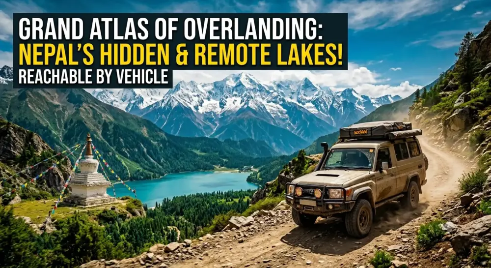
The Grand Atlas of Overland Exploration: Hidden and Remote Lakes of Nepal Reachable by Vehicle
For decades, the global imagination has viewed Nepal exclusively through the lens of traditional foot mountaineering and high-altitude trekking. The iconic images of the country—alpine glacial lakes, hidden valleys, and windswept mountain passes—were considered the exclusive reward of those willing to shoulder a heavy backpack and trek for weeks on end.
However, a quiet infrastructure revolution has transformed the geography of the Himalayas. The rapid expansion of rural road networks, the development of the Mid-Hill Highway (Pushpalal Marga), and the carving of seasonal 4×4 tracks through steep river gorges have created an entirely new frontier for adventure: Himalayan Overlanding.
Today, dual-sport motorcycles, heavily modified 4×4 vehicles, and rugged overland rigs can access remote, pristine bodies of water that were once completely isolated. This comprehensive, encyclopedic master guide details the finest hidden and lesser-known lakes in Nepal that can be reached by vehicle. It provides precise geographical parameters, technical route blueprints, mechanical preparation guidelines, and off-road driving dynamics for the ultimate overland expedition.
THE GEOGRAPHIC STAIRCASE: OVERLANDING IN THE HIMALAYAS
To successfully navigate Nepal by vehicle, an overlander must understand its unique three-tier topography. The country transitions rapidly across three distinct zones:
-
The Terai Plains: The flat, low-altitude tropical belt running along the southern border with India, sitting between 60 to 200 meters above sea level.
-
The Hill Region (Pahad): A sprawling maze of steep ridges, deep river valleys, and sub-tropical to temperate forests ranging from 500 to 3,000 meters.
-
The Mountain Region (Himal): The high-alpine, glaciated zone climbing above 3,000 meters to the highest peaks on Earth.
Because of this intense vertical relief, driving distances in Nepal are never measured in kilometers; they are measured in hours. A 100-kilometer stretch of road can easily take six to eight hours to navigate if it involves crossing multiple mountain passes, traversing loose shale fields, or negotiating unpaved cliffside ledges.
[TERAI PLAINS: 60m–200m]
        │
        ▼ (Sub-tropical jungles, wide alluvial highways)
[MID-HILL REGION: 500m–3,000m]
        │
        ▼ (Steep clay switchbacks, unpaved ridge tracks, river gorges)
[HIGH ALPINE MONARCHS: 3,000m+]
          (Glacial moraines, high-altitude hypoxia, loose shale shelves)
For the overlander, this means your vehicle will experience dramatic shifts in ambient temperature, barometric pressure, and terrain surfaces within a single day of driving. The lakes detailed below span all three geographic zones, offering a diverse range of overlanding environments.
PART I: EXTREME ALPINISM ON WHEELS (THE HIGH-ALTITUDE MONARCHS)
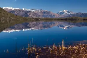
1. Rara Lake (Mugu & Jumla Districts)
The Ultimate Remote High-Alpine Overland Pilgrimage
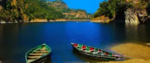
Sitting beautifully at 2,990 meters (9,810 feet) above sea level within the boundaries of Rara National Park, Rara Lake is the largest and deepest freshwater lake in Nepal. Known locally as the “Queen of Lakes,” this pristine sapphire gem covers an area of 10.8 square kilometers and reaches a maximum depth of 167 meters.
Historically, witnessing Rara required a complex domestic flight to a remote dirt airstrip followed by days of trekking. Today, it stands as the undisputed crown jewel of long-distance Himalayan overlanding.
[Kathmandu] ──(Prithvi Highway)──> [Kohalpur Hub] ──(Ratna Highway)──> [Surkhet Gateway] ──(Karnali Highway)──> [Kalikot] ──(Nagma Junction)──> [Baluwa / Talcha Perimeter] ──(Walk/Horse Ride)──> [Rara Lake Shoreline]
A. Geography & Genesis
Rara Lake is an oligotrophic alpine lake formed by tectonic activity and fed by natural underground springs and small mountain streams. It is surrounded by thick, protected coniferous forests dominated by blue pine, black juniper, Himalayan cypress, and spruce. The lake is famous for its striking water clarity; under a clear sky, the surface changes colors up to five times a day, shifting from turquoise to deep indigo, emerald green, and ink-black. The northern skyline is dominated by the snow-covered peaks of the Chuchemara Danda and the Saipal Himalayan range.
B. Comprehensive Route Blueprint
An overland expedition to Rara Lake from Kathmandu is a massive undertaking, typically requiring a minimum of 7 to 9 days for a round trip.
-
Stage 1: The Terai Transit (Kathmandu to Surkhet — Approx. 600 km): The journey begins by exiting the Kathmandu Valley via the Prithvi Highway, dropping down the steep switchbacks of the Mugling gorge, and tracking west along the East-West Highway across the flat Terai plains. You pass through Chitwan and Bardiya national parks before turning north at Kohalpur toward Surkhet (the gateway to the Karnali Province). This section is entirely paved tarmac but demands vigilance due to heavy commercial bus and truck traffic.
-
Stage 2: The Karnali Highway Crucible (Surkhet to Kalikot to Nagma — Approx. 240 km): This is where the true off-road adventure begins. The Karnali Highway is widely considered one of the most challenging and spectacular roads in South Asia. It is a narrow, single-lane road carved out of vertical cliffs above the roaring Karnali River. The surface transitions rapidly from deteriorating asphalt to loose gravel, wet mud ruts, and active landslide debris fields. Overlanders must navigate tight blind corners, cliff drops without guardrails, and heavy oncoming water tankers. You break the drive by staying in basic roadside settlements like Dailekh or Kalikot (Manma).
-
Stage 3: The High Mountain Ascent (Nagma to Baluwa — Approx. 90 km): At the small junction of Nagma, you leave the main Karnali Highway and turn north along the Hima River valley towards Mugu. The road winds through the historic Sinja Valley—the ancestral birthplace of the Nepali language—before climbing steeply through thick pine forests and over high mountain ridges. The road surface here is entirely unpaved dirt and crushed stone, which can quickly turn into thick clay mud during rain. The final drivable track terminates at Baluwa or the parking perimeter near Talcha Airport.
C. Off-Road Driving Dynamics & Vehicle Parameters
Reaching Rara Lake demands a high-clearance 4×4 vehicle equipped with a mechanical low-range transfer case ($4\text{WD Low}$) or a highly capable dual-sport adventure motorcycle.
[Low Clearance / 2WD] ──> WILL FAIL at Karnali Highway landslide zones & Sinja clay climbs.
[High Clearance / 4WD Low] ──> REQUIRED for deep mud ruts, water crossings, and loose shale shelves.
The road from Nagma to Talcha features multiple steep switchbacks with gradients exceeding $18\%$. Naturally aspirated engines will experience a noticeable drop in horsepower due to the thinning air above 2,500 meters, making a turbocharged diesel engine highly advantageous.
Tires must feature an aggressive All-Terrain ($A/T$) or Mud-Terrain ($M/T$) tread pattern with reinforced sidewalls to handle the sharp, jagged limestone rocks along the Karnali gorge. Tire pressures should be aired down to approximately $22\text{–}25\text{ PSI}$ once you leave the tarmac at Surkhet to maximize traction and absorb high-frequency trail vibrations.
D. Optimal Overlanding Season
The operational window for a Rara Lake drive is strictly governed by the seasons.
-
Autumn (October to December): The premier overlanding window. The monsoon rains have cleared the atmosphere, leaving exceptionally clear blue skies and stable road conditions. Temperatures are cool during the day and drop below freezing at night.
-
Spring (March to May): An excellent secondary window. The weather is warm, and the surrounding forests erupt with blooming red, white, and pink rhododendrons.
-
The Monsoon Hazard (June to September): Strictly avoid. The Karnali Highway and the Mugu access tracks become highly dangerous during the monsoon. Massive landslides regularly wash away large sections of the road, leaving overlanders stranded in remote canyons for weeks.
E. Camp and Accommodation Logistics
Because Rara Lake sits within a strictly protected National Park, vehicles are restricted from driving directly onto the shoreline. The final vehicle parking area is located near Talcha or the park entry gate at Baluwa. From there, overlanders must execute a highly scenic 30-to-40-minute walk or hire local horses to reach the lake.
Accommodation options on the lake’s immediate shoreline are limited to a few basic, rustic community lodges and designated tented camping grounds. The lodges provide simple, hearty meals centered around local red rice, lentils, and organic potato dishes. Overlanders carrying their own roof-top tents or expedition ground tents can arrange camping permits through the national park army checkpoint, allowing them to camp under some of the darkest, least light-polluted night skies in Asia.
2. Lake Mansarovar via the Hilsa and Rasuwagadhi Corridors
The Trans-Himalayan Overland Expedition to the Sacred High Lake
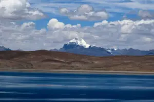
While Lake Mansarovar sits geographically on the high Tibetan Plateau in China, it represents the ultimate dream high-altitude overland expedition launched from the transport corridors of Nepal. Sitting at an immense altitude of 4,590 meters (15,059 feet), it is the highest freshwater lake system in the world.
In recent years, the opening of rugged vehicular corridors on the Nepal side has revolutionized how overlanders approach this sacred water body.
[Kathmandu Hub] ──(Galchhi Junction)──> [Syabrubesi] ──(Rasuwagadhi Border: 1,462m)──> [Kyirong Border Gorge] ──(Tibetan Plateau Highway)──> [Saga: 4,450m] ──(Paryang)──> [Lake Mansarovar: 4,590m]
A. Geography & Genesis
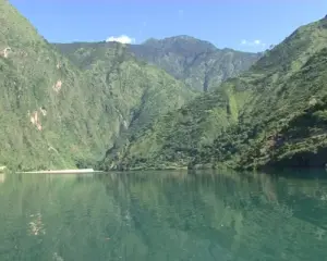
Lake Mansarovar is a high-altitude, closed-basin (endorheic) freshwater lake fed by glacial runoff from the Mount Kailash massif and the Gurla Mandhata mountain range. It is remarkably round in shape, with a circumference of approximately 88 kilometers.
According to Hindu, Buddhist, and Jain cosmologies, Mansarovar is the lake of ultimate spiritual purity. Its waters are a striking, luminous turquoise that forms a dramatic visual contrast against the barren, sun-bleached desert landscape of the Tibetan Plateau.
B. Comprehensive Route Blueprint: The Modern Dual Corridors
Overlanders can trace two primary vehicular paths from Nepal to reach the high-altitude plateau lakes:
The Rasuwagadhi-Kyirong Route (The Eastern Paved Corridor)
This is the most direct vehicular path from Kathmandu. Vehicles depart the capital heading north toward Galchhi, then trace the narrow, winding Trishuli River gorge through Dunche to the mountain hub of Syabrubesi (1,462m). This section on the Nepal side is narrow and prone to monsoonal landslides.
From Syabrubesi, a short drive brings you to the Rasuwagadhi Border Post, where you cross a concrete bridge into China. Once across the border into Kyirong (2,700m), the terrain undergoes a dramatic transformation. The road becomes a wide, perfectly engineered, smooth asphalt highway managed by Chinese transport authorities.
The road climbs out of the sub-tropical river valleys, ascending via a spectacular series of engineered switchbacks onto the vast, windswept Tibetan Plateau. Overlanders drive through Saga (4,450m) and Paryang before dropping down to the edge of Lake Mansarovar.
[Nepal Side: Syabrubesi] ──> Narrow, rock-strewn dirt ledges, water ruts, active shale slides.
               │
          (Border Bridge)
               │
[Tibet Side: Kyirong onward] ──> Perfectly engineered, multi-lane smooth asphalt highway.
The Nepalgunj-Simikot-Hilsa Route (The Far-West Wilderness Corridor)
This represents one of the newest overland routes. Overlanders drive from the southern plains of Nepalgunj up into the mountain tracks of Humla.
Following major infrastructure developments, including the installation of a strategic Bailey bridge over the Chuwakhola River, the remote mountain town of Simikot (2,910m) has become connected to the border outpost of Hilsa (3,640m) via a rugged mountain road. From Hilsa, overlanders cross into Purang (Taklakot), entering China to connect directly to the high-altitude highway leading straight to Mansarovar.
C. Off-Road Driving Dynamics & Mechanical Realities
The driving dynamics of this expedition are split into two completely different realities:
-
The Nepal Leg: Characterized by raw off-road driving. Mud, deep water ruts, unpaved cliffside ledges, and active boulder slides require constant low-range gearing, high ground clearance, and steady, slow-speed maneuvering.
-
The Tibetan Leg: Features high-speed paved cruising, but presents a massive challenge to the vehicle’s engine: Extreme Elevation. Driving a vehicle at altitudes fluctuating between 4,000 and 5,000 meters means the air density drops by nearly $40\%\text{ to }50\%$. Naturally aspirated engines will experience severe power loss, black exhaust smoke, and sluggish throttle response. Turbocharged engines manage better, but the turbochargers must work significantly harder and spin faster to generate necessary boost pressures, increasing the risk of intercooler or hose failures.
[Altitude: 4,500m+] ──> Air Density Drops ~45% ──> Severe Engine Power Loss & High EGTs.
Brake management is another major safety factor. Descending from high mountain passes on the plateau requires continuous engine braking (using lower gears) to avoid severe brake fade and overheating the rotors.
D. Optimal Overlanding Season
The Trans-Himalayan plateau is a high-altitude desert protected from the Indian monsoon by the main Himalayan wall.
-
May to September: The premier window for this expedition. During these months, temperatures are relatively mild, the mountain passes are clear of deep winter snow, and the paved highways are fully open.
-
Winter (October to April): Highly dangerous. Temperatures on the plateau drop well below $-20^\circ\text{C}$, and high-altitude blizzards can completely block the mountain passes, making vehicle travel impossible.
E. Permit and Legal Matrix
This is one of the most bureaucratic overland journeys in the world. Foreign-registered private vehicles and international drivers face strict regulations when entering China via Tibet. Overlanders cannot simply drive up to the border and cross independently.
The entire expedition must be pre-arranged months in advance through a registered travel agency. You must secure a Tibet Travel Permit, an Alien’s Travel Permit, a temporary Chinese driving license, temporary Chinese license plates, and a mandatory government-approved local guide who rides with the convoy.
PART II: THE RUGGED HILL COUNTRY ESCAPES (THE MID-ALTITUDE GEMS)
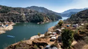
1. Indrasarovar / Kulekhani Reservoir (Makwanpur District)
The Rugged Shortcut & Weekend Overlanding Haven
Located in the hills just south of the Kathmandu Valley rim at an elevation of 1,500 meters (4,921 feet), Indrasarovar is the largest man-made lake in Nepal. Formed by the construction of the massive Kulekhani Hydroelectric Dam, this deep-blue water body stretches across a long, winding mountain valley, looking exactly like a natural alpine fjord.
It has become the premier training ground and weekend escape for Kathmandu’s growing overlanding and dual-sport motorcycle community.
[Kathmandu / Balkhu] ──(Paved Tarmac)──> [Pharping] ──(Dakshinkali Road)──> [Sisneri Chutes] ──(Unpaved Dirt Tracks)──> [Markhu Bazaar] ──(Shoreline Access Tracks)──> [Indrasarovar North Bank]
A. Geography & Genesis
Indrasarovar was created by damming the Palung and Thado rivers to feed the Kulekhani power stations. The lake winds through steep, heavily terraced green hills and pine forests, covering an area of approximately 2.2 square kilometers. The northern shores of the lake are home to the scenic settlement of Markhu, which features flat, grassy fields that slope gently directly down to the water’s edge.
B. Comprehensive Route Blueprint
Reaching Indrasarovar from Kathmandu takes between 3 to 5 hours, depending on the route choice and road conditions.
-
The Pharping-Sisneri Route (The Direct Technical Track): The classic overland route departs from the southern edge of Kathmandu at Balkhu. You climb over the valley rim through Pharping and past the Dakshinkali shrine. Once you cross the ridge line, the paved road gives way to a steep downhill dirt track leading toward Sisneri. This segment features sharp switchbacks, water ruts, and loose gravel paths. From Sisneri, a secondary unpaved dirt track follows the river valley upwards, opening up to the eastern arms of the reservoir before arriving in Markhu.
-
The Tribhuvan Highway Route (The Scenic Ridge Alternative): For a longer, more scenic drive, overlanders can exit Kathmandu via Thankot, climb over the high pass of Naubise, and track along the historic Tribhuvan Highway to Naubise and Palung. From the high mountain town of Daman, a rugged, unpaved rural road branches off, dropping down through pine forests directly into the western inlet of Indrasarovar.
C. Off-Road Driving Dynamics & Vehicle Parameters
While a standard two-wheel-drive sedan can access Markhu during dry winter months, experiencing the true potential of Indrasarovar requires a high-clearance SUV or a dual-sport motorcycle.
The shoreline tracks around Markhu feature deep, fine clay soil. If a sudden afternoon rain shower hits, this clay quickly turns into slick mud that clogs road-biased tire treads, turning them into smooth racing slicks.
A four-wheel-drive vehicle equipped with a center differential lock or a rear limited-slip differential ($LSD$) will easily navigate these muddy shores. Dual-sport motorcycles should run knobby tires (such as a $70/30\text{ or }50/50$ dirt-to-road bias) to safely tackle the steep, off-camber dirt ruts leading down to the water.
[Fine Clay Shoreline] + [Rain] ──> Slick Mud ──> Requires Knobby Tires & Center Diff Lock.
D. Optimal Overlanding Season
-
Autumn and Winter (October to February): The best time to visit. The weather is crisp, the water levels are high after the monsoon, and the tracks are dry and stable. Morning fog rolling over the water creates incredible photography opportunities.
-
Spring (March to May): The weather is warm, but water levels in the reservoir drop significantly as water is drawn down for electricity generation, exposing large mud flats around the perimeter.
-
Monsoon (June to September): The roads through Sisneri and Pharping become heavily prone to localized mudslides and flash floods across unbridged mountain streams, requiring careful route planning.
E. Camp and Accommodation Logistics
Markhu has developed a solid tourism infrastructure, offering numerous lakeside hotels, local guest houses, and fish eateries famous for serving fresh catch from the reservoir.
For true overlanders, the main attraction is the ability to pitch camp directly on the grassy banks of the lake. Multiple private landowners and local campsites allow vehicles to drive onto the turf for a small fee. This provides an ideal setup for deploying side-awnings, roof-top tents, and setting up campfire overnights just a short distance from the capital.
2. Kupinde Daha / Kupinde Lake (Salyan District)
The Hidden “Mini Rara” of the Western Mid-Hills
Tucked away in the isolated hill country of the Salyan District in Karnali Province, Kupinde Daha is a stunning, largely uncommercialized natural freshwater lake sitting at an elevation of approximately 1,300 meters.
Often called “Mini Rara” by domestic overlanders, this lake is completely enclosed by steep, emerald-green mountains covered in dense, pristine sal and pine forests.
[Nepalgunj / Dang] ──(Rapti Highway)──> [Kapurkot] ──> [Luham] ──> [Sreenagar] ──(Salyan Khalanga)──> [Unpaved Forest Track] ──> [Kupinde Daha Shoreline]
A. Geography & Genesis
Kupinde Daha is a natural, closed-basin lake covering an area of roughly 24 hectares, with a maximum length of 834 meters and an average depth of over 100 meters. The lake holds immense religious significance for the local population, who worship the ancient Baraha Temple sitting directly on its northern bank.
The defining characteristic of Kupinde is its remarkable isolation; there are no major commercial resorts or concrete hotel complexes along its shores. The deep, crystal-clear green water perfectly mirrors the untouched forest canopy that grows right down to the water line.
B. Comprehensive Route Blueprint
An overland drive to Kupinde Daha is an exceptional off-the-beaten-path road trip through the mid-hills of western Nepal.
-
The Southern Approach (Dang Valley Gateway): The journey typically starts from the major trading hubs of Nepalgunj or Tulsipur in the Dang Valley. From Tulsipur, overlanders hit the Rapti Highway, climbing sharply into the hills through the famous ginger-growing hub of Kapurkot. The highway climbs along narrow, winding ridges, offering views of the deep valleys below.
-
The Salyan Ridge Line (Luham to Sreenagar to Khalanga): You track north along the highway through the mountain towns of Luham and Sreenagar. Upon reaching Khalanga, the administrative headquarters of Salyan District, you leave the paved highway.
-
The Final Forest Descent: From Khalanga, you enter a rugged, unpaved rural forest track that snakes west for approximately 24 kilometers. This road cuts through dense forest canopies, requiring drivers to navigate loose gravel switchbacks, sharp rock steps, and narrow ledges before dropping down into the hidden bowl where Kupinde Daha sits.
C. Off-Road Driving Dynamics & Vehicle Parameters
The 24-kilometer unpaved stretch from Salyan Khalanga to the lake is the primary obstacle for vehicles. During the dry season, this track features deep bull-dust (rato mato), which can obscure hidden rocks and deep potholes.
Vehicles require a minimum ground clearance of 210mm to prevent scraping their undercarriages or damaging differential pumpkins on raised rocks. A robust four-wheel-drive system or a high-clearance rear-wheel-drive truck with good articulation is highly recommended.
Adventure motorcycles must be prepared for loose gravel corners; riders should switch off rear-wheel anti-lock braking ($ABS$) to allow for controlled rear-wheel slides when steering down the steep, unpaved switchbacks.
[Undercarriage Clearance: Min 210mm] + [ABS Switched Off] ──> Essential for Salyan's loose gravel descents.
D. Optimal Overlanding Season
-
October to May: The entire window from autumn through spring is ideal for this route. The unpaved forest tracks remain dry and highly drivable, and the lake maintains its signature deep green color.
-
Monsoon (June to September): The red clay soils of Salyan become incredibly slick and prone to major washouts. The final forest track can become impassable for standard vehicles as small streams swell into rushing torrents.
E. Camp and Accommodation Logistics
Tourism infrastructure at Kupinde Daha is minimal, which is exactly what makes it a prized destination for self-sufficient overlanders. There are only a few basic tea shops near the entrance providing simple meals.
There are no major hotels on the shoreline, making this an ideal location for full self-contained camping. Overlanders should bring their own cooking systems, water filtration units, and tent configurations. You can pitch camp in designated clearings near the lakeside with permission from the local community forest committee, offering an authentic, undisturbed backcountry wilderness experience.
3. Syarpu Lake (Rukum West District)
The Isolated Finger Lake of the Midwestern Valleys
Deep within the rugged hills of the Rukum West district in Karnali Province lies Syarpu Lake (Syarpu Tal). Sitting at an elevation of 1,372 meters (4,501 feet) near the village of Banfikot, this unique, finger-shaped natural lake has only recently become accessible to overlanders, thanks to the gradual expansion of rural tracks branching off the Mid-Hill Highway network.
[Surkhet / Jajarkot] ──(Chhinchu-Jajarkot Road)──> [Musikot Hub] ──(Mid-Hill Highway Connection)──> [Banfikot] ──(Rural Dirt Switchbacks)──> [Syarpu Lake Basin]
A. Geography & Genesis
Syarpu Lake is a natural freshwater body nestled inside a deep, narrow horseshoe valley. It spans an area of approximately 2.6 square kilometers.
The lake is long and narrow, winding through the valley like a slow-moving river. It is surrounded by steep, terraced farming slopes and traditional stone houses, offering an authentic look at rural life in the mid-western hills of Nepal.
B. Comprehensive Route Blueprint
-
The Western Approach: The journey launches from Surkhet or Nepalgunj, tracking north along the Chhinchu-Jajarkot highway. The road hugs the banks of the Bheri River, passing through spectacular river gorges and past deep cliffside walls.
-
The Musikot Junction: From Jajarkot, the route tracks east toward Musikot (Sallaghari), the main market hub of Rukum West. The road surface consists of a mix of old asphalt and rough gravel.
-
The Banfikot Descent: From Musikot, you follow sections of the newly developing Mid-Hill Highway toward Banfikot. At Banfikot, you leave the main corridor and engage a series of steep, unpaved rural switchbacks that drop hundreds of vertical meters down into the hidden Syarpu Lake basin.
C. Off-Road Driving Dynamics & Vehicle Parameters
The descent into the Syarpu Lake basin features tight, un-bermed switchbacks on loose dirt and shale. Vehicles must have an excellent steering angle and reliable brakes to handle the constant, low-speed descending turns.
A high-clearance 4×4 or a dual-sport bike is highly recommended. Drivers must use low-gear engine braking ($1\text{st or }2\text{nd}$ gear in low range) to manage their descent speed without glazing the brake pads.
The road is narrow, with few passing zones; overlanders must scan the track ahead to spot oncoming local tractors or jeeps and pull into passing pockets early.
[Steep Narrow Switchbacks] ──> Use Low-Range Engine Braking ──> Prevents Brake Glazing & Overheating.
D. Optimal Overlanding Season
-
October to April: The cool winter months provide clear weather and stable, dry dirt roads.
-
Monsoon (June to September): The rural roads down to the lake are highly vulnerable to landslides, and the mud can become deep enough to ground out even well-equipped 4×4 rigs.
E. Camp and Accommodation Logistics
Syarpu Lake is an authentic rural destination. Accommodation is limited to simple local homestays in the village of Banfikot and a few basic tea houses along the shore. These homestays offer a unique cultural experience, serving local organic millet bread (kodo ko roti), fresh local fish, and mountain chicken curry.
Overlanders looking to camp can set up their rigs on flat gravel clearings near the lakeside, using their own self-contained setups while enjoying the warm hospitality of the local community.
4. Mai Pokhari (Ilam District)
The Sacred Wetland Sanctuary of the Misty Eastern Hills
Moving to the far eastern corner of Nepal in the Ilam District, Mai Pokhari is a beautiful, high-altitude wetland sanctuary sitting at an elevation of 2,120 meters (6,955 feet). This pristine star-shaped lake is surrounded by lush, moss-covered cloud forests and extensive tea gardens, offering a completely different overlanding environment compared to the dry canyons of the west.
[Birtamod / Charali] ──(Mechi Highway)──> [Ilam Bazaar] ──(Mai Pokhari Road / Paved & Dirt Mix)──> [Mai Pokhari Wetland Sanctuary]
A. Geography & Genesis
Mai Pokhari is a natural, groundwater-fed lake with nine distinct corners or arms, giving it a unique star-like shape. Recognized globally as an official Ramsar Wetland Site, it holds immense ecological and religious significance. The lake is surrounded by a dense, temperate cloud forest home to rare orchids, rhododendrons, epiphytic mosses, and the endangered Himalayan newt. The area is frequently blanketed in a thick, ethereal mountain fog, creating a mystical atmosphere.
B. Comprehensive Route Blueprint
-
The Mechi Highway Climb: The journey begins from the hot southern plains of Charali or Birtamod on the East-West Highway. From there, you turn north onto the well-paved Mechi Highway, climbing through the rolling hills of the Ilam district. This drive is incredibly smooth and scenic, carving through endless emerald-green tea plantations.
-
The Climb from Ilam Bazaar: Upon reaching Ilam Bazaar, the route turns north along a secondary mountain road heading toward Mai Pokhari. This final 18-kilometer stretch climbs higher into the cloud belt, transitioning from smooth asphalt to a mix of paved stones, concrete tracks, and compacted dirt roads that wind up the ridge line.
C. Off-Road Driving Dynamics & Vehicle Parameters
Because the Mechi Highway is well-paved, the drive to Ilam Bazaar is smooth. However, the final climb to Mai Pokhari demands attention due to the weather.
The eastern hills of Nepal receive significantly higher rainfall than the west, meaning the roads are often damp and slick. Overlanders must be prepared for extreme fog and low visibility.
Vehicles must be equipped with high-intensity yellow fog lamps mounted low on the bumper to slice through the dense mountain mist. Tires must have good wet-weather grip. While a four-wheel-drive system isn’t strictly necessary during the dry winter weeks, having an all-wheel-drive ($AWD$) or four-wheel-drive vehicle provides vital traction on the wet, steep concrete and dirt tracks leading to the sanctuary.
[Eastern Cloud Belt] ──> High Humidity & Dense Fog ──> Requires Low-Mounted Yellow Fog Lamps.
D. Optimal Overlanding Season
-
October to March: The autumn and winter months offer the best visibility, with the crisp morning air occasionally revealing views of Mount Kanchenjunga in the distance.
-
April to September: This region enters the monsoon season much earlier than western Nepal. Heavy rains and dense, continuous fog can make driving conditions highly demanding for long periods.
E. Camp and Accommodation Logistics
To protect the delicate wetland ecosystem, vehicles are parked in a designated zone outside the main sanctuary perimeter. Accommodations around Mai Pokhari consist of cozy, traditional homestays and basic local lodges that showcase the unique culture of the eastern hills.
Because it is a protected Ramsar site and a sacred religious sanctuary, loud music, campfires, and wild open camping on the immediate shoreline are strictly prohibited. Overlanders can stay in local homestays or arrange camping on private farmlands outside the immediate forest perimeter, allowing them to support the local economy while enjoying the quiet beauty of the cloud forest.
PART III: THE EASY PLAINS CRUISES & SANCTUARIES (THE LOW-ALTITUDE BASINS)
1. Ghodaghodi Tal (Kailali District)
The Sub-Tropical Oxbow Wetland Archipelago
Moving down into the tropical Terai plains of far-western Nepal, Ghodaghodi Tal is a massive, interconnected system of 13 oxbow lakes sitting at an elevation of just 205 meters (673 feet). This expansive wetland sanctuary offers an easy, smooth driving destination that contrasts sharply with the high mountain routes.
[Kohalpur Hub] ═══════ (East-West Highway Westbound) ═══════> [Sukhad Bazaar] ──(Direct Access Gate)──> [Ghodaghodi Lakeside]
A. Geography & Genesis
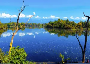
Ghodaghodi Tal is a natural oxbow lake system formed by the changing courses of the surrounding Terai river networks. Spanning an area of over 2,500 hectares, it is a globally protected Ramsar Wetland Site.
The lake is surrounded by dense tropical deciduous forests dominated by towering Sal trees (Shorea robusta). It serves as a vital wildlife corridor connecting the plains of Nepal with the foothills of the Siwalik range. The warm, shallow waters are home to marsh crocodiles (muggers), softshell turtles, and over 240 species of native and migratory birds.
B. Comprehensive Route Blueprint
-
The Highway Cruise: Reaching Ghodaghodi Tal is a straightforward highway drive. From the midwestern transport hub of Kohalpur, overlanders simply head west along the East-West Highway.
-
The Far-West Transit: The road runs straight through Bardiya National Park and crosses the iconic Karnali Bridge at Chisapani. From Chisapani, you continue west through the Kailali district until you reach the small town of Sukhad Bazaar. The entrance gate to Ghodaghodi Tal sits directly alongside the main highway, allowing vehicles to pull right off the asphalt and into the park perimeter.
C. Overland Driving Dynamics & Vehicle Parameters
Because this route follows the primary national highway, it is fully accessible to any vehicle, including standard sedans, luxury camper vans, and street motorcycles. The driving challenges here are not rock slides or steep switchbacks, but rather managing highway speeds, navigating around local cycle traffic, and watching for wildlife crossings through the national park corridors.
If you plan to explore the secondary unpaved dirt tracks that circle the wider wetland forest perimeter, a vehicle with decent ground clearance is useful to handle sandy patches and dry river beds.
D. Optimal Overlanding Season
-
November to March: The winter season is the perfect time to explore the Terai plains. The weather is comfortably warm during the day and cool at night, completely free from the intense, sweltering heat of the summer months. This window also aligns with the arrival of thousands of migratory birds from Siberia.
-
April to June: Temperatures can skyrocket above $40^\circ\text{C}$, making travel uncomfortable without a strong vehicle air conditioning system.
E. Camp and Accommodation Logistics
The lakeside area features well-maintained walking paths, wooden viewpoints, and a dedicated visitor information center. While there are plenty of hotels and modern guest houses in nearby cities like Dhangadhi or Chisapani, overlanders can find simple lodges in Sukhad Bazaar.
For camping enthusiasts, several community-managed eco-tourism zones near the forest perimeter allow overlanders to park their rigs and camp under the jungle canopy, providing an excellent base for early-morning birdwatching and crocodile-spotting safaris.
2. Begnas & Rupa Lakes (Kaski District)
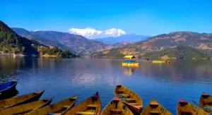
The Peaceful, Forested Twin Sanctuaries of the Pokhara Valley
While Phewa Lake in Pokhara is highly commercialized and crowded, its twin sister lakes—Begnas Tal and Rupa Tal—located just 15 kilometers east of Pokhara city center at an elevation of 650 meters (2,132 feet), offer a serene, forested alternative easily accessible by any vehicle.
[Pokhara Lakeside] ──(Prithvi Highway Eastbound)──> [Gagangauda Junction] ──(Begnas Bazaar Road)──> [Begnas Waterfront] ──(Ridge Dirt Tracks)──> [Rupa Lake Overlook]
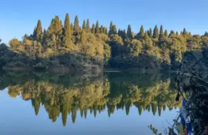
A. Geography & Genesis
Begnas and Rupa are natural freshwater lakes separated by a high, forested ridge line known as Pachabhaiya Danda. Begnas is the larger of the two, famous for its deep, calm waters that perfectly reflect the Annapurna and Manaslu mountain ranges. Rupa Lake is narrower, shallower, and heavily surrounded by dense wetlands, making it a pristine habitat for native fish farming and bird species.
B. Comprehensive Route Blueprint
-
The Main Approach: From Pokhara’s main lakeside district, you drive east along the Prithvi Highway, passing through the city center. Upon reaching the Gagangauda junction, you turn north onto a well-paved secondary road that heads straight to Begnas Bazaar, leading directly to the main waterfront parking dam.
-
The Ridge Overlander Track: For an adventurous off-road experience, look for the unpaved dirt tracks that climb onto the Pachabhaiya Danda ridge separating the two lakes. This rugged path requires navigating steep, gravelly inclines that reward drivers with panoramic vantage points where they can look down to see Begnas Lake on the left and Rupa Lake on the right.
C. Driving Dynamics & Vehicle Choices
The main access roads to Begnas waterfront are fully paved and highly accessible for all vehicles. However, if you choose to explore the unpaved ridge tracks or the rural dirt paths that encircle Rupa Lake, you will need a vehicle with good ground clearance and reliable traction.
These ridge roads feature loose, dusty gravel that can make front-wheel-drive vehicles slip on steep inclines. Activating four-wheel drive or maintaining smooth momentum on a motorcycle is key to navigating these scenic ridge tracks safely.
D. Optimal Overlanding Season
-
October to May: The entire autumn, winter, and spring seasons offer beautiful weather, clear mountain views, and stable driving conditions across both the paved roads and the unpaved ridge paths.
E. Camp and Accommodation Logistics
The area around Begnas Lake offers an excellent mix of quiet lakeside resorts, organic homestays, and local cafes.
For overlanders, the hidden dirt tracks along the northern and eastern shores of Begnas offer flat, secluded clearings right near the water’s edge. Here, you can park your vehicle, deploy a roof-top tent, and enjoy an independent lakeside campout far away from the noisy tourist crowds of Pokhara.
STRATEGIC COMPARISON OF OVERLAND LAKE DESTINATIONS
To help you plan your next major road trip, this comprehensive matrix compares all the major vehicle-accessible lakes across Nepal based on elevation, route difficulty, and vehicle requirements.
| Lake / Destination | District & Region | Elevation (m) | Drivable Surface Type | Technical Difficulty | Minimum Vehicle Requirement | Recommended Camping Style |
| Rara Lake | Mugu, Karnali | 2,990m | Paved Highway / Loose Shale / Deep Mud | Extreme | High-Clearance 4×4 or Adventure Bike | Self-Sustained / Rooftop Tents |
| Lake Mansarovar | Tibet Border Corridor | 4,590m | Rough Gorge Tracks / Paved Highways | Very High | Turbocharged 4×4 Rig (Permit Convoy) | Basic Guesthouses / Camper Van |
| Indrasarovar | Makwanpur, Central | 1,500m | Paved Tarmac / Clay Mud Tracks | Moderate | SUV / Dual-Sport Motorcycle | Lakeside Grassy Turf Camping |
| Kupinde Daha | Salyan, Western Hills | 1,300m | Paved Highway / Unpaved Forest Dirt | High | High-Clearance 4×4 or Dual-Sport Bike | Full Remote Wild Camping |
| Syarpu Lake | Rukum West, Western | 1,372m | Rough Gravel / Steep Dirt Switchbacks | High | 4×4 Vehicle or Adventure Motorcycle | Village Homestays / Vehicle Setup |
| Mai Pokhari | Ilam, Eastern Hills | 2,120m | Smooth Asphalt / Concrete Tracks | Moderate | AWD Vehicle / Wet-Weather Grip | Traditional Homestays Outside Park |
| Ghodaghodi Tal | Kailali, Far-West Plains | 205m | Paved National Highway | Low | Accessible for all vehicles | Eco-Camping near Forest Edge |
| Begnas & Rupa | Kaski, Mid-Hills | 650m | Paved Tarmac / Loose Ridge Gravel | Low to Med | Any Vehicle (4×4 for ridge tracks) | Secluded Lakeside Clearings |
THE TECHNICAL OVERLANDING BLUEPRINT: PREPARING FOR HIMALAYAN TERRAIN
Venturing into the remote corners of Nepal by vehicle requires careful mechanical preparation. Out here, a simple mechanical failure can turn an exciting road trip into a serious survival situation. Your vehicle preparation must be thorough and disciplined.
1. Essential Vehicle Mechanical Enhancements
-
Suspension and Clearance: Standard factory suspension systems are often overwhelmed by the continuous, high-frequency impacts of unpaved Himalayan tracks. Upgrading to heavy-duty, long-travel shock absorbers and raised coil springs provides a critical increase in ground clearance and helps prevent the undercarriage from grounding out on rough river beds.
-
Underbody Protection: Installing a robust, heavy-duty steel or aluminum skid plate (bash plate) underneath the engine oil pan, transmission casing, and fuel tank is non-negotiable. A single stray rock kicked up along the Karnali Highway can easily crack an oil pan open, ending your trip instantly.
-
Differential Locks: While a standard all-wheel-drive system works well on paved roads, navigating deep mud ruts or loose shale climbs requires a true four-wheel-drive system equipped with a locking center and rear differential. This ensures that engine power is distributed equally to all wheels, maintaining forward momentum even if one wheel loses contact with the ground.
[Stray Rock Impact] ──> [No Skid Plate] ──> Cracked Oil Pan ──> Engine Failure.
[Stray Rock Impact] ──> [Steel Skid Plate] ──> Rock Glides Underneath ──> Safe Journey.
2. High-Altitude Driving Dynamics & Powertrain Management
-
Managing Engine Power Loss: As your vehicle climbs above 2,500 meters, the air becomes thinner, reducing the amount of oxygen entering the combustion chambers. This results in a natural drop in engine horsepower and torque. Drivers must adapt by using lower gears to keep the engine operating within its optimal power band.
-
Monitoring Exhaust Gas Temperatures (EGT): When a turbocharged diesel vehicle climbs steep mountain passes at high altitudes, the engine works significantly harder, causing exhaust gas temperatures to rise rapidly. Drivers should install an EGT gauge and monitor it closely, pulling over to let the engine idle and cool down if temperatures cross safe thresholds.
-
Advanced Braking Systems: Long, continuous downhill descents from mountain passes can quickly overheat standard brake rotors, leading to severe brake fade. Drivers must rely on engine braking by shifting into a lower gear ($4\text{WD Low Range, 1st or 2nd Gear}$) to let the engine’s compression manage the descent speed, preserving the service brakes for emergency stops.
3. Comprehensive Recovery Gear Matrix
Every self-respecting overlanding rig heading into remote regions of Nepal must carry a dedicated, commercial-grade vehicle recovery kit:
                  [ESSENTIAL OVERLAND RECOVERY KIT]
  ┌───────────────────────┼────────────────────────┐
  ▼                       ▼                        ▼
[ELECTRIC WINCH]   [MAXTRAX LADDERS]    [KINETIC SNATCH STRAPS]
(Min 9,500 lbs,    (Essential for deep   (For vehicle-to-vehicle
 synthetic rope)    sand & clay mud)      recovery pulls)
-
Electric Winch: A front-mounted electric winch rated for at least 1.5 times your vehicle’s gross weight, fitted with a synthetic rope, is the ultimate self-recovery tool for clearing landslide blockages or pulling yourself out of deep mud ruts.
-
Recovery Tracks (Maxtrax): A set of high-strength nylon recovery boards is incredibly useful for getting out of slippery clay shoreline mud or loose river sand without needing a winch anchor point.
-
Kinetic Snatch Straps: A heavy-duty, elastic kinetic recovery strap allows another vehicle to perform a safe, high-momentum pull to rescue a stranded rig from deep mud ruts or sand traps.
-
Heavy-Duty Tire Inflator: A high-volume, 12-volt air compressor is essential for airing up your tires back to highway pressures once you transition from rough off-road tracks back onto smooth national asphalt.
ENVIRONMENTAL ETHICS & BACKCOUNTRY CONSERVATION
The long-term sustainability of overland exploration in Nepal depends directly on maintaining a high level of environmental ethics and respect for local communities.
-
Strictly Adhere to Established Tracks: Never drive your vehicle across delicate alpine meadows, wetlands, or directly into active river systems unless it is part of an established road crossing. Creating new tracks accelerates soil erosion, leading to severe gullies during the monsoon season that can permanently ruin the local landscape.
-
Complete Pack-In, Pack-Out Discipline: Remote lake destinations like Kupinde Daha or Syarpu Lake do not have centralized waste management systems. Overlanders must be completely self-contained, packing out every piece of trash, plastic, and food waste generated during their campout, ensuring the shoreline remains pristine for future travelers.
-
Respect Local Religious and Cultural Sanctuaries: Many hidden lakes in Nepal, such as Mai Pokhari and Kupinde Daha, are considered sacred religious sites by local communities. Overlanders should park in designated zones, avoid loud music or disruptive behavior near temples, and always seek permission from local community forest committees before pitching camp. This respectful approach ensures that overlanders remain welcome guests across the country.
CONCLUSION: DESIGNING YOUR EXPEDITION BLUEPRINT
Stepping away from traditional tourist paths to explore Nepal’s hidden lakes by vehicle is an incredible, life-changing adventure. Whether you are taking on the extreme off-road challenge to reach Rara Lake, navigating the misty mountain roads to Mai Pokhari, or setting up a peaceful weekend camp on the grassy banks of Indrasarovar, these journeys offer a beautiful mix of wild terrain, deep culture, and absolute freedom.
The secret to a successful Himalayan overland expedition lies in balancing a passion for exploration with careful mechanical preparation and deep respect for the environment. Ensure your vehicle is properly equipped, study your routes thoroughly, respect the changing mountain weather, and set out onto the trail knowing you are experiencing the absolute frontier of global overland adventure!


How to book a trip?

make free inquiry

confirm the trip