

The Celestial Arc: Complete Guide to Nepal’s Premier Himalayan Sunrise Viewpoints
Few travel experiences match the sheer magic of watching the first golden rays of dawn hit the snow-capped, monolithic walls of the Himalayas. Because of Nepal’s unique geography—stretching from low-altitude hill stations to the highest ridges on Earth—you can experience world-class sunrises whether you are a casual luxury traveler or an alpine trekker.
At dawn, the unique atmospheric conditions of the high Himalayas create a spectacular display of light. Before the sun rises, the peaks appear as deep blue shadows against a dark sky. As the first light hits the summits, the snow reflects vibrant shades of pink, orange, and gold, while the valleys below remain in darkness.
This comprehensive guide breaks down the premier sunrise viewpoints across Nepal, categorized by accessibility, region, and physical demand. It provides complete topographical details, mountain profiles, and logistical blueprints to help you plan the perfect morning photography or travel excursion.
1. Accessible Hill Stations (No Trekking Required)
Ideal for families, photographers, or those on short timelines who want panoramic mountain views straight from a vehicle, cable car, or boutique resort balcony.
[Kathmandu Basin] ──(32km East Drive)──> [Nagarkot Ridge: 2,175m] ──> Views of 8 Himalayan Ranges
[Pokhara Valley]  ──(30-Min Drive)─────> [Sarangkot Hill: 1,600m]  ──> Mirror View over Phewa Lake
Nagarkot (2,175m / 7,135ft) — The Valley’s Sentinel
Located 32 kilometers east of Kathmandu in the Bhaktapur District, Nagarkot is the most famous high-altitude hill station on the rim of the Kathmandu Valley. Perched strategically on a ridge, it has served for centuries as a lookout point across the central Himalayan arc.
-
The Topography: A high-altitude ridge line that drops sharply into terraced agricultural valleys to the north and east, providing an unobstructed 360-degree horizon line.
-
The Mountain Profile: On clear mornings, Nagarkot offers a sprawling, cinematic view of 8 out of Nepal’s 13 distinct Himalayan ranges. The panorama runs seamlessly from Dhaulagiri and Annapurna in the far west, past the massive walls of the Langtang Himal, Ganesh Himal, and Jugal Himal, to Gaurishankar, Cho Oyu, and even a distant, long-lens glimpse of Mount Everest’s tip on exceptionally clear autumn mornings.
-
The Experience: It is the ultimate luxury city escape. Travelers typically drive up from Kathmandu the afternoon prior, stay in one of the ridge’s premium boutique resorts, and wake up to watch the dawn light develop right from their private balconies or the public view tower. The sight of the valley fog sitting low like a white sea while the peaks ignite above is a favorite composition for landscape photographers.
Sarangkot (1,600m / 5,249ft) — The Pokhara Amphitheater
Sarangkot is a sharp, prominent hill situated just 11 kilometers northwest of Pokhara’s Lakeside district. It sits directly above the deep fracture of the Seti River gorge.
-
The Topography: A steep, narrow ridge that separates the main Pokhara Valley basin from the remote valleys of the lower Annapurna conservation footprint.
-
The Mountain Profile: Sarangkot provides a front-row seat to the Annapurna Massif, Dhaulagiri Range, and Hiunchuli. The absolute star of the morning show is the iconic, sacred, unclimbed peak of Machapuchare (6,993m / 22,943ft), known widely as the “Fishtail Mountain.” Because of its geographic proximity, Machapuchare rises like a colossal granite spire directly across the valley, catching the dawn light long before the lower hills are illuminated.
-
The Experience: Accessible via a brisk 30-minute pre-dawn taxi ride or via the Annapurna Cable Car system. The dawn experience here is unique because it combines two distinct visual elements: the glowing snow-fields of the high peaks above and the calm, glass-like reflection of Phewa Lake directly below. Watch for paragliders launching from the cliffs just after sunrise as the thermal air currents begin to warm.
Chandragiri Hill (2,551m / 8,369ft) — The Himalayan Balcony
Chandragiri Hill forms the southwest boundary of the Kathmandu Valley rim and is historically significant as the vantage point from which King Prithvi Narayan Shah first gazed upon the valley before unification.
-
The Topography: A heavily forested, steep ridge rising sharply from the valley floor at Thankot.
-
The Mountain Profile: Provides an ultra-wide, linear view of the northern skyline. On a clear day, the view extends from the massive white bulk of Manaslu (8,163m) in the west, through the entire Ganesh and Langtang chains, all the way to the jagged profile of Mount Gaurishankar in the east.
-
The Experience: Easily accessed via a modern, 10-minute cable car ride from the Thankot base station. Watching the sun break over a thick blanket of low inversion fog filling the entire Kathmandu Valley basin makes it feel as if you are standing on an island floating above the clouds.
Dhulikhel (1,550m / 5,085ft) — The Cultural Sunrise
An ancient Newari town located 30 kilometers southeast of Kathmandu along the Arniko Highway, offering a quieter alternative to Nagarkot.
-
The Topography: A valley-rim plateau characterized by centuries-old brick architecture and extensive hand-carved agricultural terraces.
-
The Mountain Profile: A sweeping focus on the Eastern and Central Himalayas, with incredibly clear framings of Langtang Lirung, Dorje Lakpa, and the massive, snow-covered wall of Gaurishankar.
-
The Experience: Dhulikhel is highly favored by travelers seeking a calm, spiritual morning experience. The sunrise unfolds over a landscape of traditional farmhouses, ancient shrines, and pine forests, making it a wonderful location for combining cultural photography with landscape shots.
2. Iconic Trekking Viewpoints (Moderate Effort)
For active travelers willing to lace up their hiking boots and ascend through rhododendron forests to stand in the heart of the sub-alpine zones.
                       [Dhaulagiri: 8,167m]           [Annapurna I: 8,091m]
                                 \                             /
                                  \                           /
                       ────────────┴─────────────────────────┴────────────
                            [ POON HILL OBSERVATION DECK: 3,210m ]
                       ───────────────────────────────────────────────────
                                                ▲
                                                │ (45-Minute Pre-Dawn Climb)
                                                │
                                      [Ghorepani Teahouses]
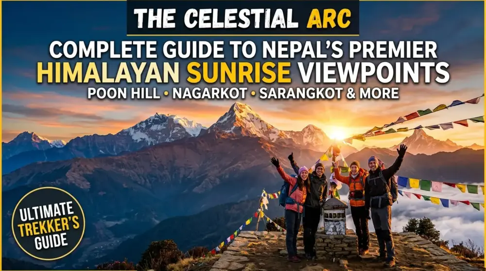
Poon Hill (3,210m / 10,531ft) — The Photographer’s Gateway
Poon Hill is the crown jewel of short-duration trekking viewpoints in Nepal. Situated directly above the village of Ghorepani in the Myagdi District, it requires a 3-to-5-day loop trek starting from the trailheads near Pokhara.
-
The Topography: A rounded, grassy sub-alpine summit equipped with a multi-tiered wooden observation tower facing due north toward the great Himalayan fracture.
-
The Mountain Profile: A complete 360-degree panorama dominated by two of the world’s fourteen 8,000-meter giants: Dhaulagiri (8,167m / 26,795ft) to the west and Annapurna I (8,091m / 26,545ft) to the north. These titans are flanked by a supporting cast of peaks, including Annapurna South, Hiunchuli, Nilgiri, and the sharp profile of Machapuchare.
-
The Experience: Trekkers wake up at 4:30 AM to make the final, headlamp-lit 45-minute climb from Ghorepani through frosted rhododendron forests. Standing at the top with hundreds of fellow travelers as the first rays of light transform the icy faces from cold blue to brilliant amber is a classic Nepali rite of passage.
Mardi Himal Upper Viewpoint (4,200m / 13,779ft) — The Spine Ride
The Mardi Himal trail is an offbeat, fast-growing ridge trek that branches away from the traditional Annapurna Base Camp route, tracking along a narrow mountain ridge toward the base of Machapuchare.
-
The Topography: A sharp, dramatic alpine ridge line with sheer drops into the Modi Khola valley to the west and the Mardi Khola valley to the east.
-
The Mountain Profile: This viewpoint offers an incredibly intimate look at Machapuchare and Annapurna South. Unlike Poon Hill, where the mountains form a distant wall across the horizon, Mardi Himal places you directly on a structural ridge right beneath the southwest face of Fishtail Mountain. The relief is so vertical that you must tilt your camera upward to frame the summits.
-
The Experience: Leaving the high camp at 4:00 AM, trekkers navigate a narrow, occasionally icy mountain path marked by stone cairns. Because the route follows a ridge, you enjoy expansive views on both sides throughout the entire pre-dawn climb. It is significantly less crowded than Poon Hill, providing a raw, wilderness-focused sunrise experience.
Khopra Danda (3,660m / 12,007ft) — The Wilderness Ridge
An exceptional alternative to the busy trails of Ghorepani, Khopra Danda (Ridge) sits high above the deepest gorge in the world—the Kali Gandaki River valley.
-
The Topography: A high, isolated pasture ridge that stands completely exposed between the main Annapurna and Dhaulagiri massifs.
-
The Mountain Profile: A jaw-dropping, eye-level view of the massive south face of Dhaulagiri (8,167m), which feels close enough to touch. To the east, the trail looks across at Annapurna South, Nilgiri, and Tukuche Peak.
-
The Experience: Reached via a demanding branch of the Annapurna trekking network. The sunrise here is stunning because no intermediate hills are blocking your view; you look straight down into the depths of the Kali Gandaki valley while the peaks above glow with morning light.
3. Ultimate High-Altitude Frontiers (Extreme Effort)
For experienced adventurers, mountaineers, and hardcore trekkers prepared to navigate thin air, freezing temperatures, and rugged terrain to stand eyeball-to-eyeball with the world’s highest peaks.
   [Gokyo Ri: 5,357m]   ──> Panoramic framing of 4 Separate 8,000m Peaks + Turquoise Lakes
   [Kala Patthar: 5,555m] ──> Front-row face of Mt. Everest (8,848.86m) & Khumbu Glacier
Kala Patthar (5,555m / 18,225ft) — The Face of Everest
Kala Patthar (meaning “Black Rock” in Nepali) is a prominent landmark located on the southern ridge of Pumori in the Khumbu region, sitting directly above the final trail outpost of Gorak Shep.
-
The Topography: A steep, wind-scoured ridge of dark shale and giant granite boulders jutting out into the upper reaches of the Khumbu Glacier system.
-
The Mountain Profile: This is the definitive vantage point for viewing the true summit of Mount Everest (8,848.86m / 29,031ft), alongside Lhotse (8,516m), Nuptse (7,861m), and Pumori (7,161m). Because Mount Everest’s summit is actually obscured by the massive shoulder of Nuptse when standing at its own Base Camp, Kala Patthar is the primary objective for photographers seeking the classic shot of the world’s highest peak.
       [Mt. Everest: 8,848m]          [Nuptse: 7,861m]
                \                           /
                 \                         /
            ──────┴───────────────────────┴───────
                [ KALA PATTHAR RIDGE: 5,555m ]
            ──────────────────────────────────────
                              ▲
                 (Grueling 2-Hour Alpine Climb)
                              │
                    [Gorak Shep Lodges]
-
The Experience: The climb begins around 4:00 AM from Gorak Shep in intense alpine cold, with temperatures regularly dropping between -10°C to -20°C. Navigating the steep switchbacks requires slow, measured pacing due to the extreme altitude. The reward is an unmatched Himalayan view: watching the sun break directly from behind the ridge of Everest, casting a giant shadow across the vast, crevassed expanse of the Khumbu Glacier below.
Gokyo Ri (5,357m / 17,575ft) — The Four-Titan Panorama
Gokyo Ri is a classic peak rising out of the northern shore of the third Gokyo Lake (Dudh Pokhari) within the high-altitude Everest region.
-
The Topography: A freestanding, pyramid-shaped alpine peak that offers an unrestricted, wide-angle view across the entire Khumbu valley system.
-
The Mountain Profile: Many professional landscape photographers rate the sunrise from Gokyo Ri as superior to Kala Patthar. From this single location, your camera can frame four of the world’s fourteen 8,000-meter peaks simultaneously: Mount Everest (8,848m), Lhotse (8,516m), Makalu (8,485m), and Cho Oyu (8,188m).
-
The Experience: The pre-dawn climb involves a relentless 2-to-3-hour trudge up steep, sandy, and rocky trails from the Gokyo lakeside lodges. The view from the summit is spectacular, combining the rugged granite forms of the 8,000-meter peaks with the turquoise waters of the Gokyo Lakes and the massive ice fields of the Ngozumpa Glacier (the longest glacier in the Himalayas) directly below.
Thorong La Pass (5,416m / 17,769ft) — The High Pass Dawn
The absolute crux and highest point of the world-famous Annapurna Circuit Trek, separating the Manang Valley from the arid Mustang region.
-
The Topography: A high-altitude mountain pass flanked by the massive peaks of Khatung Kang and Yakawa Kang.
-
The Mountain Profile: A stark, desert-like alpine landscape offering views of the Dhaulagiri Range, the Damodar Himal, and the deep trench of the Kali Gandaki Gorge.
-
The Experience: Trekkers typically leave High Camp or Thorong Phedi as early as 3:30 AM to safely cross the pass before high afternoon winds pick up. Reaching the summit marker—decorated with hundreds of colorful Buddhist prayer flags—just as the sun illuminates the Chulu peaks and Dhaulagiri is an unforgettable, high-altitude experience.
4. Off-the-Beaten-Path & Cultural Hidden Gems
For seasoned travelers looking to escape the classic tourist routes and enjoy pristine sunrises alongside unique local traditions.
Pikey Peak (4,065m / 13,336ft) — Hillary’s Favorite View
Located in the lower Solukhumbu region, Pikey Peak is an off-the-beaten-path destination that has gained steady recognition among travelers seeking a quiet alternative to the main Everest trails.
-
The Topography: A high sub-alpine ridge that stands alone south of the main Himalayan wall, offering an exceptionally wide field of view.
-
The Mountain Profile: Sir Edmund Hillary, the first man to stand on the summit of Mount Everest alongside Tenzing Norgay, famously stated that the view of Everest from Pikey Peak was his absolute favorite. The peak offers a panoramic view stretching from Mt. Shishapangma in the west past Everest, Lhotse, Makalu, all the way to Kangchenjunga in the far east.
-
The Experience: Reached via a gentle 5-to-7-day trek through traditional Sherpa and Tamang villages. The sunrise here is special because the peak’s southern placement allows you to capture the entire length of the high Himalayas illuminated by the morning sun from an elegant side-profile angle.
Antu Danda (1,977m / 6,486ft) — The First Light of Nepal
Situated in the far eastern corner of Nepal within the Ilam District, Antu Danda sits right on the border separating Nepal from Darjeeling, India.
-
The Topography: A lush, rolling hill station entirely carpeted by historic tea gardens, manicured pine forests, and local agricultural homesteads.
-
The Mountain Profile: The northern horizon is anchored by the massive, multi-peaked ridge of Kangchenjunga (8,586m / 28,169ft), the third-highest mountain on Earth.
-
The Experience: Because of its geographic placement in the far eastern reaches of the country, Antu Danda is the very first place in Nepal to receive sunlight each morning. The sunrise here offers a completely different look than the high-altitude rocky valleys, trading harsh stone and ice for rolling green tea estates, low valley mists, and unique local homestays.
Mohare Danda (3,300m / 10,826ft) — The Eco-Community Ridge
An eco-trekking route that runs parallel to Poon Hill but focuses entirely on sustainable, community-run lodge operations.
-
The Topography: A high, open pasture ridge covered in pine and rhododendron trees, directly facing the Annapurna South wall.
-
The Mountain Profile: Offers an identical view of Dhaulagiri and the Annapurnas as Poon Hill, but from a slightly closer, more direct southern angle.
-
The Experience: Because the trail is managed entirely by local village cooperatives, there are no large commercial hotels. You wake up in a cozy, community-run eco-lodge and walk just a few steps to the ridge line, enjoying the same spectacular mountain sunrise as Poon Hill without the heavy tourist crowds.
Technical Specifications: Comparative Matrix
This technical directory serves as a comparative guide to help you match your physical capabilities, location, and travel style with the ideal viewpoint location.
| Viewpoint Name | Regional Sector | Precise Altitude | Access Strategy | Technical Difficulty | Crowding Intensity | Primary Peaks Visible |
| Sarangkot | Pokhara / Annapurna | 1,600m / 5,249ft | Vehicle Drive / Cable Car | Easy (Walkway) | High | Machapuchare, Annapurna II, Dhaulagiri |
| Antu Danda | Ilam / Far-East | 1,977m / 6,486ft | Overland Jeep Transfer | Easy (Steps) | Low | Kangchenjunga, Jannu |
| Nagarkot | Kathmandu Valley Rim | 2,175m / 7,135ft | Private Vehicle Drive | Easy (View Tower) | High | Langtang Lirung, Ganesh Himal, Everest (Tip) |
| Chandragiri | Kathmandu Valley Rim | 2,551m / 8,369ft | 10-Min Cable Car Ride | Easy (Platform) | Moderate | Manaslu, Ganesh Himal, Langtang Range |
| Poon Hill | Ghorepani / Annapurna | 3,210m / 10,531ft | 3-5 Day Trekking Loop | Moderate | High | Dhaulagiri I, Annapurna South, Machapuchare |
| Mohare Danda | Annapurna Foothills | 3,300m / 10,826ft | 4-5 Day Eco-Trek | Moderate | Low | Dhaulagiri, Annapurna I, Hiunchuli |
| Khopra Danda | Annapurna / Kali Gandaki | 3,660m / 12,007ft | 6-8 Day Wilderness Trek | Demanding | Low | Dhaulagiri South Face, Nilgiri, Tukuche |
| Pikey Peak | Lower Solukhumbu | 4,065m / 13,336ft | 5-7 Day Cultural Trek | Moderate | Low | Everest, Lhotse, Makalu, Gaurishankar |
| Mardi Himal | Upper Annapurna Ridge | 4,200m / 13,779ft | 5-6 Day Alpine Trek | Demanding | Moderate | Machapuchare (Close-up), Annapurna South |
| Gokyo Ri | Gokyo Valley / Everest | 5,357m / 17,575ft | 11-13 Day High Trek | Strenuous | Moderate | Everest, Lhotse, Makalu, Cho Oyu |
| Thorong La | Manang / Annapurna Cir. | 5,416m / 17,769ft | 12-14 Day Circuit Trek | Strenuous | High | Dhaulagiri, Chulu Peaks, Yakawa Kang |
| Kala Patthar | Gorak Shep / Everest | 5,555m / 18,225ft | 12-14 Day EBC Trek | Strenuous | High | Mount Everest, Nuptse, Lhotse, Pumori |
Environmental Dynamics & Seasonal Considerations
To secure pristine, uninterrupted mountain visibility, coordinating your travel dates with the regional weather cycles of the Indian subcontinent is absolutely critical.
[AUTUMN] Oct - Nov : Crisp Air, Post-Monsoon Clarity, Optimal High-Altitude Trekking
[SPRING] Mar - Apr : Rising Temperatures, Valley Haze, Wild Rhododendron Blooms
The Autumn Window (October to November) — The Gold Standard
This is universally recognized as the prime viewing window across all elevations in Nepal. The heavy monsoon rains of the summer months have completely washed the atmosphere of dust, pollen, and pollution. The morning air is crisp, dry, and exceptionally stable, offering flawless blue skies and maximum long-range visibility. High-altitude viewpoints like Kala Patthar and Gokyo Ri are best visited during this window.
The Spring Window (March to April) — The Colorful Choice
Spring offers comfortable, warmer temperatures for morning excursions. While the lower valleys can occasionally gather ambient dust or haze by late morning, the early dawn hours remain consistently clear. This season is highly favored for mid-altitude viewpoints like Poon Hill and Nagarkot, as the surrounding hillsides come alive with blooming rhododendron forests, adding a beautiful crimson framework to your mountain photos.
The Winter (December to February) and Monsoon (June to September) Challenges
-
Winter: Offers intensely clear morning skies and nearly empty viewpoints, but comes with extreme, freezing temperatures. High-altitude spots above 4,000 meters require specialized cold-weather gear, and trails can often be blocked by heavy snow.
-
Monsoon: Heavy summer rains mean that the high peaks are almost constantly hidden behind thick storm clouds. The risk of landslides along driving mountain roads and slippery, leech-prone jungle trails makes morning viewpoint excursions highly unpredictable and generally unrewarding.
Field Guide: Photography Strategies for Himalayan Dawn
Capturing the massive scale and extreme dynamic range of a Himalayan sunrise requires specific adjustments to your shooting technique and gear selection.
1. Managing the Extreme Dynamic Range
As the sun breaks over the mountain ridges, the contrast between the highly reflective, snow-covered peaks and the dark, unlit valleys below can easily overwhelm your camera’s sensor.
-
The Exposure Target: Set your camera to spot-metering and meter directly off the illuminated snow-fields to prevent overexposing the highlights. It is much easier to recover shadow details from the dark valleys during post-processing than it is to fix blown-out highlights on a glacier.
-
Bracket Your Shots: Utilize your camera’s Automatic Exposure Bracketing (AEB) feature to take 3 or 5 separate shots at varying exposure values (-2EV, -1EV, 0, +1EV, +2EV). This gives you the ideal exposures needed to blend into a single High Dynamic Range (HDR) image later.
2. Lens Selection and Composition Options
-
The Telephoto Zoom (70-200mm / 100-400mm): Crucial for high-altitude spots like Nagarkot or Kala Patthar. A telephoto lens compresses the scene, allowing you to isolate individual peaks, ridges, or icefalls, capturing the intricate textures of the glaciers and wind-blown snow plumes trailing off the summits.
-
The Wide-Angle Prime (16-35mm): Best suited for locations like Sarangkot or Gokyo Ri, where you want to frame the wide arc of the mountains alongside foreground features like Phewa Lake or the turquoise waters of the Gokyo Lakes.
3. Essential Gear Stability and Power Backups
-
A Heavy-Duty Tripod: Pre-dawn mountain ridges are frequently subject to high winds. A sturdy tripod is essential for keeping your camera stable during slow exposure adjustments before the sun fully rises.
-
Protecting Battery Life: Extreme cold accelerates chemical drainage in lithium-ion batteries. Keep your spare camera and phone batteries tucked inside an inner jacket pocket close to your body heat until the exact moment you need to insert them into your device.
Safety Blueprints for High-Altitude Viewpoints
When pushing above the 3,000-meter threshold for early morning treks, the combination of darkness, sub-zero temperatures, and thin air requires strict safety adherence.
-
Preventing Acute Mountain Sickness (AMS): For high-altitude view ridges like Mardi Himal, Gokyo Ri, and Kala Patthar, ensure your itinerary includes dedicated acclimatization days in the preceding villages. Never attempt a rapid vertical ascent for a sunrise if you are experiencing a persistent headache, dizziness, or nausea.
-
Illumination Protocols: Always use a high-lumen, reliable headlamp for pre-dawn climbs, leaving your hands entirely free to hold trekking poles or navigate rocky steps. Do not rely on a smartphone flashlight, which can drop to zero battery instantly in the mountain cold.
-
Thermal Layering Systems: Standing stationary on an exposed mountain peak waiting for the sun to rise causes your core body temperature to drop quickly. Dress in a comprehensive three-layer system: a moisture-wicking synthetic base layer, an insulating mid-layer (down jacket), and a fully windproof/waterproof outer shell. Bring along a thermal flask filled with hot water or ginger tea to stay warm while you wait.
Conclusion: Crafting the Perfect Morning Itinerary
Whether you choose the easy luxury of watching the mountains turn gold from a resort balcony in Nagarkot, the classic trail experience of climbing Poon Hill, or the ultimate high-altitude challenge of standing at the foot of Mount Everest on Kala Patthar, witnessing a Himalayan sunrise is an unforgettable highlight of traveling in Nepal.
The key to a rewarding experience lies in matching the location with your physical conditioning, choosing the correct season, and preparing your gear for the early morning mountain cold. Pack your layers, check the weather forecasts, and step out onto the view decks ready to witness one of the most magnificent natural spectacles on earth.


How to book a trip?

make free inquiry

confirm the trip