Is June a Good Time to Visit Nepal? The Complete Travel Guide for 2026

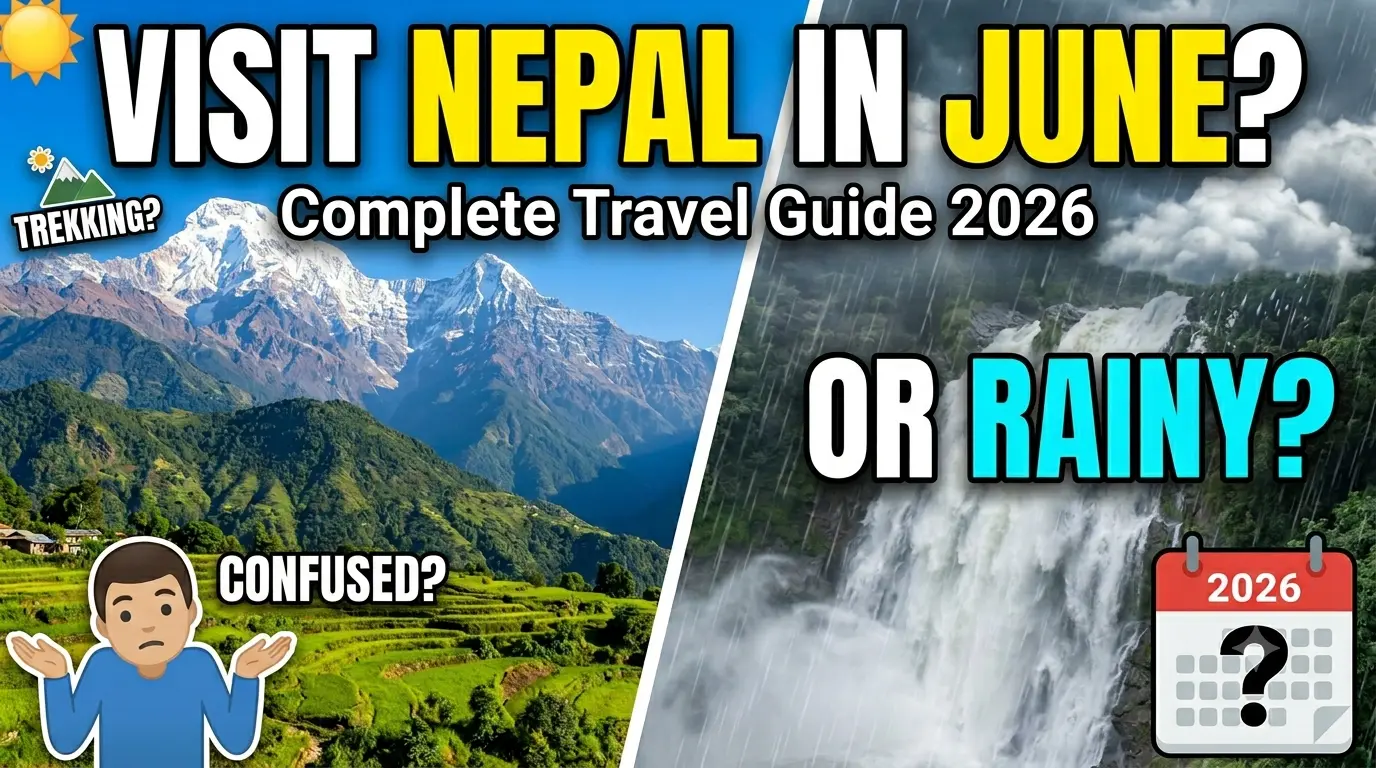
When travelers think about visiting Nepal, most immediately picture the peak trekking seasons of spring and autumn. As a result, June is often overlooked or outright dismissed. However, this lesser-known travel period offers a unique side of the country that many visitors never get to experience.

To answer the burning question simply: Yes, June can be an excellent time to visit Nepal—but it entirely depends on where you go, how you plan to travel, and what your expectations are.

June marks a major transition period in South Asia, shifting from the final hot days of spring into the summer monsoon season. While some travelers hesitate because of the possibility of rain, those who venture into Nepal in June 2026 are rewarded with lush green landscapes, fewer crowds, lower travel costs, and authentic cultural experiences. Whether you are an adventurous trekker wanting to explore isolated cultural enclaves, a budget traveler looking for lower rates, or a photographer craving vibrant landscapes, planning your trip wisely turns this “off-season” into a spectacular journey.

This comprehensive guide covers everything you need to know about traveling to Nepal in June 2026, including detailed weather breakdowns, top destinations, monsoon-proof trekking opportunities, costs, packing recommendations, and survival tips.

1. Understanding Nepal’s Weather & Climate in June

June is a transitional month in Nepal’s climate calendar. Historically, the summer monsoon officially crosses into eastern Nepal around June 10th to June 15th, gradually moving westward across the country over the subsequent weeks. In 2026, climate patterns indicate a slightly erratic transition, where early June retains many hot, dry characteristics of late spring, while late June sees more consistent monsoon rains.

The weather is a tale of multiple elevations and varies significantly depending on where you travel:

Kathmandu Valley

The weather in Kathmandu during June is generally warm, pleasant, and highly manageable.

  • Daytime Temperatures: 25°C to 31°C (77°F to 88°F)

  • Nighttime Temperatures: 18°C to 22°C (64°F to 72°F)

Mornings are frequently clear and sunny, while afternoon showers and localized thunderstorms become increasingly common as the month progresses, serving to clean the air and clear away the dust.

Pokhara

Pokhara experiences much higher rainfall than most parts of Nepal due to its geographic location directly beneath the massive Annapurna range, which acts as a rain trap.

  • Daytime Temperatures: 24°C to 30°C (75°F to 86°F)

  • Nighttime Temperatures: 20°C to 24°C (68°F to 75°F)

While rain is frequent—often manifesting as heavy downpours in the late afternoon or night—the surrounding hills, lakesides, and mountains become exceptionally green and beautiful.

Chitwan & The Terai (Southern Plains)

The southern lowlands are significantly warmer, heavier, and more humid as the tropical air mass settles in.

  • Daytime Temperatures: 30°C to 38°C (86°F to 100°F)

  • Nighttime Temperatures: 24°C to 28°C (75°F to 82°F)

The climate here feels like a steam room. While it remains a suitable time for wildlife viewing—especially during the early part of the month—the intense afternoon heat requires a slower travel pace.

Mountain Regions

Higher-altitude regions remain much cooler and more physically comfortable for walking. Temperatures vary based on elevation but generally range from 5°C to 20°C (41°F to 68°F). Many trekking areas remain fully accessible, although visibility may occasionally be affected by shifting cloud decks.

2. Why June Can Be a Great Time to Visit Nepal

Many travelers automatically avoid Nepal in June 2026 because they associate it strictly with monsoon weather. However, if you look past the surface-level warnings, there are several compelling reasons why June deserves serious consideration.

Fewer Tourists and Less Crowding

One of the grandest advantages of visiting Nepal in June is the drastic reduction in tourist numbers. Popular attractions, heritage sites, and trekking trails become incredibly quiet compared to the packed spring and autumn windows. This means:

  • More peaceful, contemplative sightseeing experiences at sacred monuments.

  • Clean photography opportunities without a sea of selfie sticks.

  • Less crowded trekking routes and empty teahouses.

  • Highly personalized service from guides, drivers, and hotel staff.

Beautiful, Vibrant Green Landscapes

If you dislike the dry, dusty, brown landscapes of the late winter months, June will be a revelation. The first rains of the season act as a life-giving tonic for the countryside. Terraced farms, deep valleys, and hillsides erupt into vibrant, neon shades of green. Rivers flow strongly, waterfalls cascade down canyon walls with roaring power, and the entire natural world feels completely refreshed.

Lower Travel Costs

Because June is universally considered a shoulder or off-peak season, the cost of traveling within Nepal drops substantially. If you are a budget-conscious traveler, you can capitalize on major discounts:

  • Hotel and boutique lodge rates are often slashed by 20% to 40%.

  • Domestic flight availability is high, and premium tour packages are more affordable.

  • Trekking agencies and transportation providers are far more open to pricing negotiations.

Better Availability of Accommodation

Finding premium rooms in popular destinations like Thamel in Kathmandu or Lakeside in Pokhara is incredibly easy in June. Even luxury boutique lodges frequently have immediate availability, granting you ultimate flexibility to alter your itinerary on the fly without booking months in advance.

3. The Challenges of Visiting Nepal in June

An honest, comprehensive guide must balance the silver linings with the genuine complications of the season. Traveling during a monsoon transition introduces specific obstacles you must be prepared to face.

Increasing Rainfall & Humidity

Rainfall becomes steadily more frequent as the weeks pass. Travelers should expect humid conditions, sudden afternoon thunderstorms, and wet roads. In lower regions like Chitwan, the high humidity can make outdoor walking physically exhausting, requiring plenty of hydration.

Reduced Mountain Visibility

Cloud cover can frequently obscure panoramic mountain views, particularly during late June. If your primary, uncompromised dream is to sit on a balcony and stare at an uninterrupted wall of snow-capped peaks all day long, the clear skies of October and November are better suited for you. In June, mountain views are a game of chance—though early mornings often surprise you with sudden, dramatic clearings.

Logistical Disruptions (Flights and Roads)

Monsoon rains introduce real logistical headaches. Heavy downpours mean low visibility, which can lead to temporary delays or cancellations for domestic flights—especially small aircraft flying into mountain airstrips. Furthermore, highways carved into Nepal’s steep hills are prone to muddy conditions and landslides, which can delay road travel.

Leeches and Slippery Trails

In the damp, lower trekking elevations and forested hills, the wet conditions bring out leeches (jugas). While completely harmless, they are a nuisance. Trails also become muddy, slick, and physically demanding to navigate, requiring careful footing.

4. Best Places to Visit in June 2026

Not all destinations in Nepal are equally affected by the arriving monsoon. By aligning your itinerary with the country’s unique geography, you can find regions that are at their absolute prime.

[Bay of Bengal Monsoon Winds] ---> Dumps rain on Southern Slopes (Pokhara / Lowlands)
                                        |
                                  [HIMALAYAN WALL] (Annapurna / Dhaulagiri Ranges)
                                        |
                                        v
                                 [RAIN SHADOW ZONE] ---> Dry, sunny, perfect for:
                                                         * Upper Mustang
                                                         * Upper & Lower Dolpo

A. The Himalayan Rain-Shadow Paradises

When moisture-heavy monsoon winds blow north, they hit the massive physical barrier of the Annapurna and Dhaulagiri mountain ranges. The air is forced upward, cools, and dumps its moisture on the southern slopes. By the time the clouds cross over to the northern side of the peaks, they are completely dry. This creates a geographic phenomenon known as a rain shadow, making these destinations perfect for June travel.

Upper Mustang (The Forbidden Kingdom)

Upper Mustang is arguably Nepal’s ultimate treasure during the monsoon season. Located entirely within the rain shadow, it receives very little rainfall, offering dry trekking conditions, comfortable temperatures (around 20°C), and bright skies.

In June, melting peak snow feeds the valley floors, causing barley fields to turn emerald green and alpine wildflowers to bloom against a dramatic backdrop of wind-sculpted, desert-like ochre cliffs. Because it is a restricted area, it sees very few tourists; in June, you will have the ancient walled capital of Lo Manthang and century-old monasteries entirely to yourself.

Dolpo (Upper & Lower)

Another spectacular rain-shadow destination, Dolpo offers a remote, rugged trekking experience immortalized in classic travel literature. June opens up access to the deep blue, crystal-clear waters of Phoksundo Lake and clears the high mountain passes of heavy winter snow. It is an ideal refuge for adventurous travelers seeking untouched Bon and Tibetan Buddhist cultures, completely insulated from the rainy season.

B. Kathmandu Valley & Pokhara

  • Kathmandu Valley: Historic sites like Pashupatinath Temple, Boudhanath, Swayambhunath, and the ancient Durbar Squares of Kathmandu, Patan, and Bhaktapur remain excellent in June. The afternoon rain showers wash away the city dust and leave the brick architecture looking vibrant. Morning sightseeing is highly rewarding, followed by long afternoons exploring world-class indoor museums or enjoying Thamel’s cafe culture.

  • Pokhara: Pokhara becomes incredibly lush and scenic. While you must navigate frequent rain, the waterfalls (like Davis Falls) become roaring and powerful, and boating on a quiet Phewa Lake surrounded by emerald hills is deeply peaceful. On clear mornings, the reflection of the Annapurna range against the fresh landscape is stunning.

C. Chitwan National Park

Wildlife enthusiasts can still enjoy safari experiences in June, particularly during the early part of the month before the vegetation grows too tall. Morning safaris offer excellent opportunities to spot one-horned rhinoceroses, Bengal tigers, crocodiles, and exotic birds along the riverbanks.

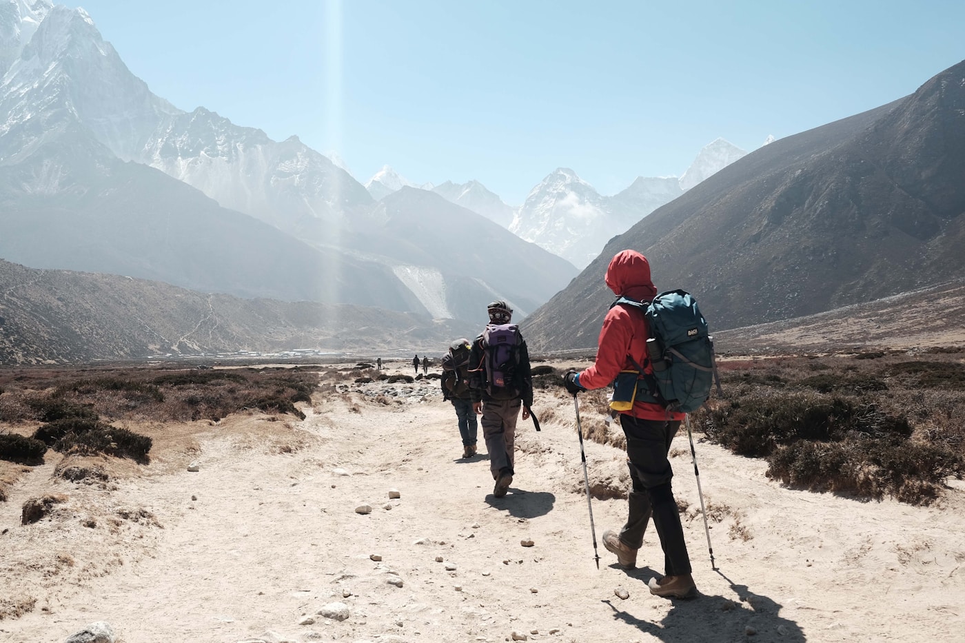
5. Trekking in Nepal During June: Best Route Options

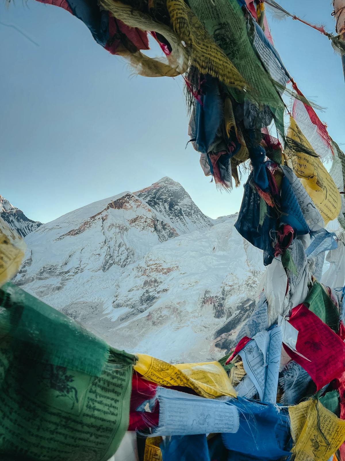
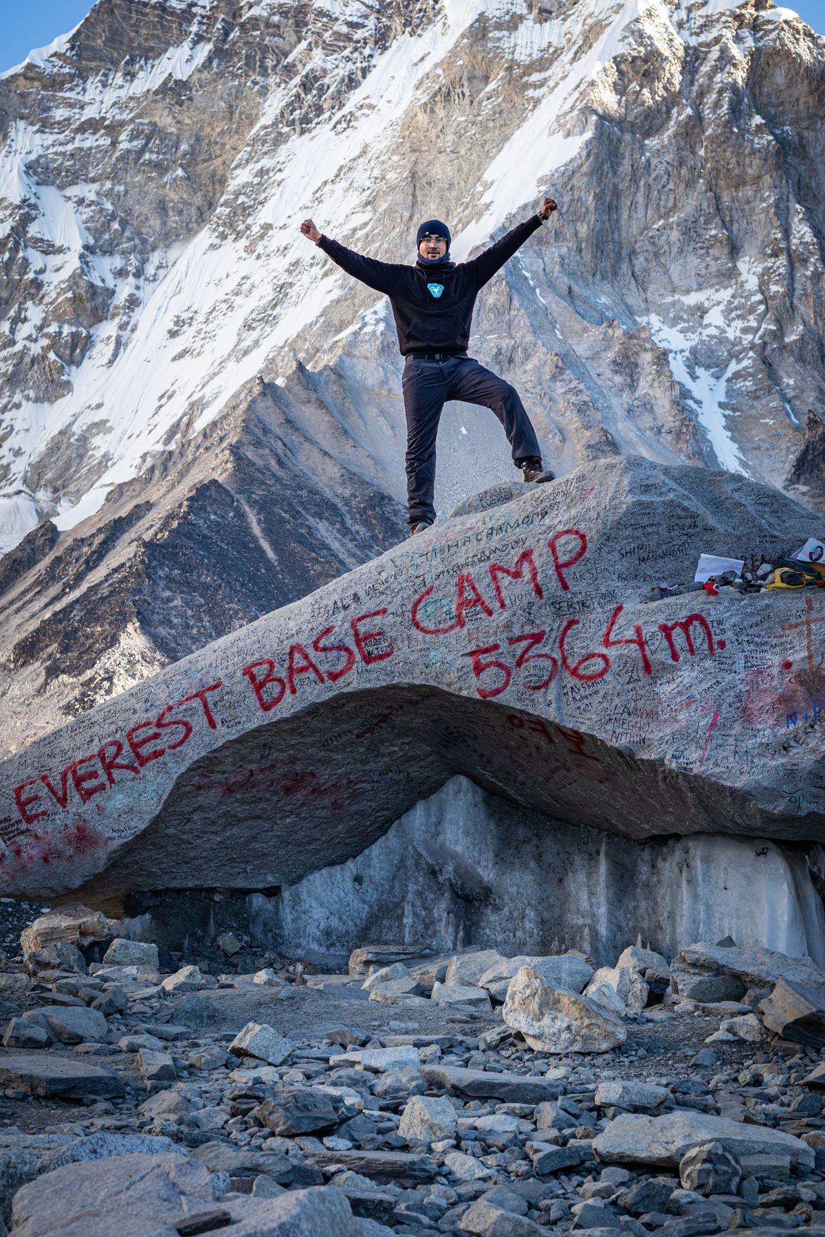
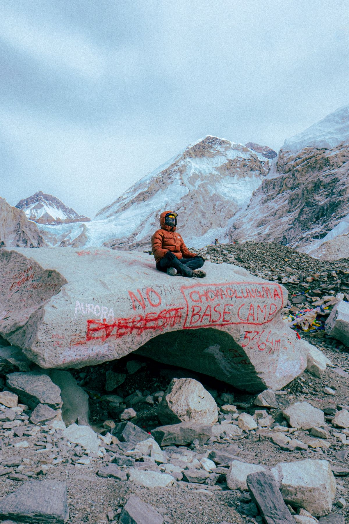
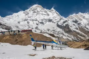
Can you go trekking to Nepal in June 2026? Yes, but destination selection is critical. While classic, exposed routes like Everest Base Camp or the full Annapurna Circuit face severe flight cancellations at Lukla and high landslide risks on lower trails, these specific routes offer favorable conditions:

  • Upper Mustang Trek: The gold standard for June. Arid, culturally rich, and completely unbothered by monsoon rains.

  • Nar Phu Valley Trek: A remote, hidden gem trek tucked behind the Annapurna range, offering relatively dry conditions and zero crowds.

  • Lower Mustang Trek: A shorter, highly accessible option around Jomsom, Muktinath, and Marpha that provides spectacular canyon scenery and comfortable teahouse stays.

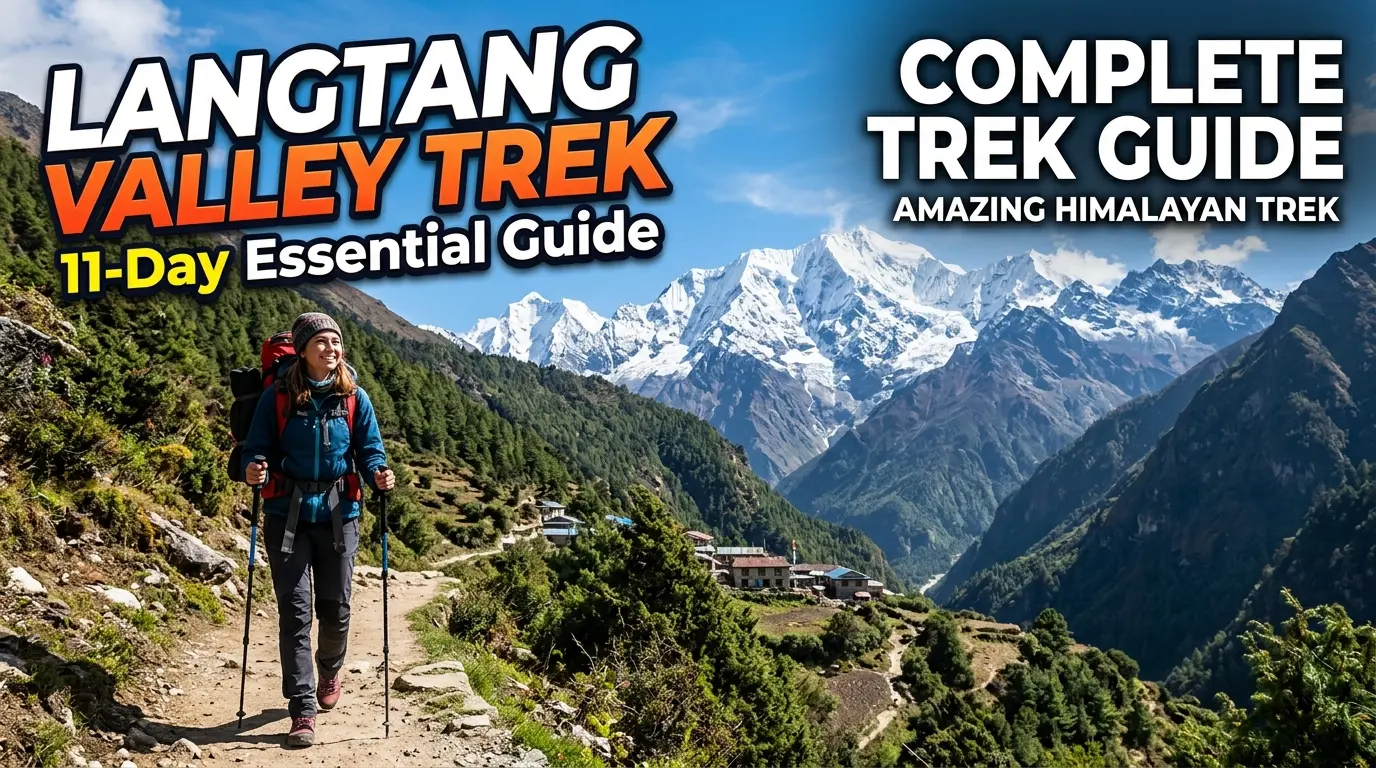
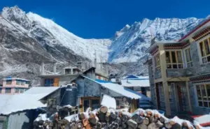
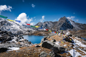
  • Langtang Valley Trek: Suitable during early June. It offers lush forest walking and alpine views before the heavier, late-monsoon downpours set in.

  • Mardi Himal Trek: An excellent choice for a short trek in early June, offering dramatic, close-up mountain views from high ridges before the afternoon clouds roll over the valleys.

6. Festivals and Cultural Experiences

June is a culturally rich, highly joyous month to experience local traditions up close without competing with tourist crowds.

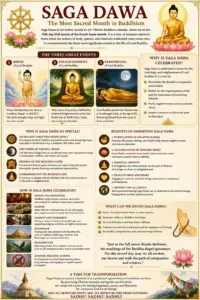
Saga Dawa (The Month of Merits)

Observed with immense devotion by Tibetan Buddhist communities, Saga Dawa commemorates the birth, enlightenment, and parinirvana (passing) of Gautama Buddha. The festival is celebrated over an entire lunar month, with its most holy day—the full moon day of Saga Dawa Düchen—falling at the very turn of the season.

Celebrations are incredibly vibrant around the great stupas of Boudhanath and Swayambhunath in Kathmandu. Visitors can quietly witness thousands of devotees chanting, offering butter lamps, spinning prayer wheels, and participating in sacred spiritual gatherings. Because it is known as the “Month of Merits,” it is a time of immense generosity, virtue, and compassion, making it a beautiful period for cultural immersion.

Ropain Festival (The Monsoon Rice Planting)

nepal-in-june

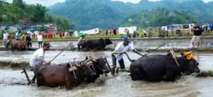
Celebrated on Asadh 15 of the Nepali calendar (typically June 29th), this is one of the most joyful agricultural festivals in Asia. Known as National Paddy Day (Dhan Diwas), it marks the official start of the rice-planting season.

Farmers gather in mud-soaked terraced fields to plant rice saplings to the rhythm of traditional folk songs (Asare Git). The day quickly turns into a playful celebration where locals and travelers jump into the mud together, splash each other, dance, and share the traditional festival meal of Dahi-Chiura (beaten rice with yogurt). The fields surrounding Pokhara, Bhaktapur, and Kaskikot are fantastic places to experience this firsthand.

7. What to Pack for Nepal in June

Packing appropriately is the line between a miserable trip and an incredible adventure. Because June is both hot and wet, leave your heavy winter gear behind and focus on high-performance, lightweight layers.

Essential Clothing

  • Lightweight, Breathable Shirts: Moisture-wicking fabrics that dry quickly in high humidity.

  • Waterproof Shell Jacket: Opt for a lightweight, breathable Gore-Tex jacket with underarm ventilation zippers. Avoid heavy insulated raincoats; they will cause you to sweat profusely.

  • Quick-Dry Hiking Pants & Shorts: Lightweight synthetic materials that won’t hold water.

  • Rain Poncho or Sturdy Umbrella: A compact travel umbrella is incredibly useful for walking around cities when it is too warm for a full jacket.

  • Footwear: Waterproof hiking boots with deep rubber lug soles for slick trails, paired with quick-drying trail sandals (like Tevas or Chacos) for urban exploring.
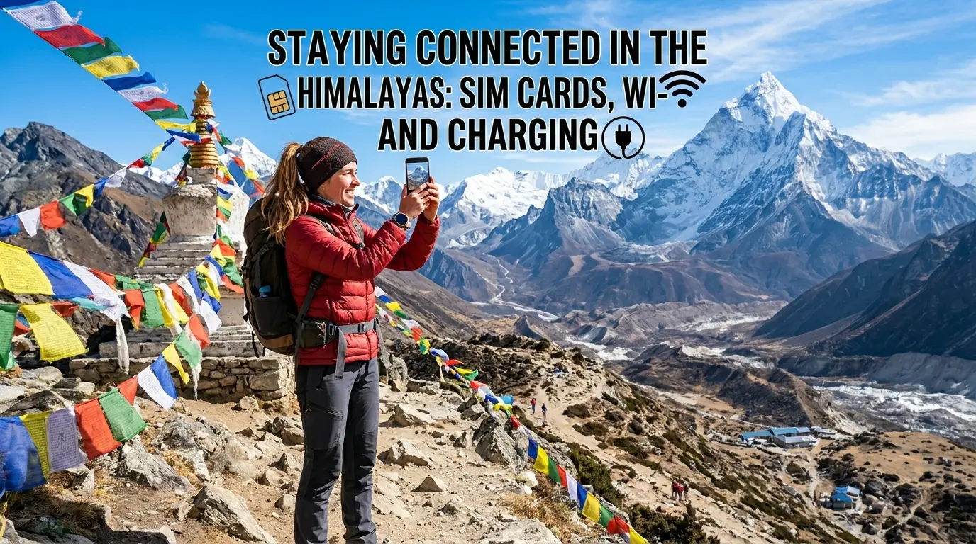
Travel Accessories

  • Waterproof Backpack Cover: Essential for keeping your gear dry during sudden downpours.

  • Dry Sacks / Plastic Liners: Line the inside of your daypack with heavy-duty bags to protect electronics.

  • Power Bank: Essential for keeping phones and cameras charged during temporary rural power outages caused by storms.

  • Sun Hat & Sunglasses: For the intense, bright morning sun.

Health and Safety Items

  • High-DEET Insect Repellent: To ward off mosquitoes in the lowlands and Pokhara.

  • Anti-Leech Defense: Carry a small pouch of fine salt or a concentrated saltwater spray bottle. Dabbing salt on an attached leech causes it to drop off instantly without tearing the skin.

  • Sunscreen & First-Aid Kit: Basic medications, hand sanitizer, and blister band-aids.

8. Travel Costs in Nepal During June 2026

Traveling during the shoulder season offers excellent value for money across all categories. Here is a realistic breakdown of what you can expect to spend:

Accommodation

Accommodation Tier Estimated Cost per Night (USD)
Budget Hotels & Teahouses $10 – $25
Mid-Range Hotels $30 – $80
Luxury Hotels & Boutique Resorts $100 – $300+

Food & Drink

  • Local Restaurants (Dal Bhat, Momo, Chowmein): $2 – $8 per meal.

  • Tourist Cafes & Restaurants (Thamel/Lakeside): $8 – $20 per meal.

  • Fine Dining: $20+ per person.

Transportation

Domestic travel remains relatively affordable. Many local airlines, private jeep operators, and tour agencies offer promotional rates or flexible discounts during the shoulder season to keep vehicles moving.

9. Photography Opportunities in June

Photographers often discover that June reveals a far more dramatic, artistic side of Nepal than the clear, flat blue skies of autumn.

  • Vibrant, High-Contrast Landscapes: The clean, rain-washed air creates unbelievable clarity. The neon green terraced fields stand out sharply against dark stone villages and mountain backdrops.

  • Atmospheric, Dramatic Clouds: Monsoon clouds add incredible depth, scale, and moodiness to mountain photography. Catching a jagged peak piercing through a breaking sea of mist makes for an elite composition.

  • Powerful Waterfalls and Rushing Rivers: June is the prime season for long-exposure water photography. Rivers swell to their maximum capacity and roadside waterfalls cascade with thunderous power.

  • Intimate Cultural Encounters: With fewer tourists competing for space, locals are relaxed. You can capture genuine, candid portraits of daily life, agricultural work, and temple devotion without intrusion.

10. Practical Travel Tips for June Success

To ensure a seamless, stress-free trip, weave these five practical rules into your travel strategy:

  1. Start Your Activities Early: The monsoon is a creature of the afternoon. Make it a habit to wake up by 5:30 AM. Mornings offer the coolest temperatures, clearest skies, and the highest statistical probability of catching stunning mountain views before clouds roll in. Plan to finish trekking or outdoor city tours by 1:00 PM.

  2. Build Absolute Flexibility into Your Schedule: Never plan a rigid, tight itinerary. Always leave a 2 to 3-day buffer window at the very end of your trip in Kathmandu. If a landslide temporarily delays a highway bus or a low cloud deck grounds flights out of mountain airstrips like Jomsom, your buffer ensures you won’t miss your international flight home.

  3. Book Experienced, Local Guides: Local guides understand seasonal shifts intimately. They know which specific trails turn into mud hazards, how to spot alternative paths, and possess real-time networks to check road conditions before you set out.

  4. Purchase Premium Travel Insurance: Ensure your insurance policy explicitly covers weather-related trip interruptions, flight delays, and emergency high-altitude helicopter evacuation.

  5. Monitor Weather Forecasts Constantly: Keep a close eye on local meteorological updates and check in regularly with your hotel hosts or trekking agency regarding regional highway conditions.

Who Should Visit Nepal in June?

June is Perfect For:

  • Budget Travelers: Who want premium hotel stays, private transport, and boutique experiences at a fraction of peak-season prices.

  • Nature Lovers & Photographers: Who crave dramatic lighting, mist-shrouded peaks, and incredibly vibrant, alive green landscapes.

  • Cultural Explorers: Who want to immerse themselves deeply in authentic celebrations like Saga Dawa and the Ropain Festival without fighting tourist crowds.

  • Rain-Shadow Trekkers: Adventurers who want to cross off bucket-list regions like Upper Mustang or Dolpo under ideal, dry, and crowd-free conditions.

  • Repeat Visitors: Travelers who have seen Nepal in the dry autumn and want to witness its softer, greener, and more intimate side.

June May Not Be Ideal For:

  • First-time trekkers are completely dead-set on guaranteed, all-day panoramic views of Mount Everest or completing the classic Annapurna Circuit.

  • Travelers who experience high stress when facing sudden itinerary changes, domestic flight delays, or occasional rain showers.

  • High-altitude mountaineers require completely stable, predictable weather windows.

Final Verdict: Is June a Good Time to Visit Nepal?

Absolutely. While Nepal in June 2026 may not offer the consistently clear, flat skies of autumn, it provides something equally valuable and far more intimate.

By steering away from vulnerable, exposed mountain trails and heading straight for the spectacular rain-shadow plateaus of Upper Mustang and Dolpo, or by immersing yourself in the rich, mud-splashed joy of local agricultural festivals, you will unlock an authentic perspective of the country that ordinary tourists never get to see. Rather than viewing June as an off-season, think of it as Nepal’s beautiful hidden season—where the crowds vanish, the landscape comes alive, and the legendary warmth of the Nepalese people shines brighter than ever.

The Ultimate Guide to Saga Dawa in Nepal: Sacred Sites, Local Rituals, and the Month of Merits

What Is Saga Dawa?

Saga Dawa is one of the most sacred months in Tibetan Buddhism. It commemorates the birth, enlightenment, and parinirvana (passing away) of Gautama Buddha. Observed during the fourth month of the Tibetan lunar calendar, Saga Dawa is a time of spiritual reflection, compassion, generosity, and religious devotion.

For Tibetan Buddhists around the world, Saga Dawa represents an opportunity to deepen spiritual practice and accumulate merit through positive actions.

Meaning of Saga Dawa

The term “Saga Dawa” comes from the Tibetan language:

  • Saga refers to a star associated with the Virgo constellation.
  • Dawa means “month.”

Together, Saga Dawa refers to the fourth month of the Tibetan lunar calendar, which is considered especially auspicious in Tibetan Buddhist tradition.

Why Is Saga Dawa Important?

Saga Dawa is significant because it honors three pivotal events in the life of Gautama Buddha:

1. The Birth of Buddha

Buddhists celebrate the birth of Prince Siddhartha Gautama, who would later become the Buddha and the founder of Buddhism.

2. The Enlightenment of Buddha

After years of spiritual practice and meditation, Siddhartha attained enlightenment and became the Buddha, discovering the path to liberation from suffering.

3. The Parinirvana of Buddha

Saga Dawa also commemorates the Buddha’s final passing into parinirvana, marking the completion of his earthly journey.

What Is Saga Dawa Düchen?

The full moon day of Saga Dawa, known as Saga Dawa Düchen, is considered the holiest day of the month.

According to Tibetan Buddhist beliefs, the effects of both positive and negative actions are multiplied on this day. As a result, devotees place special emphasis on ethical conduct, prayer, and charitable activities.

How Is Saga Dawa Celebrated?

Throughout the month, Buddhists engage in various religious and community activities.

Prayer and Meditation

Many practitioners spend additional time in prayer, meditation, and recitation of sacred texts to cultivate wisdom and compassion.

Pilgrimage and Circumambulation

Devotees visit monasteries, temples, and sacred sites, often performing circumambulation (walking around a holy structure in a clockwise direction) as an act of devotion.

Acts of Generosity

Giving to the poor, supporting monasteries, and making offerings are common practices during Saga Dawa.

Vegetarianism and Compassion

Many Buddhists avoid eating meat during Saga Dawa as an expression of compassion toward all living beings.

Releasing Animals

Some devotees participate in symbolic animal-release ceremonies to promote kindness and respect for life.

Saga Dawa Celebrations in Nepal

Saga Dawa is widely observed in Nepal, particularly among Tibetan Buddhist communities.

Two of the most important religious sites where celebrations take place are:

  • Boudhanath
  • Swayambhunath

During Saga Dawa, thousands of devotees gather at these sacred sites to offer prayers, light butter lamps, spin prayer wheels, and participate in religious ceremonies.

Spiritual Practices During Saga Dawa

Many practitioners use this sacred month to strengthen their spiritual discipline through:

  • Daily meditation
  • Chanting mantras
  • Reading Buddhist teachings
  • Practicing generosity
  • Observing ethical conduct
  • Participating in community service

These practices are believed to generate positive karma and foster inner peace.

Lessons of Saga Dawa

Saga Dawa encourages individuals to reflect on the core teachings of Buddhism, including:

  • Compassion for all living beings
  • Mindfulness and self-awareness
  • Generosity and kindness
  • Non-violence
  • Spiritual growth and wisdom

The month serves as a reminder of the Buddha’s teachings and the importance of living a meaningful and ethical life.

While the massive flagpole ritual at Tarboche in Tibet captures global headlines, you do not have to cross the northern border to feel the raw, transformative energy of the Saga Dawa Festival.

Right here in Nepal—the very birthplace of Siddhartha Gautama—the fourth month of the Tibetan lunar calendar turns local stupas, ancient meditation caves, and trans-Himalayan valleys into hotbeds of intense devotion. Known colloquially as the “Month of Merits,” Saga Dawa commemorates the birth, enlightenment, and parinirvana (passing) of Shakyamuni Buddha.

Because any virtuous deed performed during this month is believed to multiply its karmic return exponentially, the atmosphere in Nepal’s Buddhist hubs undergoes a profound shift. This guide explores exactly how Saga Dawa is uniquely celebrated across Nepal, detailing the profound importance of the Kora, the contrasting day-and-night energies of its primary sites, and why this current year represents a once-in-a-generation spiritual alignment.

saga-dawa

1. 2026: The Rare Fire Horse Year Alignment (Once Every 60 Years)

If you are experiencing or planning for Saga Dawa this year, you are stepping into an incredibly rare astrological and spiritual convergence.

In the Tibetan and Himalayan lunisolar calendar, each year cycles through 12 zodiac animals and 5 cosmic elements. The Year of the Horse arrives only once every 12 years. However, the specific alignment of the Fire Horse Year is a true once-in-a-lifetime occurrence that happens only once every 60 years (the last one was in 1966).

THE 2026 SACRED KICK: A DOUBLE AMPLIFIER

[Saga Dawa Moon] ──► Multiplies merit millions of times on the Full Moon
         +
[Fire Horse Year] ──► Acts as a cosmic accelerator for spiritual progress

Why the Horse Year Changes Everything

In Himalayan Buddhist cosmology, the horse is a symbol of rapid spiritual progress, tireless energy, and untamed prana (life force). It is the vehicle of the mind and the core of the Lungta (Wind Horse) that carries prayers across the universe on the wind.

Furthermore, historical tradition dictates that Shakyamuni Buddha was born in a Horse Year, and completing a sacred pilgrimage or mountain Kora during a Horse Year is traditionally believed to grant spiritual merit equivalent to completing 13 ordinary circuits.

When you combine the merit-multiplying power of the Saga Dawa month with the fiery, transformative velocity of the 2026 Fire Horse, this year’s festival becomes an unprecedented window for burning away ancient negative karma and accelerating inner growth.

2. Understanding the Kora: The Act of Walking Meditation

At the absolute center of Saga Dawa is the practice of the Kora (sacred circumambulation). To the casual observer, a Kora looks like a massive crowd walking in a circle around a monument. To the practitioner, it is a physical and mental moving meditation.

THE THREEFOLD PURIFICATION OF KORA

Body (Walking the Path) + Speech (Mantra Chanting) + Mind (Devotion)
                                       │
                                       ▼
                       THE THREEFOLD PURIFICATION OF KORA

The Spiritual Mechanics of the Kora

The Direction

A Kora is always performed in a clockwise direction, keeping the sacred monument or mountain safely on your right-hand side. This honors the ancient tradition of keeping holy objects at one’s core.

The Threefold Devotion

A proper Kora engages the entire human instrument. The body purifies its karma by walking the grueling distance; the speech purifies itself by continuously chanting mantras (such as Om Mani Padme Hum); and the mind purifies itself by visualizing the Buddha and generating boundless compassion for all living beings.

The Cumulative Power

During Saga Dawa, completing multiple Koras is paramount. Pilgrims track their progress using Mala (108-bead prayer strings) or handheld wrist counters. It is believed that walking a Kora with a pure heart unties the knots of worldly attachment and realigns the practitioner with the Dharma.

3. The Rhythm of the Crowds: Day vs. Night Dynamics

The experience of performing Kora changes dramatically depending on the position of the sun. During Saga Dawa, Nepal’s three main Buddhist landmarks exhibit completely different daytime and nighttime personalities.

Sacred Site Daytime Crowd Vibe Nighttime Crowd Vibe
Boudhanath Intense, rhythmic, and bustling Ethereal, glowing, and meditative
Swayambhunath Festive, social, and widespread Serene, cool, and introspective
Namobuddha Monastic, ritualistic, scenic Quiet, deeply personal, silent

Boudhanath Stupa: The Dynamic Human Tide

Boudhanath is the undeniable focal point of Saga Dawa in Kathmandu, and its gates never truly seem to rest during the holy month.

The Day Crowd

As early as 3:30 AM, a tidal wave of humanity hits the inner circle. The daytime crowd is dense, fast-paced, and highly rhythmic. Elderly grandmothers in traditional Tibetan chubas anchor the inner track, moving with steady devotion, while younger practitioners weave through the outer edge. The air is warm, thick with the smell of burning juniper incense (Sang), and vibrant with the sound of clacking prayer beads and low-muttered mantras.

The Night Crowd

As dusk falls, the energy shifts from industrious to completely ethereal. The daytime dust settles, and tens of thousands of glowing yak-butter lamps are lit around the stupa’s base. The night crowd moves at a slower, more meditative pace. Bathed in a warm, flickering golden glow, the Kora turns into a silent, deeply spiritual procession beneath the illuminated eyes of the Buddha.

Swayambhunath Stupa: The Hillside Pilgrimage

Perched on a steep hilltop overlooking the valley, Swayambhunath divides its crowd naturally by altitude and time of day.

The Day Crowd

The daytime crowd participates in the sweeping, valley-level Saga Dawa Kortsay. Thousands of non-monastic devotees form an enormous circle that encompasses the entire base of the hill rather than just the upper platform. It is lively, social, and deeply community-oriented. Local families set up stalls under canvas tents to practice Dana (generosity)—handing out free glucose water, juice, and hot tea to sweaty pilgrims navigating the massive loop.

The Night Crowd

As the daytime heat fades, the action climbs up the 365 stone steps to the main platform. The night crowd at Swayambhunath is much cooler and quieter. With the entire Kathmandu Valley sparkling like a sea of lights below, night-time pilgrims perform their upper Kora in relative serenity, accompanied only by the soft chanting of monks from the adjacent monasteries and the rustle of wind through the prayer flags.

Thrangu Tashi Yangtse Monastery (Namobuddha): The Mountain Sanctuary

Located on a high ridge in Kavre, Namobuddha offers a stark contrast to the urban intensity of Kathmandu.

The Day Crowd

The daytime crowd consists of a mixture of local Tamang and Newar villagers, dedicated pilgrims from Kathmandu, and hundreds of resident young monks. The daytime Kora winds around the sacred hill where the Buddha famously offered his body to a starving tigress. The energy is highly ritualistic, punctuated by the sounds of traditional long horns (dungchen) echoing from the main monastery halls during midday prayer assemblies.

The Night Crowd

Once the day-tripping buses leave for Kathmandu, Namobuddha drops into profound Himalayan silence. The night crowd is small and intensely focused, made up mostly of overnight travelers and resident monastics. Under a clear, star-filled sky, a handful of pilgrims circumambulate the stupa illuminated by simple strings of lights and butter lamps. It is an ideal space for solo contemplation and deep, undistracted mantra recitation.

4. On-Page Utility: The “Month of Merits” Survival Checklist

If you are planning to join the Kora crowds during the peak of the festival, use this practical matrix to navigate the space safely and respectfully:

Element Best Practice / Action Why It Matters
Direction of Kora Always walk clockwise around stupas, shrines, mani walls, and prayer wheels. Walking counter-clockwise disrupts the spiritual flow and is considered highly disrespectful.
Dietary Consciousness Opt for strict vegetarianism when eating out near holy sites during the month. Saga Dawa emphasizes Ahimsa (non-harm). Local restaurants around Boudha ban meat entirely during this time.
Photography Etiquette Always ask permission before filming individual pilgrims, especially during night vigils. Flash photography ruins the meditative ambiance of the butter-lamp lighting and intrudes on private prayers.
Footwear and Attire Wear easily removable shoes; keep shoulders and knees fully covered. You will be stepping in and out of active temple rooms and monastery halls constantly.
Navigating the Flow If you need to rest, step completely out of the circular track toward the shop fronts. Stopping abruptly in the middle of a dense daytime Kora at Boudha causes a human traffic jam.

5. Frequently Asked Questions (FAQs) About Saga Dawa in Nepal

When exactly is Saga Dawa celebrated?

Saga Dawa spans the entire fourth month of the Tibetan lunar calendar, typically falling between mid-May and mid-June. The absolute peak day of the festival, called Saga Dawa Düchen (the Full Moon day), changes annually on the solar calendar.

Why is the Horse Year considered so special for this festival?

In Tibetan astrology, the Horse Year occurs only once every 12 years. According to tradition, Buddha was born in a Horse Year. Performing a pilgrimage or Kora during this astrological window causes spiritual actions to be dynamically amplified, traditionally yielding merit equivalent to 13 ordinary circuits. The rare Fire Horse Year configuration arrives only once every 60 years.

Can non-Buddhists or tourists participate in the Kora?

Yes, absolutely. The Kora lines are welcoming to anyone moving with a spirit of peace and respect. You do not need to be a practicing Buddhist to walk the circuit; simply step into the crowd, maintain a clockwise direction, match the walking pace of those around you, and experience the moving meditation.

Can I buy meat around Boudha or Swayambhu during Saga Dawa?

It is highly unlikely. Out of respect for Ahimsa (non-harming) during the holy month, the vast majority of local restaurants and butchers around major Buddhist enclaves close their meat sections completely. Expect delicious, hearty vegetarian and vegan options like mushroom momos, laphing, and traditional lentil-based dal bhat.

Which is better to visit: Boudhanath or Swayambhunath?

Both offer entirely different structural experiences. If you want to witness a massive, rolling human tide and a sea of evening butter lamps on flat ground, choose Boudhanath. If you prefer a hillside climb, panoramic views of Kathmandu, a vibrant community-led outer-hill loop, and a cooler evening breeze, head to Swayambhunath.

6. Practical Logistics for Travelers in Nepal

Beating the Heat

Because May/June marks the pre-monsoon summer season in Nepal, daytime temperatures in Kathmandu can easily climb above 30°C (86°F). To stay energized, emulate the locals: complete your active physical Koras during the cool morning hours (5:00 AM – 8:00 AM) or join the glowing lamp walks after 6:30 PM.

High-Altitude Trekking Connections

For adventure travelers, the 2026 Horse Year makes this the ultimate time to trek through high-altitude, culturally Tibetan Buddhist regions of Nepal like Upper Mustang, Dolpo, or the Manaslu Circuit. The local village monasteries along these routes host unique, isolated festival rituals and pristine mountain Koras that offer a rare glimpse into an ancient world, far away from city crowds.

Staying Connected in the Himalayas: Sim Cards, Wi-Fi, and Charging on Nepal’s Trekking Trails

Imagine this: You’ve just spent six grueling hours trekking up a rocky, wind-swept trail. Your legs are like lead, but as you round a final bend, the clouds part to reveal the glowing, snow-capped peak of Mount Ama Dablam or Annapurna South. It is a moment of pure, jaw-dropping magic. Naturally, your first instinct is to pull out your phone, snap a photo, and share it with your loved ones back home—or perhaps verify the local weather forecast for tomorrow’s high-altitude pass.

But then you look at the top corner of your screen: No Service. Trekking in Nepal is an unforgettable journey into the wild, but it shouldn’t mean dropping completely off the grid unless you want to. Whether you need to check in with your family, manage a remote work project from a high-altitude tea house, or post your daily milestones on Instagram, staying connected in the Himalayas is entirely possible. However, the digital landscape changes dramatically the higher you climb.

From choosing the right local SIM card to navigating prepaid mountain Wi-Fi networks and avoiding exorbitant device-charging fees, this comprehensive guide covers everything you need to know about staying connected on Nepal’s premier trekking routes.

1. Local SIM Cards in Nepal: Ncell vs. NTC (Nepal Telecom)

For the vast majority of your journey, your primary line of communication will be a local Nepalese SIM card. International roaming packages from Western carriers are not only incredibly expensive, but they also rarely clear the technical hurdles required to ping off local mountain towers effectively.

In Nepal, the telecommunications market is dominated by two primary networks: NTC (Nepal Telecom), the state-owned provider often locally referred to as Namaste, and Ncell, a private telecommunications giant. Choosing between them depends heavily on where you are going.

Feature NTC (Nepal Telecom) Ncell
Best For High-altitude & remote routes Cities, towns, and lower elevations
4G Speed in Cities Good / Stable Lightning Fast / Excellent
High Altitude Signals (>4,000m) Best chance of 3G/4G connectivity Rapidly drops to No Service
Tourist Packages Availability Simple, budget-friendly data bundles Highly flexible, massive data plans
eSIM Support Yes Yes

NTC (Nepal Telecom): The King of Remote Coverage

This comprehensive guide serves to enhance your trekking experience in Nepal’s Himalayas by outlining essential information regarding SIM cards, Wi-Fi availability, and charging options. It highlights the advantages of NTC SIM cards for high-altitude regions and Ncell for urban areas and lower valleys, ensuring optimal connectivity. Furthermore, it addresses the purchase process for SIM cards, necessary documentation, and the limitations of eSIMs, while providing insights into network coverage for popular trekking routes such as Everest, Annapurna, and Langtang. Additional considerations include Wi-Fi options in teahouses, charging costs, and practical tips for battery maintenance in cold conditions.

If your trekking itinerary takes you deep into the mountains—such as the upper stretches of the Everest Base Camp route, the Manaslu Circuit, or the restricted valleys of Mustang—NTC is your best option. Because it is backed by the government, NTC prioritizes infrastructure in rural and geographically challenging terrains.

While its 4G speeds in bustling cities like Kathmandu or Pokhara might feel slightly slower than Ncell’s, NTC shines when the altitude climbs past 3,500 meters (11,480 feet). When Ncell towers completely vanish into thin air, you will often find an NTC signal quietly blinking with a usable 3G or 2G connection, allowing text messages and basic WhatsApp notifications to pass through.

Ncell: The Speed Daemon of Lower Elevations

sim-cards

Ncell is the private alternative, immensely popular for its slick marketing, user-friendly mobile app, and blistering 4G/LTE speeds across urban regions. If you are doing a lower-altitude or highly developed trek—such as the Ghorepani Poon Hill trek or the lower stretches of the Annapurna Base Camp route—Ncell works flawlessly.

Ncell data plans are incredibly cheap and easy to configure. However, once you push past major mountain trading hubs like Namche Bazaar (Everest region) or Manang (Annapurna Circuit), Ncell’s infrastructure tapers off significantly. It is the perfect choice for digital nomads who plan to work intensively from a café in Pokhara or a comfortable lodge in Thamel, but it shouldn’t be your sole lifeline in the deep backcountry.

The Pro-Tip: The Dual-SIM Strategy

sim-cards

If your smartphone supports dual physical SIM cards or a combination of a physical SIM and an eSIM, the smartest strategy is to buy both.

Load a primary data package onto an Ncell SIM for high-speed internet in the valleys and lower towns. Keep an NTC SIM as your backup option for when you cross high-altitude thresholds. This hybrid setup ensures you have the absolute best coverage footprint available in the country.

2. Where and How to Buy a SIM Card (and eSIMs)

Getting your hands on a local SIM card in Nepal is a straightforward process, provided you have the correct documentation ready.

Buying at Tribhuvan International Airport (TIA)

sim-cards

The absolute easiest place to secure your SIM card is immediately after landing at the arrivals hall of Kathmandu’s Tribhuvan International Airport. Both NTC and Ncell maintain brightly lit, dedicated kiosks specifically designed to handle arriving international travelers.

The staff at these airport counters are incredibly efficient. They will help you select a tourist data plan, scan your passport, and even physically install and test the SIM card in your device to ensure it is functioning before you step into a taxi.

Buying in Thamel, Kathmandu, or Lakeside, Pokhara

sim-cards

If your flight lands late at night when the airport kiosks are closed, do not stress. You can easily purchase a SIM card the next morning at any authorized telecommunications outlet or local electronics shop in tourist hubs like Thamel in Kathmandu or Lakeside in Pokhara. Look for the official blue signs for NTC or purple signs for Ncell.

Documents You Must Bring

To comply with Nepalese telecommunications regulations, you cannot simply buy a SIM card over the counter without registration. You must present the following:

  • A physical copy of your passport.

  • A copy of your valid Nepalese tourist visa.

  • One passport-sized photograph (though many modern shops can now take a digital photo of you using a smartphone on the spot).

  • Cash in Nepalese Rupees (NPR) to pay for the starter kit and data package.

What About Travel eSIMs?

The digital travel world has shifted heavily toward global eSIM providers like Airalo, Nomad, or Holafly. While these services offer unparalleled convenience—allowing you to install a data profile via a QR code before your flight even takes off—they come with a massive catch in Nepal.

Global travel eSIMs do not own physical infrastructure; they lease data roaming rights from local networks (typically Ncell). Consequently, a travel eSIM will suffer from the exact same geographic limitations as a standard Ncell card at high altitudes, but at a significantly higher price point. If your phone relies strictly on eSIM technology, your best bet is to visit the official NTC or Ncell websites or their brick-and-mortar stores in Kathmandu to purchase a localized, native Nepalese eSIM rather than a generic international roaming profile.

3. Trail-by-Trail Connectivity Breakdown

To give you an accurate picture of what to expect while walking, let’s look closely at how mobile data behaves across the three most popular trekking regions in Nepal.

Trekking Region NTC Mobile Data Ncell Mobile Data Alternative Wi-Fi Availability
Everest Base Camp (EBC) Stable up to Tengboche Stable up to Namche Excellent via Everest Link Ecosystem
Annapurna Circuit / ABC Widespread in valleys Excellent up to Manang Good (Teahouse Wi-Fi networks)
Langtang Valley Trek Reliable up to Kyanjin Drops past Langtang Moderate (Local satellite internet)

1. The Everest Base Camp (EBC) Route

The Khumbu region is one of the most technologically advanced mountain regions in the world, thanks to decades of heavy mountaineering investments.

  • Lukla to Namche Bazaar (2,860m – 3,440m): Both NTC and Ncell offer rock-solid 4G coverage. You can easily make crystal-clear video calls, stream videos, and upload high-resolution image galleries. Namche Bazaar acts as the digital capital of the trail; enjoy the high-speed data here, as it represents the peak of mobile internet quality.

  • Tengboche to Dingboche (3,860m – 4,410m): Beyond Namche, Ncell’s infrastructure drops off significantly, frequently showing a weak 3G or 2G signal. NTC maintains an intermittent but functional 4G and 3G signal along the valley floor, sufficient for texts, emails, and basic browsing.

  • Lobuche, Gorak Shep, and EBC (>4,900m): Mobile data becomes incredibly scarce and erratic. NTC may occasionally pick up a weak signal near Gorak Shep, but it cannot be relied upon for data. In this upper alpine zone, mobile data is practically useless, and you must transition to localized satellite networks.

2. The Annapurna Region (Circuit & Base Camp)

The Annapurna region benefits from a lower average altitude and closer proximity to major highways and towns, making mobile signals more reliable throughout the valleys.

  • Annapurna Circuit: Ncell and NTC offer excellent coverage through the lower villages. As you climb toward Manang (3,540m), Ncell remains surprisingly stable. However, once you leave Manang to tackle the grueling ascent toward Thorong Phedi and the Thorong La Pass (5,416m), both networks completely disappear. Coverage stays dead until you drop down the other side into the holy settlement of Muktinath and the windy hub of Jomsom, where high-speed 4G returns instantly.

  • Annapurna Base Camp (ABC): Mobile towers track cleanly along the Modi Khola river valley. You will have decent coverage through Chomrong and Dovan. However, as you enter the deep, rocky amphitheater of the Annapurna Sanctuary (Machapuchare Base Camp and ABC), the towering stone walls block out transmission signals, resulting in highly spotty coverage.

3. The Langtang Valley Trek

Langtang is a shorter, deeply rewarding trek, but its narrow, steep canyon topography creates unique challenges for cellular tower positioning.

  • Syabrubesi to Lama Hotel: Cellular coverage is decent but can drop unexpectedly depending on whether your trail is shielded by a cliffside.

  • Langtang Village to Kyanjin Gompa (3,430m – 3,870m): Following extensive reconstruction efforts, NTC has established a stable presence in Langtang Village. At Kyanjin Gompa, the final overnight stop, NTC data works intermittently. Ncell data is highly unreliable here, meaning NTC is the undisputed choice for the Langtang corridor.

4. Mountain Wi-Fi: Teahouse Networks & Prepaid Data Cards

When mobile towers inevitably fade into the mountain mist, your next option for connectivity is local Wi-Fi. Almost every modern tea house along major routes features some form of internet access. However, do not expect a standard, free residential fiber connection. Mountain Wi-Fi relies on line-of-sight radio links or satellite dishes, and access comes with distinct terms.

Standard Teahouse Wi-Fi

In lower-altitude villages, tea houses will often sell you their local Wi-Fi password for a small, flat fee ranging from NPR 300 to NPR 800 (approximately $2 to $6 USD) per device for the duration of your overnight stay.

While convenient, these networks suffer heavily from a phenomenon known as “bandwidth choking.” Imagine thirty cold, tired trekkers all entering the communal dining hall at 5:00 PM after a long walk. The moment everyone simultaneously connects to post photos and text their families, the local router becomes completely overwhelmed. The speed drops to a crawl, and even sending a simple text message can take minutes.

The Strategy: If you must use the teahouse Wi-Fi, try waking up an hour before breakfast or waiting until late at night after the dining hall empties. With fewer users actively draining the bandwidth, you can browse at a much more reasonable speed.

To bypass unreliable teahouse routers, private internet service providers have built dedicated, region-wide wireless networks across major trekking trails. The most famous of these is Everest Link, which blankets the Khumbu/Everest trail, while Air Jalma services portions of the Annapurna and Langtang zones.

Instead of paying a single tea house for a password, you purchase a prepaid scratch card or a digital data pack at a local shop or your lodge. These cards provide a unique login code that grants you access to specialized wireless hotspots broadcasting across almost every village on the trail.

Trekking Region NTC Mobile Data Ncell Mobile Data Alternative Wi-Fi Availability
Everest Base Camp (EBC) Stable up to Tengboche Stable up to Namche Excellent via Everest Link Ecosystem
Annapurna Circuit / ABC Widespread in valleys Excellent up to Manang Good (Teahouse Wi-Fi networks)
Langtang Valley Trek Reliable up to Kyanjin Drops past Langtang Moderate (Local satellite internet)
  • Pros: Everest Link is significantly faster and more reliable than generic teahouse routers. It operates independently of the lodge’s internal network, allowing you to maintain a stable connection even in high-altitude zones like Lobuche and Gorak Shep.

  • Cons: The data is capped, meaning background updates can burn through your balance quickly. Additionally, it only functions while you are within range of a participating village or lodge; the service does not work while you are actively hiking on the trail between settlements.

5. Powering Your Journey: The Reality of Charging Electronics

All the internet data in the world won’t help you if your smartphone battery dies from the biting alpine cold. Managing your power consumption is arguably more critical than managing your connectivity.

Why Charging Costs Money in the Mountains

In Kathmandu and Pokhara, you can plug your devices into wall outlets for free. In the mountains, however, electricity is a scarce, precious commodity. Lower villages operate on small, community-run micro-hydroelectric plants, while high-altitude settlements rely exclusively on solar panels mounted to tea house roofs.

Because keeping the lights on and running kitchen appliances strains these fragile systems, tea houses charge a tiered fee to power your electronic accessories.

  • Lower Altitudes: Charging costs between NPR 200 and NPR 400 ($1.50 to $3 USD) per full device charge.

  • High Altitudes (>4,000m): As power storage becomes scarcer, fees rise to NPR 500 to NPR 800 ($4 to $6 USD) per device.

  • The Power Bank Premium: Charging a large, high-capacity power bank can cost double or triple the price of a standard smartphone because it draws significantly more current from the lodge’s batteries.

Outlets: A Rare Commodity

Do not expect to find an electrical outlet inside your private bedroom. In ninety percent of Himalayan tea houses, the only available plugs are located on a single charging strip mounted in the communal dining hall.

In peak trekking seasons, these charging stations turn into a competitive battleground. Dozens of trekkers vie for a handful of slots to plug in phones, cameras, and power banks. If the weather is cloudy for multiple days in a row, solar generation plummets, and lodge owners may shut down the charging station entirely to preserve power for essential lighting.

6. Practical Packing & Technical Survival Guide

To avoid unexpected costs and keep your devices safe from the elements, implement these tactical tech habits on your trek.

1. Invest in a High-Capacity Power Bank

The absolute best financial and logistical investment you can make is to purchase a high-quality 20,000mAh power bank (such as an Anker or Baseus unit) before leaving for Nepal.

Make sure to charge this power bank completely to one hundred percent while you are still in Namche Bazaar or Manang, where electricity is still cheap and abundant. A full 20,000mAh bank can recharge a standard smartphone four to five times. By relying entirely on your personal power reserve during the upper four to five days of your ascent, you can completely avoid the steep, high-altitude charging fees levied by the topmost tea houses.

2. Protect Batteries from Extreme Cold

Lithium-ion batteries hate the cold. When temperatures drop below freezing, the chemical reactions inside your battery slow down dramatically, causing its charge level to drop rapidly from 60% down to 5% in mere minutes.

  • During the day, do not keep your phone inside your backpack or an exposed exterior pocket. Keep it stored in an inner jacket pocket close to your chest, allowing your natural body heat to insulate the battery.

  • During the Night: Never leave your phone, camera batteries, or power bank sitting on a nightstand or on the floor of your unheated bedroom. Tuck all your electronics securely inside the bottom of your sleeping bag before you go to sleep. Your body heat will prevent the batteries from draining overnight.

3. Stop Your Phone from Burning Through Data Backgrounds

Because mountain internet data is metered and expensive, you must prevent your smartphone from silently draining your megabytes via hidden background processes. Before you head out on the trail, adjust your settings:

  • Turn off Automatic App Updates.

  • Disable Cloud Photo Backups (such as iCloud or Google Photos syncing). Wait until you return to Kathmandu to upload your trip galleries.

  • Set your messaging applications to not download media automatically (preventing large videos or photos sent in group chats from draining your data allowance).

  • Download your navigation aids, such as Google Maps or Maps.me, for complete offline use so you can navigate via GPS without requiring an active cellular connection.

Summary: Your Checklist for Connected Trekking

To ensure you stay connected seamlessly without any surprises, follow this quick, step-by-step digital roadmap:

  • [ ] Before Arrival: Purchase a heavy-duty 20,000mAh power bank and download all regional maps for offline use.

  • [ ] At Kathmandu Airport: Stop by the arrival kiosks and secure an NTC or Ncell physical SIM card or localized tourist eSIM.

  • [ ] In the Lower Valleys: Use your mobile data freely for heavy tasks while speeds are high and signals are strong.

  • [ ] At Mountain Hubs (Namche/Manang): Top up your phone data plans and charge every power bank to maximum capacity before electricity costs rise.

  • [ ] In the Upper Alpine Zone: Turn off your cellular roaming data to preserve battery, buy an Everest Link or Air Jalma card if you need internet access, and sleep with your electronics inside your sleeping bag.

By planning your digital setup ahead of time, you can document your incredible Himalayan adventure, stay safe on the trail, and keep in touch with the world—all while immersing yourself fully in the pristine beauty of Nepal’s mountain landscapes. Safe travels, and enjoy every single step of your journey with Green Horizon Tours!

Realistic Connectivity Expectations by Altitude

For example:

Altitude Typical Connectivity
Below 3,000m Excellent 4G
3,000–4,000m Mixed 3G/4G
4,000–5,000m Weak/intermittent
Above 5,000m Mostly Wi-Fi only

Frequently Asked Questions (FAQs)

Can I trek solo in Nepal without a guide or internet access?

No. Under Nepal’s strict “No Guide, No Trek” safety policy, independent or solo trekking without a government-licensed guide is prohibited across all major national parks, conservation areas, and restricted regions (including Everest, Annapurna, and Langtang). You must book your trek through a registered agency like Green Horizon Tours, which will handle your E-TIMS registration and pair you with an authorized guide. Your guide will also serve as your primary safety link if you lose personal cellular service.

Which is better for trekking in Nepal: Ncell or NTC?

For high-altitude, remote trekking routes, NTC (Nepal Telecom) is the clear winner because its state-backed infrastructure provides better coverage above 3,500 meters. However, Ncell offers faster 4G/LTE data speeds in cities like Kathmandu and Pokhara, as well as lower-elevation valleys. For the safest and most reliable setup, we recommend utilizing a dual-SIM smartphone with both networks.

Does Wi-Fi work at Everest Base Camp (EBC)?

Mobile data networks (NTC and Ncell) do not work at Everest Base Camp or Gorak Shep. Instead, connectivity in this high-altitude alpine zone relies entirely on satellite internet. You can purchase a prepaid wireless data pass from Everest Link, a private hotspot provider with networks installed in the tea houses throughout the Khumbu region.

Everest Link packages generally cost around NPR 2,000 (~$15 USD) for a 10 GB data pack and NPR 3,000 (~$22 USD) for a 20 GB heavy data pack, typically valid for 30 days. You can easily buy these scratch cards at local shops and lodges in Namche Bazaar, Dingboche, or Lukla.

How much cash should I bring to pay for device charging?

You should budget approximately NPR 300 to NPR 800 ($2.50 to $6 USD) per individual device charging session. Prices increase with altitude because high-altitude tea houses rely on limited solar energy systems. To completely avoid these fees, invest in a high-capacity 20,000mAh power bank and charge it fully in lower towns where electricity is still cheap and abundant.

Can I use an international eSIM in the mountains of Nepal?

While international travel eSIMs (like Airalo or Holafly) are convenient for your arrival in Kathmandu, they lease network space from Ncell. This means an international eSIM will face the exact same coverage drops as a standard Ncell card once you ascend past 3,500 meters. For reliable mountain coverage, it is much better to purchase a physical or native tourist eSIM directly from an NTC or Ncell kiosk at the airport.

Everest Base Camp Trek: Complete Guide 2026 (Itinerary, Cost & Tips)

Everest Base Camp trek is the world’s most iconic trekking route — 130 kilometres through the Khumbu Valley, past Sherpa villages, ancient monasteries, and glacial moraines, to the foot of the world’s highest mountain at 5,364 metres (17,598 ft). No technical climbing required. Just your legs, your lungs, and the most spectacular mountain scenery on Earth.

This guide covers everything you need to plan your EBC trek in 2026: the full 14-day itinerary, current permit fees, realistic costs, difficulty level, best seasons, and packing essentials — written by the Nepal trekking experts at Green Horizon Tours & Travels.

⛰ Everest Base Camp Trek — Quick Facts

Altitude (Base Camp) 5,364 m / 17,598 ft
Highest Trekking Point Kala Patthar — 5,545 m / 18,192 ft
Duration 12–14 days (round trip from Lukla)
Total Distance ~130 km (80 miles) round trip
Starting Point Lukla (2,860 m) — scenic flight from Kathmandu
Difficulty Moderate — no technical skills required
Best Seasons March–May & September–November
Cost Range USD $1,200–$2,000 (local guided package)
Required Permits Sagarmatha NP Permit + Khumbu Pasang Lhamu Permit
Guide Required? Yes — Nepal mandates a licensed guide (2023 regulation)
Trekkers hiking toward Himalayan peaks on the Everest Base Camp trail in Nepal
The classic EBC trail — trekkers ascending toward the Khumbu Valley with Himalayan giants on the horizon. Photo: Unsplash (Tanya Grypachevskaya)

Why Trek to Everest Base Camp?

Standing at the foot of Mount Everest (8,849 m) is a profound experience even without climbing a single metre of the actual mountain. The Everest Base Camp trek is a journey through one of the most dramatic and culturally rich landscapes on Earth.

  • No mountaineering skills needed. The trek is a walking route — challenging due to altitude, not technical terrain.
  • Sherpa culture. You’ll pass through villages like Namche Bazaar, Khumjung, and Dingboche — home to the legendary Sherpa people whose knowledge and endurance built Himalayan mountaineering.
  • World-class mountain views. Everest, Lhotse (8,516 m), Makalu (8,485 m), Cho Oyu (8,188 m), Ama Dablam (6,812 m) — the Khumbu Valley is surrounded by six of the world’s fourteen 8,000m peaks.
  • Achievable bucket list. With good preparation, healthy adults of most ages (including 60+) complete the trek every season.
Note: Everest itself is not visible from Base Camp — the West Shoulder and Nuptse block the view. Kala Patthar (5,545 m) — a 45-minute climb above Gorak Shep — is the trek’s highest point and the classic Everest viewpoint. Sunrise from Kala Patthar is one of the most photographed moments in all of adventure travel.

How Hard Is the Everest Base Camp Trek?

The EBC trek is rated moderate to challenging. Here’s what that actually means:

What Makes It Hard

  • Altitude, not terrain. The trail is well-maintained with no scrambling or fixed ropes. But altitude above 3,500 m reduces oxygen significantly — your body works harder at rest than at sea level on a run.
  • Consecutive days of walking. You’ll hike 5–8 hours per day for 12–14 days. Cumulative fatigue is real.
  • Cold nights. Temperatures at Gorak Shep (5,164 m) drop to -15°C and below in spring and autumn nights.

Who Can Do It

  • Adults with reasonable cardiovascular fitness — you don’t need to be an athlete, but regular hiking (3–5 hours, 2–3x per week) in the 3 months before the trip is essential.
  • Ages 16 to 70+ — the trail sees trekkers of all ages each season.
  • No prior high-altitude experience required, though it helps. Proper acclimatization days are built into the itinerary.

How to Train for EBC

Start training 3–4 months before departure:

  1. Long-distance hiking with a loaded pack (8–10 kg) on trails with elevation gain
  2. Cardio base: running, cycling, swimming — 30–45 min, 4x/week
  3. Stair training with a loaded daypack
  4. Practice trekking poles — they reduce knee strain by 20–25% on descents
Mount Everest viewed through colorful Buddhist prayer flags on the Everest Base Camp trek
Mount Everest viewed through prayer flags. The prayer flags strung across mountain passes are a defining visual of the EBC trek. Photo: Pexels

Best Time to Trek to Everest Base Camp

  • Clear skies and stable weather
  • Rhododendron forests in bloom below Namche
  • Everest climbing season — Base Camp is active with expedition teams
  • Busier trails and teahouses — book in advance
  • Temperatures: -5°C to +10°C in the Khumbu at altitude

Autumn (September–November) — Best Conditions

  • October is widely considered the single best month for EBC — post-monsoon skies are crystal clear
  • Excellent mountain visibility
  • Cooler than spring but less crowded
  • Temperatures: -10°C to +8°C at altitude; colder in November
  • Heavy rainfall, leeches on lower trails, cloud cover obscures views
  • Landslide risk on access roads
  • Lower teahouse prices if you’re flexible — but views and trail conditions suffer

Winter (December–February) — For Experienced Trekkers Only

  • Fewer crowds, stunning snow-covered landscapes
  • Temperatures plunge to -20°C and below at Gorak Shep
  • Some teahouses close; requires cold-weather gear and experience
Aerial view of Namche Bazaar the main gateway town on the Everest Base Camp trek in Nepal
Namche Bazaar (3,440 m) — the acclimatization hub and main trading town on the EBC route. Photo: Unsplash

Everest Base Camp Trek Itinerary: Day-by-Day (14 Days)

The standard EBC itinerary follows the classic Lukla–Base Camp route with two built-in acclimatization days. Highlighted rows are rest/acclimatization days — do not skip these.

Day Route Altitude Walking Time
1 Kathmandu → Fly to Lukla → Trek to Phakding 2,652 m 3–4 hrs
2 Phakding → Namche Bazaar 3,440 m 5–6 hrs
3 Acclimatization Day — Namche Bazaar (hike to Everest View Hotel, 3,880 m) 3,440 m 3–4 hrs optional hike
4 Namche → Tengboche 3,870 m 5–6 hrs
5 Tengboche → Dingboche 4,410 m 5–6 hrs
6 Acclimatization Day — Dingboche (hike to Nangkartshang Peak, 5,083 m) 4,410 m 4–5 hrs optional hike
7 Dingboche → Lobuche 4,940 m 5–6 hrs
8 Lobuche → Gorak Shep → Everest Base Camp → return to Gorak Shep 5,164 m (sleep) 7–8 hrs
9 Gorak Shep → Kala Patthar (sunrise) → Pheriche 5,545 m (Kala Patthar) 6–7 hrs
10 Pheriche → Namche Bazaar 3,440 m 6–7 hrs
11 Namche Bazaar → Lukla 2,860 m 6–7 hrs
12 Fly Lukla → Kathmandu (buffer day for flight delays) 1,400 m Flight ~30 min
13 Buffer / Rest day in Kathmandu
14 Depart Kathmandu
Important: Trekkers do not sleep at Everest Base Camp. You reach EBC on Day 8 as a day visit, then return to Gorak Shep (5,164 m) to sleep. Kala Patthar is climbed early morning Day 9 for sunrise views of Everest — the highest point on the entire trek.
Trekker standing at Everest Base Camp Nepal at 5364 metres altitude sign
Reaching Everest Base Camp at 5,364 m — the moment every EBC trekker trains for. Photo: Pexels

Everest Base Camp Trek Cost: Complete Breakdown (2026)

The total cost depends on whether you book a package tour or organize independently, and which level of comfort you choose. Here is a realistic 2026 breakdown:

Expense Budget Mid-Range Premium
Guided Trek Package (14 days, guide + porter + teahouse) $900–$1,200 $1,400–$1,800 $2,500–$4,000
Sagarmatha NP Permit NPR 3,000 (~$22) — same for all
Khumbu Pasang Lhamu Rural Municipality Permit NPR 2,000 (~$15) — same for all
Kathmandu–Lukla Round-Trip Flight $180–$320 (varies by season)
Travel Insurance (mandatory for high altitude) $80–$120 $120–$180 $180–$300
Guide Tip (customary) $100–$150 (guide) + $50–$80 (porter)
Snacks, drinks, charging, Wi-Fi on trail $50–$80 $100–$150 $150–$250
TOTAL ESTIMATED (excl. international flights to Nepal) $1,400–$1,800 $2,000–$2,800 $4,000–$7,000+
Hidden costs to budget for: Hot showers ($2–$5), phone/camera charging ($1–$3 per device), Wi-Fi ($2–$5/hr in higher villages), water purification tablets, Diamox altitude medication (~$10). These add $80–$150 over 12–14 days.

Required Permits for EBC Trek (2025/2026)

You need two permits for the Everest Base Camp trek. Note: the TIMS card is no longer required for the Khumbu/Everest region — many older guides still list it incorrectly.

1. Sagarmatha National Park Entry Permit

  • Cost: NPR 3,000 (approximately USD 22) per person
  • Where to get it: Nepal Tourism Board office in Kathmandu, or at the park entrance in Monjo
  • Covers entry into Sagarmatha National Park, a UNESCO World Heritage Site

2. Khumbu Pasang Lhamu Rural Municipality Entry Permit

  • Cost: NPR 2,000 (approximately USD 15) per person
  • Where to get it: Only available in Lukla or Monjo — cannot be obtained in Kathmandu
  • Required for all trekkers entering the Khumbu region including Namche Bazaar and beyond
2023 Regulation: Nepal now requires all trekkers in high-altitude areas to be accompanied by a licensed registered guide. Solo/unguided trekking on the EBC route is not legally permitted for foreign nationals. Your Green Horizon Tours package includes a certified guide — this is a legal requirement, not an upsell.
Colorful Tibetan Buddhist prayer flags on Himalayan mountain pass Everest trek Nepal
Prayer flags at a mountain pass — always pass mani stones and chortens on the left (clockwise) as a sign of respect. Photo: Unsplash

Getting There: Flights to Lukla

All EBC treks begin with a flight from Kathmandu’s Tribhuvan International Airport to Lukla (Tenzing-Hillary Airport, 2,860 m). The 30-minute flight over the Himalayan foothills is a trip highlight in itself.

  • Airlines: Tara Air, Summit Air, Sita Air (small twin-otter or caravan aircraft)
  • Cost: USD $180–$320 round trip per person
  • Important: Always build 1–2 buffer days into your itinerary. Lukla flight cancellations due to weather are common, especially in spring. Your Green Horizon guide monitors conditions and manages rebooking.
  • Tenzing-Hillary Airport has a 527-metre runway ending at a cliff — consistently rated among the world’s most dramatic airports.

Accommodation & Food on the Trek (Teahouse Guide)

The entire EBC route is a teahouse trek — no camping required. Teahouses are family-run mountain inns providing a bed and meals at each stop.

What to Expect

  • Rooms: Simple twin rooms with basic beds and thick blankets. Private rooms in lower villages; dormitories may be the only option at Gorak Shep.
  • Food: Dal bhat (lentil soup + rice + vegetables) is the classic trekking fuel — nutritious, everywhere, and often unlimited refills. Also pasta, pizza, noodle soup, porridge, and Tibetan bread.
  • Electricity & Wi-Fi: Available in most teahouses; solar-powered above Namche. Charging costs $1–$3. Wi-Fi is slow but available for $2–$5/hour.
Tengboche Monastery stone building surrounded by Himalayan peaks Nepal EBC trek
Tengboche Monastery (3,867 m) — the spiritual heart of the Khumbu region. Many trekkers receive a blessing here before continuing to Base Camp. Photo: Unsplash

What to Pack: EBC Gear Essentials

Clothing (Layering System)

  • Moisture-wicking base layers (merino wool or synthetic) — 2–3 sets
  • Insulating mid-layer (fleece or down jacket) — essential above 4,000 m
  • Waterproof/windproof outer shell (Gore-Tex or equivalent)
  • Down jacket or puffer — critical for evenings at altitude
  • Trekking trousers (zip-off convertible style), warm hat, sun hat, buff/neck gaiter
  • Gloves (liner + waterproof outer), trekking boots (broken-in before departure)

Essential Gear

  • Trekking poles (reduce knee strain by 20–25% on descents)
  • Headlamp + spare batteries
  • Sleeping bag rated to -15°C
  • Daypack (25–30L) + duffel bag for porter (porter carries up to 15 kg)
  • Water purification (Steripen or tablets)
  • High SPF sunscreen (50+) and UV-protective sunglasses — glacial UV exposure is severe
  • First aid kit: blister supplies, Diamox (consult doctor), ibuprofen
  • Power bank (20,000 mAh) + offline maps downloaded (Maps.me or Gaia GPS)

Altitude Sickness: What You Need to Know

Acute Mountain Sickness (AMS) (WHO guidance) is the most common medical issue on the EBC trek. At 5,000 m there is roughly 50% of the oxygen available at sea level.

Symptoms of AMS

  • Headache, nausea, fatigue, dizziness, loss of appetite, difficulty sleeping
  • If severe: confusion, loss of coordination, wet cough — these are signs of HAPE/HACE. Descend immediately.

Prevention

  • Ascend slowly. The standard itinerary’s acclimatization days exist for a reason — never skip them.
  • “Climb high, sleep low” — the daily acclimatization hikes follow this principle.
  • Drink 3–4 litres of water per day
  • Avoid alcohol and sleeping tablets above 3,500 m
  • Consider Diamox (acetazolamide) — consult your doctor 4–6 weeks before departure
Golden rule: Never ascend with symptoms of AMS. If symptoms worsen, descend immediately — there is no treatment at altitude that substitutes for descent. Your Green Horizon guide carries a pulse oximeter and is trained in high-altitude first aid.

The Khumbu Icefall: What Trekkers Need to Know

The Khumbu Icefall is one of the most famous — and most dangerous — sections of the Everest climbing route. It sits above Base Camp, between 5,364 m (Base Camp) and Camp I at approximately 5,900 m.

Trekkers do not enter the Khumbu Icefall. You can see it from Base Camp — a dramatic cascade of broken glacial ice — but access is strictly restricted to permitted mountaineering expeditions. The trek ends at Base Camp where the mountaineering route begins.

Solo trekker with backpack walking up mountain trail toward Everest Base Camp Nepal
The final approach to Gorak Shep — the last teahouse stop before Everest Base Camp. Photo: Unsplash

Route Variations: Beyond the Classic EBC Trek

EBC + Gokyo Lakes Trek (17–20 days)

Adds the stunning Gokyo Valley — turquoise glacial lakes at 4,700–5,000 m and Gokyo Ri (5,357 m) viewpoint. Connected to the EBC route via the Cho La Pass (5,420 m).

EBC Three High Passes Trek (20–22 days)

Crosses Kongma La (5,535 m), Cho La (5,420 m), and Renjo La (5,360 m) — the most comprehensive Khumbu circuit. Requires strong fitness and prior trekking experience.

Helicopter Return

Fly out from Gorak Shep by helicopter — saves 3 days of descent. Cost: $250–$500 per person (shared helicopter). Popular with trekkers with tight schedules.


Top Photography Spots on the EBC Trek

  1. Kala Patthar (5,545 m) — sunrise view of Everest, Nuptse, and the entire Khumbu Himalaya
  2. Tengboche Monastery — prayer flags, monks, and Ama Dablam rising behind the roof
  3. Hillary Suspension Bridge — swinging bridges above the Dudh Koshi River gorge
  4. Namche Bazaar from the ridge above — the whole horseshoe valley visible at once
  5. Everest Base Camp — the Khumbu Glacier and the scale of Everest’s South Face
  6. Ama Dablam from Pangboche — considered the world’s most photographed mountain for its perfect pyramid profile
Trekker at Everest Base Camp Nepal surrounded by dramatic Himalayan mountain panorama
Arriving at Everest Base Camp — the Khumbu Glacier and surrounding Himalayan giants create a panorama that no photograph fully captures. Photo: Pexels

Frequently Asked Questions

How long does the Everest Base Camp trek take?

The standard Everest Base Camp trek takes 12 to 14 days round trip from Lukla. This includes two built-in acclimatization days and a buffer day for Lukla flight delays. Shorter 10-day itineraries exist but skip acclimatization days — significantly increasing altitude sickness risk.

How much does the Everest Base Camp trek cost in 2026?

A complete guided EBC trek from Kathmandu costs USD $1,200–$2,000 for a standard local agency package including guide, porter, teahouse accommodation, and most meals. Additional costs: permits (~$37), Kathmandu–Lukla flights (~$180–$320 round trip), travel insurance ($80–$180), tips, and on-trail expenses ($80–$150). Total budget: approximately $1,800–$3,000 excluding international flights to Nepal.

Do I need a guide for the Everest Base Camp trek?

Yes. As of 2023, Nepal requires all foreign trekkers in high-altitude areas to be accompanied by a licensed registered guide. Solo trekking on the EBC route is not legally permitted for foreign nationals.

Is the Everest Base Camp trek suitable for beginners?

Yes — the EBC trek requires no technical climbing skills. However you should be comfortable hiking 5–8 hours per day with a daypack. Start a structured training program at least 3 months before your trek date.

What permits do I need for the Everest Base Camp trek?

Two permits are required: (1) Sagarmatha National Park Entry Permit — NPR 3,000 (~USD 22), obtainable at Nepal Tourism Board in Kathmandu or at Monjo; and (2) Khumbu Pasang Lhamu Rural Municipality Entry Permit — NPR 2,000 (~USD 15), only available in Lukla or Monjo. Note: the TIMS card is no longer required for the Khumbu region.

Can you see Mount Everest from Everest Base Camp?

No — Everest’s summit is not visible from Base Camp. The West Shoulder and Nuptse block the view. The best Everest viewpoint is Kala Patthar (5,545 m), a 45-minute climb above Gorak Shep, included in the standard itinerary.

What is the best month to trek to Everest Base Camp?

October is widely considered the single best month — post-monsoon skies are crystal clear and mountain visibility is at its peak. April and May offer stable weather and Everest climbing season activity at Base Camp. Avoid June–August (monsoon) unless you are flexible on views and trail conditions.

How do I prevent altitude sickness on the EBC trek?

Ascend slowly and never skip acclimatization days. Drink 3–4 litres of water per day, avoid alcohol above 3,500 m, and consider Diamox (acetazolamide — consult a doctor before your trip). If symptoms appear, do not ascend further. If symptoms worsen, descend immediately.

Can older trekkers (50+, 60+) do the Everest Base Camp trek?

Yes — many trekkers in their 50s, 60s, and even 70s successfully complete the EBC trek each season. Age is not a barrier; cardiovascular fitness and patience on the ascent are what matter. A pre-trek medical checkup is strongly recommended.

What is the highest point on the Everest Base Camp trek?

The highest point reached on the standard EBC trek is Kala Patthar at 5,545 m (18,192 ft) — not Everest Base Camp itself (5,364 m). Kala Patthar is climbed on the morning after reaching Base Camp and provides the best panoramic view of Mount Everest on the entire route.

Ready to Trek to Everest Base Camp?

Green Horizon Tours & Travels runs small-group and private EBC treks year-round. Licensed Nepali guides, full permit support, teahouse bookings, and airport transfers — all included. Packages from USD $1,350 per person.

View EBC Trek Package & Book →

Inside a Nepali Tea House Experience: What Trekkers Can Really Expect

Nobody tells you about the smell.

That hit of woodsmoke and something frying in yak butter the second you push open the door of a Nepali tea house after eight hours on a trail. Your calves are screaming. Your lips are cracked from the dry altitude air. And then you step inside, and this little wooden room just… wraps around you like a blanket.

That is the Nepali tea house experience. And once you have had it, you will spend years trying to explain it to people who haven’t.

This is not a polished description of facilities and room types. This is what it actually feels like to sleep, eat, and spend your evenings in one of these mountain lodges. The good parts, the uncomfortable parts, and the parts that make you want to cry a little without fully understanding why.

What Even Is a Tea House?

tea-house

A tea house in Nepal is a small family-run lodge sitting along a trekking trail. Not a hotel. Not a hostel. Something that does not really have a Western equivalent.

The simplest version of one is a room attached to someone’s kitchen. The most developed version has a proper dining hall, hot showers, and a menu that lists pasta, pizza, and apple pie alongside Dal Bhat. Both of them are called tea houses, and both of them are worth every rupee.

They started centuries ago as rest stops for traders moving goods between Tibet and Nepal across the high passes. Somewhere along the way, trekkers showed up. The families who ran these stops started building extra rooms, expanding their kitchens, and eventually, the entire system that makes independent trekking in Nepal possible was born. Today, you could walk the entire route to Everest Base Camp or Annapurna without carrying a tent, a stove, or a single meal. The tea houses handle everything.

Where You Will Find Them

Everest Base Camp

The Everest Base Camp route is the most famous tea house corridor in the world. From the moment you land in Lukla, every settlement along the trail to Gorak Shep has at least a few lodges waiting for you. Namche Bazaar, about three days in, has tea houses that would genuinely surprise you — decent wifi, hot showers that actually work, menus with things like lasagne and fresh-baked bread.

Annapurna Region

The Annapurna region gives you a different energy. The tea houses on the circuit and the route to Annapurna Base Camp are monitored by Nepal’s conservation authority, so pricing is standardized, and quality is consistent. Something is reassuring about that, especially if it is your first time on a long trail.

Langtang

Langtang, sitting just north of Kathmandu, has lodges that feel more intimate. Fewer trekkers, smaller dining rooms, more time actually talking to the families who run the place. If you want to feel like less of a tourist and more of a guest, Langtang does that.

Manaslu

Manaslu is where things get properly remote. The tea houses there are basic in the way that makes you genuinely grateful for a flat surface to sleep on. It is raw, and it is real, and it is spectacular.

The Room Situation — Be Honest With Yourself

tea-house

The rooms are small. Usually two single beds pushed against opposite walls, a window, a blanket folded at the foot of the bed, and a door with a lock that you will use. That is it. Plywood construction in most places. Walls that are more of a suggestion than a sound barrier.

At lower elevations and in the bigger villages, you might get an attached bathroom, a thicker mattress, even a heater. Do not count on any of that above 4,000 meters. Up there, you get the bed and the blanket, and you are grateful.

The blankets are fine. But at altitude, fine is not always enough. Bring a sleeping bag. Even a lightweight one makes the difference between a rough night and a decent one. Temperatures inside unheated rooms at 4,500 meters can go well below freezing. Your feet will let you know.

Electricity runs on solar in most high-altitude tea houses. Charge your phone and camera batteries before 9 pm when the power starts to dip. Better yet, carry a power bank so you are not scrambling the next morning with 4% battery before a seven-hour walk.

One thing nobody puts in the brochure: the walls between rooms are thin enough that you will hear every cough, every alarm, every whispered conversation from your neighbors. Buy earplugs before you leave Kathmandu. Buy two pairs.

The Food Is Better Than You Think

Dal Bhat

Dal Bhat. You will eat it on day one, and you will still be ordering it on day fourteen, and you will not be sick of it. Lentil soup poured over steamed rice, vegetable curry on the side, pickle, sometimes a papad, refills usually included. It is perfectly engineered for people who need to climb a mountain the next morning.

Most tea houses offer free second helpings of Dal Bhat. This is not an accident. The families who built this dish into the daily rhythm of mountain life understood long before sports nutritionists did what a body needs at altitude. Eat it. Order extra. Do not feel embarrassed.

Other Food You Will Find

Beyond Dal Bhat, the menus are longer than you expect. Tibetan bread, which is thick and doughy and fried and perfect with honey, shows up at every breakfast table on every trail. Momos appear in the evenings — steamed dumplings stuffed with vegetables or meat — and on a cold night after a long day, they taste obscenely good. Noodle soups, thukpa, porridge, eggs cooked four different ways, and pancakes. You will not go hungry.

Prices climb as you climb. A bowl of noodles that costs you NPR 200 in a lower village might cost NPR 500 near the top of the trail. This is not exploitation. Every single ingredient you are eating was carried up that mountain on a porter’s back. The price makes sense when you picture that.

The Part of Tea House Life Nobody Really Talks About

The Dining Room

Every tea house has one central room where everyone eats. There is usually a stove in the middle of it — a big oil drum or a wood burner — and by 6 pm, that room fills up with every trekker who arrived that afternoon. Germans, Koreans, Australians, a few locals, your guide if you have one, and the family’s kids doing homework in the corner.

What happens in those rooms over the course of an evening is something I have never been able to fully explain. People who were strangers three hours ago end up swapping trail beta, sharing food off their plates, and playing cards on the benches. Someone gets a headache from the altitude, and three people immediately produce different remedies. Someone else pulls out a speaker. The fire gets going properly around 7 pm, and the room gets loud and warm and a little bit magical.

You go there to eat. You stayed for two hours longer than you planned. This happens every single night.

The People Running These Places

Sherpa families in the Everest region. Gurung and Tamang families in Annapurna and Langtang. These communities have been hosting strangers for generations, and it shows in a way that is very hard to describe without sounding sentimental.

The hospitality is not a performance. Nobody is playing a role. A woman brings you butter tea because you look cold and she has noticed. An older man explains the weather forecast for the next two days using hand gestures and broken English that somehow communicates more than the app on your phone. The kids wave from across the room. There is a warmth in these interactions that has nothing to do with tourism and everything to do with how these communities actually are.

Take your boots off at the door. Greet people with Namaste. Eat what is put in front of you with genuine appreciation. Do not treat the dining room like a restaurant — it is someone’s home. These small things matter, and the families notice them.

What It Costs

Tea houses in Nepal are genuinely affordable, especially in the lower sections of any route. Rooms run between USD 5 and USD 15 a night, depending on altitude and location. Dal Bhat is usually USD 4 to USD 8. A hot shower, where available, costs around USD 2 to USD 5 on top of that. WiFi is another USD 2 to USD 5 if you need it. Charging your devices separately might cost USD 1 to USD 3.

Carry cash the whole way. Nepali rupees. Most tea houses have no card machine, ATMs vanish after the lower villages, and being stuck without local currency on a high mountain is a genuinely stressful situation you do not need. Load up before you leave Kathmandu.

WiFi and Hot Showers — The Honest Version

WiFi

WiFi exists on the major routes. In Namche Bazaar, it is perfectly usable. At Dingboche or Lobuche on the EBC route, it is slow and unreliable. Above 5,000 meters, do not count on it at all. Buy a local SIM with a data package in Kathmandu if staying connected matters to you.

Hot Showers

Hot showers follow the same logic. Available in most tea houses in the lower and mid-altitude sections. Solar-heated. Extra charge. Above 4,000 meters, they get less common and cooler. At the highest lodges, a wet wipe is a completely respectable substitute, and no one will judge you for it.

The Real Challenges

The cold at night above 4,000 meters is not a small thing. Rooms are unheated. Thin walls. You feel the altitude in your sleep in ways that are hard to predict. Some nights are fine. Some nights, you are awake at 3 am with cold feet and a headache that ibuprofen barely touches.

Toilets at the higher elevations are squat style, shared with the other rooms on your floor, and basic in every sense. Bring toilet paper because tea houses run out. Bring hand sanitiser. Know that these are the conditions going in, and they will not bother you the way they might if you arrived expecting otherwise.

Privacy is minimal. Walls are thin. The communal nature of tea house trekking is mostly a wonderful thing and occasionally not. Some mornings, you want five minutes of quiet, and the dining room does not offer that. Step outside with your tea and watch the mountains until you feel better. This always works.

Before You Go — Practical Things Worth Knowing

  • Take more cash than your budget says you need. The trail has a way of producing expenses that did not appear in the planning.
  • A sleeping bag rated to 0°C minimum is not optional above 4,000 meters, regardless of what any packing list says.
  • Charge devices early every evening. Solar power fades by 9 pm on most high-altitude routes.
  • Book your guide before peak season. October and November are incredibly busy, and tea houses fill up completely on popular stretches.
  • Drink water all day. More than feels necessary. Altitude dehydration is quiet and quick, and it will take your legs from you before you realize what happened.
  • Go easy on alcohol above 3,000 meters. It hits harder, and the hangover at altitude is a punishment that does not fit the crime.

Which Trek Should You Do First?

Annapurna Base Camp Trek

If it is your first time and you want a proper introduction to the Nepali tea house experience with a good level of comfort and incredible scenery, the Annapurna Base Camp Trek is hard to beat. Well-run lodges, diverse landscapes, and tea houses that give you a genuine taste of mountain life without pushing you into the most remote conditions.

Everest Base Camp Trek

If you want the full iconic Himalayan experience and you are willing to go higher and push harder, the Everest Base Camp Trek is the one. The tea houses along that route are part of trekking history, and stepping into them feels like stepping into every story you have ever read about Nepal.

Langtang Trek

Langtang is the right call if you want fewer people, more authentic family interactions, and something that feels a little less like a tourist trail.

All of them are extraordinary. Pick based on what you want to feel, not just what you want to see.

The Thing That Actually Stays With You

When you get home, and people ask what Nepal was like, you will talk about the mountains. The scale of them, the light on them in the morning, the way they sit there, completely indifferent to how small you feel.

But late at night, when you are being honest, what you think about is the dining room at 7 pm with the stove going and a cup of something hot and a table of strangers who felt like friends by the time you went to bed. You think about the woman who brought you tea without being asked. The kid who pointed at your boots and laughed. The guide who sat with you through a hard morning without saying a word because he understood that was what you needed.

The mountains are what bring people to Nepal. The tea houses are what send them home changed.

If you are ready to find out what that feels like for yourself, the team at Green Horizon Tour has been planning authentic Himalayan trekking journeys for years. Reach out, and we will help you build a trip worth every single step.

Quick Answers for Common Questions

Are Nepali tea houses safe for solo travelers?

Yes, completely. Tea houses on major trekking routes are safe and welcoming for solo trekkers. Lock your room, keep valuables in your bag, and use normal common sense.

Do tea houses provide blankets?

They do, but bring your own sleeping bag for high-altitude treks. The blankets are not always enough once you are above 4,000 meters.

Can vegetarians eat well in tea houses?

Better than almost anywhere. Dal Bhat is vegetarian, most soups and noodle dishes are vegetarian, and the breakfast options are almost entirely plant-based. Eating meat at altitude carries more risk than it is worth anyway.

Is WiFi reliable on the trails?

In lower and mid-altitude sections, yes. Above 4,500 meters, do not rely on it. Get a local data SIM in Kathmandu as a backup.

Do tea houses take cards?

Almost none of them do. Cash only. Nepali rupees. Carry more than you think you need.

How cold is it inside at night?

At 4,000 meters and above, room temperatures can drop below 0°C. A sleeping bag is essential.

Which trek has the best tea house trail overall?

Everest Base Camp for the iconic experience. Annapurna Circuit or ABC for comfort and variety. Langtang for something quieter and more personal.

Himlung Himal Expedition (7,126 m): Complete Itinerary & Climbing Guide

You’ve done Mera Peak. Maybe Island Peak, too. And somewhere between those summits and the flight home, something shifted. The trekking peaks don’t feel like enough anymore. You want something that keeps you up at night, something that makes your stomach drop a little when you look at the elevation profile.

That’s where Himlung Himal enters the picture.

At 7,126 metres, tucked inside the Nar-Phu Valley near the Tibetan border, this is the kind of mountain that earns real respect. Not because it’s the hardest, but because it’s genuinely serious — and almost nobody has stood up there compared to the crowds on Everest or Manaslu.

Here’s everything you need to plan your expedition properly.

himlung-himal

Quick Facts Worth Knowing First

Detail Information
Elevation 7,126 m (23,380 ft)
Region Nar-Phu Valley, Manang, Nepal
Expedition Duration 25 to 30 days from Kathmandu
Difficulty Grade PD+ (Snow and Ice)
Base Camp 4,900 m
High Camps C1: 5,425 m / C2: 5,900 m / C3: 6,300 m
Best Seasons Spring (Apr–May) and Autumn (Sep–Nov)
Permit Needed Climbing permit + Restricted Area Permit
First Ascent 1992, Japanese expedition

One thing that’s changed recently — Nepal now requires every Everest permit applicant to have at least one 7,000 m summit. Himlung has become the most popular way to tick that box. And for good reason.

Why Himlung Himal? Here’s What Makes It Different

Plenty of peaks sit at 7,000 m. Not all of them are worth your time. Himlung is.

Genuine Remoteness

The Nar-Phu Valley was closed to outsiders until the early 1990s. Even now, it needs a special restricted area permit to enter. That means the trail to base camp doesn’t look like a highway. You walk through medieval stone villages, pass ancient monasteries, and spend days in landscapes most visitors to Nepal will never see.

Fewer Crowds

The crowds just aren’t there. While Manaslu Base Camp sees hundreds of climbers every season, Himlung might have a handful of teams at any given time. On some days, on approach, you won’t cross another group.

Extraordinary Summit Views

The summit view is genuinely extraordinary. From 7,126 m, you’re looking out at Annapurna II, Gangapurna, Tilicho, Dhaulagiri, Manaslu, and the flat white stretch of the Tibetan plateau.

Climbers who’ve been up there describe it as one of the finest panoramas in the entire range.

Ideal Training Ground for 8,000 m Peaks

It’s the smartest training ground for 8,000 m peaks. Three high camps, structured acclimatization rotations, and real technical terrain above 6,000 m. Himlung teaches you how a big mountain expedition actually works before you set foot on something like Manaslu or Cho Oyu.

High Success Rates

Compared to other 7,000 m peaks, Himlung has one of the best summit records in Nepal. Well-prepared teams with good guides get up there far more often than they don’t.

Full 25-Day Himlung Himal Expedition Itinerary

Days 1 and 2 — Kathmandu Arrival and Prep (1,400 m)

  • Airport pickup on Day 1, hotel check-in, and evening expedition briefing
  • Day 2 covers permit processing at the Ministry of Tourism and final gear checks
  • Thamel has good gear shops if you’re missing anything
  • This admin phase matters a lot. Sorted permits in Kathmandu means zero delays on the mountain

Day 3 — Drive to Besisahar (760 m)

  • Seven to eight hours by road heading northwest out of the city
  • Terrain shifts dramatically from crowded valley to foothills to proper mountain country
  • Lodge overnight, early rest

Day 4 — Drive to Koto (2,600 m)

  • Rough 4×4 jeep road from Besisahar into the hills
  • Koto is the checkpoint into the restricted Nar-Phu region — permits are checked here
  • First real altitude for most climbers. Nothing dramatic, but your body notices.

Day 5 — Trek Koto to Meta (3,560 m)

  • First full day walking, roughly 5 to 6 hours on the trail
  • Gorge terrain, pine forest, the Marsyangdi River running loudly below
  • Legs warm up, lungs start adjusting

Day 6 — Trek Meta to Phu Gaon (4,080 m)

  • One of the best days of the whole expedition, no question
  • Phu is a genuinely ancient Tibetan village — stone houses, prayer flags, yaks wandering through
  • The cultural side of this expedition isn’t a footnote. It’s part of what people remember most.
  • Walk slowly here. Talk to people. Take photos.

Day 7 — Rest Day at Phu Gaon

  • Active acclimatization day — a short hike above the village is recommended
  • The views from the ridge above Phu are already worth the trip
  • Bodies at 4,000 m need patience, not ambition. Don’t skip this day.

Day 8 — Trek to Himlung Base Camp (4,900 m)

  • Four to five hours across the Pangri glacier moraine to base camp
  • Camp sits on a grassy shelf with Himlung rising directly above
  • Tents go up. The expedition starts properly here.

Acclimatization Rotations (Days 9 to 20)

This is where most expeditions get won or lost. Rushing acclimatization is the single biggest reason teams fail on Himlung.

The three rotation system isn’t optional — it’s what keeps you safe and gets you to the summit.

Rotation 1 — Base Camp to Camp I (5,425 m)

  • Climb to C1, sleep a night, come back down to base camp
  • Your body starts producing more red blood cells at this point
  • Feels slow. Is necessary. Trust the process.

Rotation 2 — Camp I to Camp II (5,900 m)

  • Technical terrain appears properly here
  • Fixed rope sections, sustained snow climbing, and real glacier work
  • Return to base camp and rest 2 to 3 days

Rotation 3 — Camp II to Camp III (6,300 m)

  • The altitude effects become real above 6,000 m
  • Appetite drops, sleep gets restless, and every step takes more effort than it should
  • This is completely normal. Your body is adapting.
  • Rest at base camp and wait for a weather window before the push

Summit Push — What Actually Happens

The alarm goes off around midnight or 1 AM on summit day. It is very cold. Minus 25°C is common at Camp III. Frozen boot laces, headlamps, the quiet of a camp waking up before dawn.

From Camp III to the summit is roughly 800 vertical metres on steep snow and icy ridges.

Sections between 45 and 50 degrees are normal above Camp II. Front-pointing on crampons, ice axe working constantly, fixed ropes clipped all the way.

Most teams reach the summit between 6 and 10 in the morning.

Standing at 7,126 m, the Himalayan giants spread out below you in every direction. It takes a few minutes to actually take it in. That’s the moment climbers talk about for the rest of their lives.

Descent back to base camp takes one to two days. Take your time on the way down. Most accidents on big mountains happen on descent, when legs are tired, and concentration drifts.

Return Journey (Days 21 to 25)

Day 21

  • Break down base camp, begin trek back toward Phu

Days 22 to 23

  • Trek Phu to Koto, retracing the valley route

Day 24

  • Jeep from Koto to Besisahar, drive back to Kathmandu

Day 25

  • Rest day in Kathmandu, celebration dinner, depart the next morning

That drive back to Kathmandu after a summit tends to be very quiet. Good quiet.

How Much Does the Himlung Himal Expedition Cost?

Pricing depends on group size, operator, and service level. Here’s an honest breakdown for 2026 and 2027.

Full-Board Guided Packages (Kathmandu to Summit and Back)

  • Groups of 2 to 4 people: roughly USD 7,000 to USD 8,500 per person
  • Groups of 5 or more: roughly USD 6,500 to USD 7,500 per person
  • Solo expedition: can exceed USD 9,000 to USD 9,500

What’s Typically Included?

  • Climbing permit and restricted area permit
  • TIMS card and conservation area fees
  • Experienced Sherpa climbing guides
  • Base camp cook team and all meals on the expedition
  • Tents and group climbing equipment
  • Kathmandu hotel nights and airport transfers

What’s NOT Included?

  • International flights
  • Personal travel and evacuation insurance — this is mandatory, not optional
  • Personal climbing gear (crampons, harness, ice axe, layering system)
  • Summit bonus for your Sherpa (customary — factor in around USD 500 to USD 700)
  • Tips for cooks and support staff
  • Personal snacks and drinks beyond main meals

Permit Costs

  • Climbing royalty: USD 500 per person in spring / USD 250 in autumn
  • Nar-Phu restricted area permit: USD 100 per person per week in peak seasons

At Green Horizon Tour, every quote is fully itemised. No “from” pricing with surprises buried in the exclusions.

Get in touch, and a cost breakdown can be built specifically around your team size and dates.

Best Time to Climb Himlung Himal

Spring — April and May

  • During the primary climbing season, most expedition teams go in the spring
  • Temperatures rising, skies generally clear, reliable weather windows
  • April is slightly less crowded, and May has longer stable periods

Autumn — September to November

  • Post-monsoon skies are the clearest of the year
  • October is the peak of peak season — visibility is spectacular
  • Slightly colder than spring at altitude, but extremely rewarding

Avoid Completely

Monsoon Months (June to August)

  • Heavy snow, unpredictable conditions, and dangerous upper mountain

Deep Winter

  • Wind loads at high altitude become dangerous, and summit windows are near impossible

Who Is Himlung Himal Actually For?

himlung-himal

Let’s be straight about this because a lot of blogs aren’t.

Himlung is often labelled “entry-level 7,000 m climbing,” and that’s accurate in a relative sense. But relative doesn’t mean easy.

Summit day is 10 to 12 hours, gaining 1,100 metres from Camp III, at temperatures that can hit minus 30°C. The ridge above Camp II runs at 45 to 50 degrees.

You are operating at an altitude where your body is in a permanently stressed state.

You Should Attempt Himlung If

  • You’ve trekked or climbed above 5,000 m before
  • You’re physically strong and have been training specifically for this
  • You have real experience with crampons, an ice axe, and clipping fixed ropes
  • You’ve done peaks like Mera, Island Peak, or Lobuche East as a foundation

You Should Not Attempt Himlung If

  • You’ve never been above 4,000 m
  • You’re still learning the basics of crampon and rope work
  • You’re planning to rely entirely on your guide to compensate for a lack of fitness
  • You’re underestimating this because someone called it “beginner-friendly.”

Build the foundation first. Himlung will still be there in a year. And when you’re ready, you’ll summit it properly.

Permits You Need

Four permits are required for the Himlung Himal Expedition, and your operator handles all of them in Kathmandu before departure.

  • Climbing Permit from Nepal’s Ministry of Culture, Tourism, and Civil Aviation
  • Restricted Area Permit for the Nar-Phu Valley
  • TIMS Card (Trekkers’ Information Management System)
  • Annapurna Conservation Area Permit

Budget roughly USD 700 to USD 900 per person for permit costs, depending on the season.

Attempting Himlung without proper permits is illegal and will result in your team being turned back at checkpoints.

Himlung Himal FAQs

How Long Is the Full Expedition?

Most well-structured expeditions run 25 to 30 days from Kathmandu arrival to departure, including approach, three acclimatization rotations, summit push, and return.

What Is the Summit Success Rate?

Himlung consistently records one of the highest success rates among Nepal’s 7,000 m peaks. Well-prepared teams with proper guides succeed far more often than they don’t — some operators report 80% or above for guided groups.

Do I Need Supplemental Oxygen?

Not standard for Himlung, unlike 8,000 m peaks. Emergency oxygen is always carried. Some climbers with slower acclimatization choose to use it on summit day, but it’s not required.

How Cold Does It Get?

At Camp III and above, expect minus 20°C to minus 30°C at night and on early morning summit starts. Proper down equipment is non-negotiable.

Is Prior 6,000 m Experience Required?

Strongly recommended. Experience above 5,000 m and confidence with technical glacier equipment make the difference between a safe attempt and a dangerous one.

Can a Total Beginner Do This?

No. Go climb Mera Peak or Island Peak first, get comfortable at altitude, build your technical skills, then come back for Himlung. That path works. Skipping it doesn’t.

Why Climb With a Local Nepalese Operator?

There are international companies that run Himlung expeditions. They cost significantly more, and a large portion of that money goes back to offices in Europe or North America — not to the Sherpa guides and local staff who are actually keeping you safe on the mountain.

Booking through a local operator like Green Horizon Tour means:

  • Your Sherpa guides are properly paid, equipped, and insured
  • Logistics are handled by a team that knows this valley intimately
  • You’re contributing to local communities along the route
  • You get flexible, personal service rather than a packaged group product

Our team has worked in Nepal’s restricted valleys for years. We know Himlung. We know the approach. And we’re genuinely invested in every climber we take out there coming home with a summit and a safe return.

Get in touch at the Green Horizon Tour Official Website to start planning your 2026 or 2027 Himlung Himal expedition. We’ll answer every question you have, honestly, without the sales pitch.

Annapurna Helicopter Tour (1 Day): The Only Guide You Actually Need in 2026

Annapurna Helicopter Tour is one of the fastest and most unforgettable ways to experience Annapurna Base Camp in 2026, allowing travelers to fly from Pokhara or Kathmandu, land at 4,130 meters inside the Annapurna Sanctuary, and return the same morning without any trekking experience required. I want to start with something that stopped me mid-scroll the first time I read it.

Someone on a Nepal travel forum wrote:

“I have bad knees, I’m 67, and I stood at Annapurna Base Camp last October. Flew in at sunrise, cried a little, flew back, had breakfast. Best morning of my life.”

That one comment did more for me than any travel brochure ever could. Because it told me exactly who this tour is for. It is for that guy. It is for the person who assumed Annapurna was out of reach for them. It is for the couple who only have four days in Nepal. It is for the trekker who already did the trail ten years ago and wants to see it again from above.

It is honestly for almost anyone.

Okay, so what is this tour?

annapurna

You get on a helicopter in Pokhara, you fly into the Annapurna Sanctuary, you land at Annapurna Base Camp, you stand there with mountains on all sides at 4,130 meters above sea level, you get back on, and you are back in Pokhara before the city has even properly woken up.

That is it. That is the tour.

There is no fitness test, no gear list, no acclimatisation schedule. You just go.

The Annapurna Sanctuary is one of those places that genuinely earns the word dramatic. It is a bowl-shaped valley completely encircled by giants. Annapurna I at 8,091 meters is the tenth-highest mountain on Earth. Machhapuchhre, the Fishtail peak, is this impossibly shaped sacred mountain that has never been officially summited. Dhaulagiri is somewhere in the distance, looking enormous and unbothered. And you are standing in the middle of all of it at 7 in the morning.

People fly in from all over the world, specifically to trek to this base camp. It takes them seven to twelve days. You will be there and back before lunch.

The Day Itself, Step by Step

This is the Pokhara departure version, which is the most common way to do it.

5:30 AM — Hotel Pickup

Your hotel pickup comes. Dress properly warm. Pokhara at dawn can feel pleasant, but base camp is cold in a way that will surprise you if you show up in a light jacket.

6:00 AM — Arrival at the Airport

You reach the airport. Small airport, quick check-in. Weight check because helicopters care about that, a brief safety run-through, then you board. Four or five passengers usually.

6:30 AM — Takeoff

You are in the air. The first stretch is over Pokhara’s outskirts and the foothills, which are pretty in a normal way. Then, almost without warning, the terrain shifts completely. River gorges open up below you, the forests get thick and dark green, terraced fields cling to hillsides at angles that make no sense, and the white starts appearing on the high ridges ahead.

Around 7:00 AM — Landing at Annapurna Base Camp

And this is the part where I cannot really tell you what it feels like because everyone I have spoken to describes something slightly different. Some people cry. Some people just stand with their mouths open. One person told me she kept turning in circles because she could not figure out which direction to look first.

You have about twenty to thirty minutes. Use all of it.

7:25 AM — Return Flight

Back in the helicopter and heading home. The return flight hits differently because the morning light has moved, and you are seeing the same mountains from a new angle, and your brain has had a few minutes to catch up with what it saw.

By 8:30 AM — Back in Pokhara

Your whole day is still ahead of you. That is genuinely a strange feeling.

For anyone flying from Kathmandu, add about two hours each way. Some operators will route you from Kathmandu to Pokhara to ABC and back all in one long day if that is what your schedule needs.

What Does It Cost?

No point dancing around it, here are the real numbers for 2026:

What You Are Booking Flying From Price
Shared group (4 to 5 people) Pokhara USD 250 to 300 per person
Shared group (4 to 5 people) Kathmandu USD 500 to 600 per person
Private helicopter Pokhara USD 1,000 to 1,200 total
Private helicopter Kathmandu USD 1,400 to 1,800 total

Group sharing is how most solo travelers and couples do it. You split the helicopter with a small group, and the experience is completely identical to going private, just cheaper. I have heard from multiple people that the strangers they shared a helicopter with ended up joining them for breakfast. There is something about shared awe that makes people friendly.

What Should Be Included

  • The flight
  • The ACAP permit for the conservation area
  • Fuel charges
  • Your time at base camp
  • Emergency oxygen onboard
  • Hotel transfers from Pokhara

What Is Usually Not Included

  • Personal travel insurance
  • Tips for the crew
  • Anything you eat or drink at base camp

If someone quotes you a number that seems too low by a big margin, just ask what the permit and fuel situation is. Sometimes those get added quietly later, and you do not want that surprise.

What You Are Going to See Up There

I am going to try to describe this properly, but I want to manage expectations first: it does not photograph the way it feels. You will take a hundred pictures on the helicopter, and maybe three of them will come anywhere close.

From the air, the transition happens faster than you expect. Pokhara is a lakeside city with roads, hotels, and motorbikes. Then, in about ten minutes, you are somewhere completely different.

The Modi Khola river cuts through the valley below you, looking silver and far away. Villages appear on ridgelines that should not be accessible. Then the forests go alpine and patchy, the snow lines come into view, and suddenly the mountains are not in front of you anymore, they are all around you.

Annapurna I, up close from a helicopter, does not look like the mountain photos you have seen. It looks like a physical barrier. A wall of white and grey is going up to a point that is somewhere in the sky. The scale is actually hard to process at first.

Machhapuchhre is the one that surprises most people who have not researched it. The twin-peaked Fishtail shape is genuinely that dramatic in person. And because it is considered sacred by the local community and climbing it has effectively been banned, there is this untouched feeling about it. Like it belongs to itself.

At base camp on the ground, you are inside the Sanctuary bowl. Mountains on every side, closing you in from all directions. The glacier is right there. The air at 4,130 meters has that thin, cold quality where you notice every breath just slightly more than usual.

The silence is real.

No engine noise from the helicopter for a few minutes, no wind, just cold and quiet and mountains.

The Altitude Thing, Honestly

annapurna

Four thousand one hundred and thirty meters is properly high. Do not let anyone brush that off. It is higher than any peak in the Alps, higher than anything in Europe, actually. The oxygen is noticeably thinner, and your body knows it.

But here is the practical reality: you are landing, spending twenty to thirty minutes, and leaving.

Altitude sickness is a time-dependent process. The people who have serious problems on the ABC trail are usually experiencing the accumulated effect of ascending over several days. You are not doing that. You are doing a brief visit and returning to a lower altitude before any significant physiological response kicks in.

Most healthy adults, including older travelers, handle the short stay fine. A slight headache, maybe some chest heaviness, normal. It passes fast on the way down.

If you have a serious heart condition or known respiratory issues, just run it past your doctor first. That is just sense. For the vast majority of people, this is not an obstacle; it just sounds like one before you understand how it actually works.

Is It Safe to Fly?

The legitimate version of this question is worth answering properly.

The pilots who fly these routes are not generic aviation pilots who sometimes do scenic tours on the side. They are Himalayan specialists. They hold CAAN certification from Nepal’s Civil Aviation Authority, and most of them have been flying these specific mountain routes for years.

Reading weather in the Annapurna corridor, understanding how valley winds behave, knowing when a flight needs to be called: that is their actual professional expertise.

Weather cancellations happen, and they are a feature, not a bug. A good operator will push your flight to the next clear morning without charging you. Any operator who tells you they always fly no matter what is someone to walk away from.

Licensed commercial Annapurna Base Camp helicopter tours have no recorded fatality. Worth knowing.

Book through a licensed CAAN-certified company. Give yourself one buffer day in your Nepal itinerary for the weather. And when the pilot makes a call, you trust it completely, because they know something you do not.

When to Go

March, April, and May

Peak season, and they earn that status. Morning skies are clear, the rhododendron forests in the valleys below are flowering in red and pink, and visibility is generally reliable. April is the single most consistent month of the whole year for this tour.

October and November

The other golden window. Post-monsoon air has this extraordinary clarity to it. October, especially, is the kind of month where the mountains look unreal because there is nothing in the atmosphere between you and them. Photographers plan entire trips around October visibility in Nepal.

December Through February

Possible. Cold at base camp, real cold, and rescheduling risk goes up because cloud cover is more frequent. But when you get a clear winter day up there with the snow and the light, it is something else. Just allow extra days for the weather.

June Through August

I would avoid if you have any choice at all. Monsoon clouds sit heavy over the mountains for weeks at a stretch, visibility is poor, and your odds of multiple cancellations are genuinely high. Not impossible, but not the best use of your time or money.

Best Months Overall

The two months to lock in if you can: April and October.

Helicopter vs Trekking: The Honest Take

Helicopter Tour ABC Trek on Foot
One day Seven to twelve days
No physical fitness needed Moderate to quite hard
USD 250 to 1,200 USD 500 to 1,000 plus
Aerial perspective, base camp moment Trail life, villages, the slow reveal
Right for time-limited, older, non-trekkers Right for those who want the full thing

Here is my honest take, having spoken to people who have done both: they are not competing with each other.

Trekkers describe something the helicopter cannot give you, which is the way the mountains reveal themselves slowly over days, getting bigger as you approach, the teahouse culture, and the physical satisfaction of having walked somewhere hard.

Helicopter visitors describe something trekking cannot give you, which is the aerial scale, the full Sanctuary from above, and the concentrated purity of having just that one base camp moment without the buildup.

A lot of people come back to Nepal and do the other one. Make of that what you will.

Permits: Quick and Simple

You need an ACAP permit to enter the Annapurna Conservation Area. It costs around NPR 3,000 for foreign visitors. A TIMS card may also apply depending on the operator and route.

Any good tour company handles all of this, and it should be in the price. Just confirm it when you book. If permits have not come up at all in their quote, ask directly.

Pokhara vs Kathmandu: Which Makes More Sense?

Pokhara

Pokhara is the right answer for most people. It is already the gateway to the Annapurna region, the flight to base camp is only about thirty minutes each way, and the cost is meaningfully lower.

If you are spending any time in Pokhara at all, which most Nepal travelers do, you just book from there.

Kathmandu

Kathmandu is the option when your itinerary genuinely does not allow a Pokhara leg. Longer flight, higher price, longer day, but absolutely doable if that is your situation.

What to Actually Pack

You are not going trekking, so keep it simple.

  • Warm jacket or fleece because base camp is cold
  • Sunglasses because UV intensity at that altitude is intense, and people always forget this
  • Gloves
  • Camera with a full charge
  • Sunscreen
  • A small bag for your jacket on the way back when the Pokhara heat returns

That is genuinely the whole list.

So, Is It Worth It?

Yes. Without much deliberation.

I keep coming back to that guy on the forum. Sixty-seven years old, bad knees, standing at Annapurna Base Camp at sunrise. There is no version of that story where the answer is no.

You are going to spend a few hundred dollars on one early morning. In return, you get a view that most people either spend twelve days trekking to earn or never see at all.

The mountains genuinely do not care how you arrived. The moment you are standing inside the Sanctuary is real regardless.

If you are in Nepal and you have a morning to spare, this is not a hard decision.

Green Horizon Tour offers fully licensed Annapurna Helicopter Tours departing from both Pokhara and Kathmandu. Proper permits, transparent pricing, and pilots who know these mountains.

Book or send an inquiry at greenhorizontour.com

The Questions People Always Ask

How long is the whole tour from Pokhara?

Three to four hours total, including transfers and your time on the ground at base camp. Most people are back at the hotel before 9:30 AM.

Can the helicopter actually land at base camp?

Yes, a proper landing at 4,130 meters with around twenty to thirty minutes on the ground. You are not just flying over it.

What is the 2026 price?

Shared group from Pokhara is around USD 250 to 300 per person. Private charter from Pokhara starts at around USD 1,000 total.

I have never trekked anywhere. Can I still do this?

Yes, completely. Zero fitness or experience required. Children do this. People in their seventies do this.

How high does the helicopter go?

The highest point is Annapurna Base Camp at 4,130 meters. That is where you land and spend your time before returning.

I am worried about safety. Is this actually okay?

With a licensed CAAN-certified operator, yes. Weather causes rescheduling sometimes, and that is correct pilot behavior. The safety record for licensed commercial ABC helicopter tours is clean.

Jugal Everest Viewpoint 2026: 5 Unbelievable Views That Rival Everest Base Camp

The Viewpoint Nobody Saw Coming

Jugal Himalayan Range Finally Gives the World a Front Row Seat to Everest

An Exclusive Travel Feature | Nepal Himalayan Discoveries, 2026

There is a moment that happens on very few trails in Nepal. You are walking through a rhododendron forest, your boots are damp from morning dew, and the path ahead gives no hint of anything remarkable. Then the trees pull back. The ground flattens. And there it is. Mount Everest, the highest point on this whole spinning planet, sits in front of you so close and so enormous that your brain genuinely struggles to understand what it is looking at.

That is not a description from Kala Patthar. That is not the famous Gokyo Ri ridge. That is the newly discovered Jugal Everest Viewpoint, tucked inside the Jugal Himalayan Range northeast of Kathmandu, and it has been quietly sitting there for centuries while the trekking world looked the other way.

A Range That Lived in Someone Else’s Shadow

Most people who visit Nepal and chase mountain views head straight for the Khumbu or the Annapurna region. That makes complete sense. The infrastructure is there, the lodges are warm, and the trails are mapped down to every switchback. The Jugal Range, meanwhile, sits quietly in Sindhupalchok and Dolakha districts, a wall of serious Himalayan peaks that most travelers pass through on a bus without a second glance.

That is about to change, and frankly, it was only a matter of time. Local guides and a handful of independent researchers, some from Nepal’s own tourism board and some working independently, had long suspected that certain ridgelines in the Jugal Range offered something unusual. The geometry of the terrain, the way those peaks angle themselves toward the east and northeast, created a sightline toward the Khumbu that almost nobody had tested on foot.

When a team of local Nepali mountaineers and trail scouts finally pushed through the upper Jugal last season and documented their findings with photographs and GPS coordinates, the trekking community had a quiet but genuine moment of surprise. The views were not just good. They were exceptional. Mount Everest was not some distant smudge on the horizon. It was right there, dramatic and unobstructed, flanked by Lhotse and Makalu in a panorama that rivals anything the Khumbu valley offers from its most celebrated ridges.

What Makes This Viewpoint Different

jugal-everest

Here is the thing about famous Himalayan viewpoints. Many of them ask a lot of you. Kala Patthar sits at 5,545 metres, and you earn every inch of that altitude through days of acclimatisation, crowded tea houses, and a rather merciless final climb. The Jugal viewpoint is high enough to feel genuinely alpine and to put you well above the treeline, but it is not at the kind of altitude that demands weeks of preparation from a reasonably fit trekker.

The approach itself is part of what makes the whole experience feel different from the standard Himalayan trek. The trail winds through terraced farmland that still belongs entirely to local Tamang and Sherpa communities, who have not yet seen the kind of tourism footfall that changes a place. The villages are small, the teahouses are few and genuinely family run, and the people you meet on the trail are farmers and shepherds who are quietly amused and pleased to see anyone coming this way.

The landscape transitions over the course of the walk in a way that keeps you engaged rather than grinding through repetitive terrain. Lower elevations give you a subtropical forest full of ferns and birdsong. The middle section opens into pine and juniper. And then above that comes a stretch of high alpine meadow, locally called kharkas, where yaks graze in summer against a backdrop of permanent snowfields. By the time the viewpoint reveals itself, you have moved through what feels like three or four completely different worlds.

The View Itself, Honestly Described

jugal-everest

Words do some work here, but not enough, which is true of most genuinely extraordinary views. What can be said is this. The Jugal Everest Viewpoint sits on a natural ridge platform that faces the eastern Himalayas with almost nothing between you and the peaks. On a clear morning, typically from November through early March, the visibility stretches across an arc of Himalayan giants that takes a few minutes just to properly scan.

Everest dominates the right portion of the panorama. It is distinctive even from here, its characteristic triangular pyramid and the dark Kangshung face catching the early light in a way that makes it unmistakable. Lhotse sits close and massive beside it. Makalu, often underappreciated from other viewpoints but fully visible here, adds its own bold presence to the left. Across the rest of the horizon, you get a rolling succession of Jugal Range peaks, Dorje Lakpa most notably, and on the clearest days, the white teeth of peaks reaching all the way toward the Langtang region.

What catches people off guard is the quiet. At sunrise on the Jugal ridge, with those peaks burning pink and then orange and then blazing white in the morning sun, there is a very good chance you will be the only person standing there. That is not a small thing. After years of photographs from Kala Patthar crowded with trekkers in matching down jackets, having that scene entirely to yourself changes the emotional quality of it completely.

Getting There: The Practical Reality

The Jugal viewpoint is accessible from Kathmandu, which is a great practical advantage of its location. The Jugal Range begins relatively close to the capital compared to the Khumbu, meaning you are not looking at a flight to Lukla and days of walking before you even reach interesting terrain. The trailhead is reachable by road from Kathmandu in three to five hours, depending on your starting point and road conditions.

From the trailhead, a fit and acclimatised trekker can reach the viewpoint area in three to four days of walking. This is not a casual day hike, and it should not be treated as one. The terrain is genuine mountain territory, trail conditions are not always well marked since the route is newly documented, and the weather in the high Himalayas deserves consistent respect. A local guide is strongly recommended both for navigation and for supporting the communities along the route.

Permits are required for trekking in the Jugal Himalayan Range area, administered under Nepal’s trekking permit system. As the route gains attention, it is expected that more formal infrastructure around permitting and trail marking will develop. For now, the advice from those who have done the route recently is to go with an agency or guide who has direct experience in the Jugal area specifically, not just general Himalayan trekking credentials.

Best Time to Go and What to Expect from the Weather

The Himalayan trekking seasons apply here much as they do elsewhere in Nepal, but with some nuances specific to the Jugal Range’s orientation and altitude. October and November are the classic choices. The monsoon is finished, the air has been washed clean, visibility is at its peak, and the rhododendron forests on the lower slopes have turned to autumn gold. These months also give you the coldest nights at altitude, so sleeping bag quality matters.

February and March are emerging as the secondary favourite season among those who have done the Jugal route recently. The days are clear and crisp, the snowpack on the high ridges is beautiful rather than treacherous, and the rhododendrons begin their famous Himalayan bloom on the way out. There is something about doing a high ridge walk in late winter with those red and pink flowers opening around you that feels particularly Nepali in the best possible way.

The monsoon months from June through September are best avoided for the viewpoint goal specifically. Low cloud and persistent rain make mountain views unreliable or impossible, trails turn muddy and slippery at high elevations, and leeches on the lower forested sections are a genuine nuisance rather than a minor inconvenience. The landscape is green and dramatic during the monsoon, and some trekkers love it for that, but the Everest panorama is largely hidden behind clouds for weeks at a time.

A Discovery That Belongs to Nepal First

It would be easy, and a little lazy, to frame this as a story about tourists discovering something. That is not quite right. The Jugal Range and its views have been known to local shepherds, village elders, and generations of Tamang communities for as long as those communities have lived there. What is new is not the place. What is new is the formal documentation of the viewpoint, the mapping of a trekking route that outsiders can follow, and the beginning of a conversation about how to share this landscape without destroying what makes it valuable.

Nepal’s trekking history has a complicated relationship with discovery narratives. The Annapurna Circuit was once described as an untouched wilderness. Langtang was a hidden gem. Now, both have paved stretches and jeep roads that were unimaginable two decades ago. The Jugal communities and Nepal’s tourism planners are aware of this pattern, and early conversations about the viewpoint’s development have included strong voices arguing for controlled visitor numbers, community benefit requirements, and strict rules around camping and waste in the high alpine zone.

If that model holds, the Jugal Everest Viewpoint has a genuine chance to be something different. Not a place that is loved to a familiar, comfortable, slightly hollow version of itself, but a place that stays genuinely wild, genuinely Nepali, and genuinely worthy of the long walk it takes to reach it.

Why This Matters Beyond the Instagram Frame

There is always a tension in writing about a new place. Write about it, and you contribute to the very footfall you are describing as a threat. Say nothing, and the discovery happens anyway, just without thoughtful voices in the conversation. The honest position here is that the Jugal Everest Viewpoint will attract attention because the views are genuinely world-class and the location is accessible. The question is whether that attention arrives in a way that the communities and the landscape can absorb.

For the individual traveler, this is also a moment worth thinking about. There are very few places left in the Himalayas where a genuinely spectacular mountain experience is still in its early, quiet phase. The Jugal route right now offers what the Everest Base Camp trek did in the 1980s. Not a worse version of the famous thing, but an earlier, quieter, more personal version of the same essential experience. The mountains are there. The silence is there. The path is largely your own.

Anyone who has stood on a Himalayan ridge at dawn and watched the world’s highest peak light up in the first sun of the day knows that it is not something you describe to people who have not felt it. You simply tell them to go. The Jugal Everest Viewpoint is worth going to. Go thoughtfully, go prepared, go with local guidance, and leave it as close to how you found it as is humanly possible.

Quick Reference for Prospective Trekkers

  • Location: Jugal Himalayan Range, Sindhupalchok and Dolakha Districts, Nepal
  • Distance from Kathmandu: 3 to 5 hours by road to the trailhead
  • Trek Duration: Approximately 6 to 10 days round trip, depending on route and fitness
  • Best Seasons: October to November and February to March
  • Permits Required: Yes. Obtain through the Nepal Tourism Board or a registered trekking agency
  • Guide Recommended: Strongly yes. Trail marking is still in early development
  • Key Views: Mount Everest, Lhotse, Makalu, Dorje Lakpa, and the full Jugal Range arc
  • Difficulty: Moderate to strenuous. No technical mountaineering required
  • Crowd Level (as of 2025): Very low. One of the quietest major Himalayan viewpoints currently accessible

The mountains were always there. Now, finally, there is a path to see them.

Nepal Himalayan Travel Feature, 2026.

The Plastic-Free Revolution: A Master Guide to Eco-Conscious Trekking in Nepal (2026 Edition)

Plastic-Free Trekking is no longer just an ideal—as of 2026, it is the mandatory standard for every adventurer visiting the Himalayas. Close your eyes and picture the jagged, snow-dusted spine of the world, the fluttering prayer flags, and the golden light of a sunset over Nuptse. What you probably don’t want to picture is a trail of blue plastic water bottles or crinkly noodle wrappers littering the path to Everest Base Camp.

For decades, the “bottled water trail” was a necessary evil of high-altitude adventure. But as we navigate 2026, the story has changed. Nepal has officially entered a new era of tourism—one where “Leave No Trace” isn’t just a polite suggestion; it’s the law of the land.

If you’ve already hiked the famous circuits and think you know the trails, think again. From the new 2026 “Green Fees” to the total ban on single-use plastics in the Khumbu and Annapurna regions, here is the absolute definitive guide to trekking Nepal with a clean conscience.

1. Why the Shift? The Reality of Himalayan Pollution

Before we dive into the “how,” we need to talk about the “why.” By the start of 2026, scientific reports showed that microplastics had been found as high as 8,440 meters—just below the summit of Everest. These particles aren’t just an eyesore; they infiltrate the glacial meltwater that billions of people downstream rely on for life.

The Nepal government, in partnership with local municipalities, realized that “cleaning up” wasn’t enough. We had to stop the waste at the source. This led to the aggressive 2026 sustainability mandates that now govern every trekker from the moment they land in Lukla or Jomsom.

2. The New Rules of the Trail (2026 Updates)

If you’re planning a trip this year, your old guidebook is likely outdated. Here’s the 2026 regulatory landscape:

The “No Guide, No Trek” Policy

As of the 2026 spring season, the Mandatory Guide Policy is in full effect across all protected areas, including Annapurna, Langtang, and Manaslu. While solo trekking was once a badge of honor, the government now requires a licensed guide for two reasons: Safety and Sustainability. Your guide isn’t just a navigator; they are your environmental auditor, ensuring that every piece of waste your group generates is accounted for and carried out.

The Digital E-TIMS and Green Fee

The old paper TIMS cards have been replaced by the E-TIMS (Electronic Trekkers’ Information Management System).

  • The Cost: NPR 2,000 (~$15 USD).

  • The “Green Fee”: A new 2026 mandatory fee of NPR 1,000 is now standard. This money goes directly into a dedicated fund for waste management infrastructure and high-altitude reforestation. You’ll receive a QR code on your phone that is scanned at various checkpoints.

3. Mastering Water Purification in a Plastic-Free Zone

The most significant change for 2026 is the total ban on single-use plastic water bottles in regions like Namche Bazaar and Annapurna Base Camp. You cannot buy them. Period. So, how do you stay hydrated at 5,000 meters?

The Safe Drinking Water Stations

The local communities have stepped up. Throughout the major trails, you will find “Safe Drinking Water Stations.” These are teahouses or community centers equipped with industrial UV or Ozone filtration systems.

  • The Cost: It usually ranges from NPR 100 to 300 per liter.

  • The Benefit: It’s significantly cheaper than the old bottled water and guaranteed to be pathogen-free.

The “Double-Purification” Gold Standard

plastic-free plastic-free

For the modern eco-trekker, we recommend a two-step process to ensure you never have to worry about “Delhi Belly” (or its Himalayan cousin):

  1. Mechanical Filtration: Use a squeeze filter like the Sawyer Squeeze or Katadyn BeFree. This removes the physical sediment (glacial flour) and bacteria.

  2. UV Treatment: Follow up with a SteriPEN. UV light scrambles the DNA of viruses that filters might miss.

Expert Tip: In 2026, “Boiled Water” at teahouses has become more expensive due to the rising cost of sustainable fuel. Using your own UV pen on tap water is the most cost-effective and eco-friendly way to go.

4. The 2026 “Green” Packing List

Your gear choices are your first line of defense against waste. If you want to be a sustainable hero on the trail, your backpack should look a little different this year.

Reusable Everything

  • The Bottle: Ditch the flimsy plastic. Bring two 1-liter wide-mouth Nalgene bottles. They can handle boiling water (great for a makeshift bed-warmer at night!) and are virtually indestructible.

plastic-free

  • Silicone Bags: Instead of plastic Ziplocs for your trail mix, use reusable silicone bags (like Stasher).

plastic-free

Hygiene without the Chemicals

Himalayan soil is incredibly sensitive. Traditional soaps contain phosphates that can devastate local water sources.

  • Shampoo & Soap Bars: Use solid bars instead of liquid bottles. They last longer, don’t leak, and have zero plastic packaging.

  • Biodegradable Wet Wipes: If you must use them, ensure they are 100% compostable and never bury them. Pack them out in a dedicated waste bag.

The Power of Solar

In 2026, many teahouses are moving toward limited solar grids. To reduce the strain on these small communities:

  • Portable Solar Panels: Attach a small solar charger to the back of your pack. It’ll juice up your power bank while you walk, keeping your SteriPEN and camera ready for action.

5. Food: Eating for the Planet and Your Energy

What you eat has a carbon footprint. In 2026, there is a massive push toward “Mountain-to-Table” dining.

The Dal Bhat Powerhouse

plastic-free

You’ve heard the saying: “Dal Bhat Power, 24 Hour!” In 2026, it’s more true than ever.

  • Why it’s sustainable: The ingredients (lentils, rice, local greens) are usually grown in the lower valleys and brought up by mule or porter, rather than being imported in cans or plastic trays from overseas.

  • The Efficiency: Teahouses cook Dal Bhat in massive batches, which uses significantly less fuel than cooking individual orders of pasta or burgers.

6. Beyond Trash: Social and Cultural Sustainability

Being an eco-conscious trekker isn’t just about what you put in the bin; it’s about how you interact with the human landscape of Nepal.

Respect the “Silent Trails”

With the rise of “Digital Nomadism” in 2026, more people are working from the mountains. However, there is a growing movement to keep the trails “silent.” Avoid playing loud music on speakers. Let the sound of the wind, the bells of the yak caravans, and the distant roar of the rivers be your soundtrack.

Supporting Local Craftsmanship

Instead of buying mass-produced souvenirs in Kathmandu, wait until you are on the trail. Buy a hand-knitted wool hat in Dingboche or a yak-cheese block in Langtang. Supporting the local economy directly ensures that these communities can afford to maintain the trails and continue their conservation efforts.

7. The Future of the Himalayas: What’s Next?

As we look toward the end of 2026 and into 2027, the Nepal Tourism Board is testing “Zero-Emission Trekking Zones” where even the transport to the trailhead (like the flight to Lukla) might eventually be offset by mandatory carbon credits.

The goal is simple: to ensure that when your children—or their children—stand at the foot of Everest, they see the same pristine wilderness that the first explorers saw in 1953.

Final Thoughts: The Responsibility of the Traveler

Trekking in Nepal is a privilege, not a right. In 2026, the mountains are asking us to be more than just observers; they are asking us to be protectors. By embracing a plastic-free lifestyle, respecting the new regulations, and supporting the local “Green” economy, you become part of the solution.

So, when you pack your bags for the Manaslu Circuit, the Annapurna Sanctuary, or the Upper Mustang, remember: The best thing you can leave behind is nothing at all.

Langtang Valley Trek: 11-Day Essential Guide to an Amazing Himalayan Trek

Nobody warned me that Langtang would be the one I kept thinking about.

I had done the research, looked at all the usual options, and nearly booked the Annapurna Circuit as everyone else does. Then someone mentioned Langtang almost in passing, and something about the way they said it made me stop. Not enthusiastic exactly. More like quietly certain. The kind of recommendation that comes from someone who does not need to convince you because they know what they know.

That is the energy around this trek. The people who have done it do not oversell it. They just say go.

So this is everything you need to know before you do.

Where Is Langtang and How Do You Actually Get There

solo-trekking

Langtang Valley is in the Rasuwa district of northern Nepal. Pressed right up against the Tibetan border, inside Langtang National Park, about 117 kilometres north of Kathmandu.

No flight required. That is the first thing people do not realise. You just take a jeep or bus from Kathmandu, roughly 7 to 8 hours along mountain roads that follow the Trishuli River, and you arrive at Syabrubesi. That is where the walking starts. Compare that to getting to the Everest region, which involves flights, delays, altitude before you even step on a trail, and the Langtang approach already feels better.

Gosaikunda Lake is higher up in the same park. Altitude of 4,380 metres. It is sacred to both Hindus and Buddhists, feeds the Trishuli River below, and has been drawing pilgrims for longer than written records cover. You reach it in the second half of the trek, after the Langtang Valley section.

Why This Trek and Not the Famous Ones

langtang

Look, I am not going to tell you Everest Base Camp is not worth doing. It obviously is.

But there is something that happens to a trail when it gets famous enough. It becomes about the trail. The teahouses start catering entirely to foreigners, the prices triple, the locals working there are sometimes not even from the region, and you end up walking for two weeks surrounded by people who are also just walking to say they walked it.

Langtang has not done that yet. Maybe it will one day. Right now, though, you are walking through actual Tamang villages where the culture goes back centuries. These are Tibetan-Buddhist communities, so prayer flags, mani walls, monasteries, and butter lamps are burning not for tourists but because that is just what happens here every single day.

You eat at teahouses where the family running it has been doing this since before it was a trekking route. You can have real conversations. That sounds like nothing until you have spent a few days on a more commercial route and you realise how much you missed it.

And then there is Gosaikunda, which is where the trek earns something extra. Hindu mythology says Lord Shiva struck his trident into the glacier here after swallowing the poison that was going to destroy everything, trying to find water. The lake that came from the melting ice became one of the most sacred sites in the hills. Every August during Janai Purnima, thousands of pilgrims walk up here. Actual devotees, not tourists. Families carrying offerings, old men and women making the climb barefoot sometimes.

If you go in August, you will see all of this happening around you. If you go any other time, you will just stand at the lake knowing that story, and it will still change how the place feels. That is how much the history of a place can do when it is real and not manufactured.

The Itinerary Day by Day

Full trek is 10 to 12 days, depending on pace. Here is a solid version of it.

Day 1 – Kathmandu to Syabrubesi (1,540m)

Driving day. Long one. About 8 hours, but the road along the Trishuli gorge is genuinely beautiful, so it does not feel wasted. Arrive, eat, sleep. Resist the urge to explore. Your legs have work coming.

Day 2 – Syabrubesi to Lama Hotel (2,380m)

First day walking, and it eases you in well. Forest trail along the Langtang River, around 6 hours. Lama Hotel is not a hotel; it is a cluster of teahouses that got named that sometime in the past, and nobody has changed it since. Comfortable enough.

Day 3 – Lama Hotel to Langtang Village (3,430m)

The valley opens on this day. You come around a ridge, and suddenly, there is this wide mountain valley in front of you with peaks on every side, and the scale of everything just becomes clear.

Langtang Village itself was almost destroyed in the 2015 earthquake. An enormous avalanche triggered by the tremors buried most of it. The families who survived largely came back and rebuilt. Walking through the village knowing that it is a different experience from most trekking villages. It just is.

Day 4 – Langtang Village to Kyanjin Gompa (3,870m)

Kyanjin Gompa is the end of the valley section and one of the highlights of the entire trek. Working Buddhist monastery, prayer wheels, mountains so close they look unreal. There is also a yak cheese factory here that has been operating since the 1950s. The cheese is hard and salty and good, and you will buy too much of it. Completely fine.

Day 5 – Acclimatisation Day at Kyanjin Gompa

Do not try to skip this. I know it feels like a wasted day when you are keen to move, but it is genuinely not. Hike up to Kyanjin Ri at 4,773m or push to Tserko Ri at just under 5,000m for a panorama of Langtang Lirung, Ganesh Himal, and peaks across the Tibetan border. Then you come back down and sleep low. That is the whole strategy at altitude. Your body needs the night at a lower elevation to adjust.

Days 6 and 7 – Back through the valley, up toward Sing Gompa

You leave Langtang Valley now and start climbing toward the Gosaikunda ridge via Thulo Syabru and Sing Gompa, also called Chandanbari, sitting at around 3,330m. There is another cheese factory at Sing Gompa. By this point in the trek, you will have fully committed to the cheese thing.

Day 8 – Sing Gompa to Gosaikunda Lake (4,380m)

This is the one. Steep climb through Laurebina, the terrain becoming more open and raw the higher you go, fewer trees, more rock, the sky feeling closer. And then the lake is just there. Big and dark and absolutely still in the morning. Surrounded by ridges with snow sitting on them. A small temple on the far shore.

Sit down. Do not rush the photos. Actually be there for a bit. The moment when the sun first hits the peaks behind the lake, and the reflection starts forming on the water, is one of those things that is very hard to describe to someone who has not seen it and very easy to understand once you have.

Days 9 to 11 – Descent to Dhunche, drive to Kathmandu

You drop down to Dhunche, and from there it is the road back to the city. Most people are quiet in the jeep. Not sad, quiet. Just full.

How Hard Is This Trek

Moderate is the accurate answer. Harder than a city hike, nowhere near mountaineering.

Most days are 5 to 6 hours of walking. Trails are well-marked. There are teahouses throughout, so you are never genuinely remote. The climbs are real, but they are walking climbs, not technical ones.

What catches people is altitude. Not fitness. Above 3,500 metres, your body is working harder for every breath, and it behaves in ways that feel strange if you have never experienced it. Headaches are common. You might sleep the first night or two at an elevation. Going up a gentle slope at Kyanjin can leave you more winded than a sprint would at sea level.

Respect the acclimatisation process, and this trek is very manageable. First-time Himalayan trekkers complete it every season without major issues. If you can walk for 5 or 6 hours at a comfortable pace and you are not someone who ignores warning signs from your own body, you will be fine.

Best Time to Go

Spring, March through May, or Autumn, September through November.

Spring has the rhododendron forests in full bloom through the lower sections. Big dense bursts of red and pink against the snow above. Temperatures are comfortable, skies are mostly clear, and the valley has a particular lushness to it that autumn does not quite match.

Autumn has the clearest skies of the year. Post-monsoon visibility is extraordinary. Mountains look sharper and closer than you would believe possible. If summit views are the main thing you are coming for, October in particular is hard to beat.

Monsoon runs from June through August. Wet, muddy, leeches on the lower trails. But August has the Janai Purnima pilgrimage, and if witnessing that is something that calls to you, the wet trails are a fair trade.

Winter is cold and remote, and possible with proper gear. Not the first choice for most people.

Permits You Need

Two of them are simple.

TIMS Card, about USD 10. Langtang National Park Entry Permit, roughly NPR 3,000, which is around USD 23. Both available at the Nepal Tourism Board in Thamel or handled for you through a tour package. Not complicated.

What Does It Cost

Independent budget trekking comes to roughly USD 30 to 50 per day once you factor in teahouse accommodation, three meals, snacks, and transport. Full trek total somewhere between USD 400 and 650.

A fully guided package through Green Horizon Tour runs approximately USD 650 to 850 per person and covers your guide, porter, all meals on the trail, accommodation, permits, and transport from Kathmandu. For what is included, that is fair pricing.

Worth saying this plainly: the Langtang community lost an enormous amount in the 2015 earthquake. Tourism is directly tied to how this valley recovers. Booking a guided trek with a local company is not just the easier option. It actually matters to the people living here.

Altitude and the Things That Actually Help

Maximum altitude on the standard route is 4,380 metres at Gosaikunda. Optional hikes push toward 5,000 metres.

Three things that genuinely make a difference:

  • Drink water all day, not just when thirsty, 3 to 4 litres daily above 3,000 metres
  • Walk at a pace where you can still hold a conversation without stopping
  • Take the acclimatisation day

Real altitude sickness signs are a headache that will not respond to paracetamol, nausea, confusion, and any coordination problems. If those show up and do not improve with rest within an hour or two, you descend immediately. Not after one more sleep. Immediately. The mountain will still be there. Your health is more important than the summit.

The Specific Moments You Will Not Stop Thinking About

Not the statistics. The moments.

  • The rebuilt Langtang Village and realising that the family serving you dinner came back to this place after everything and built again
  • Standing outside the monastery at Kyanjin at 6 am with cold milk tea and the peaks turning from grey to gold above you
  • The yak cheese. Genuinely. You will think about it when you are back home, and you will not be able to explain why
  • Gosaikunda at dawn, before the other trekkers wake up, when the water is completely still, and the reflection of the mountains in it is so clear you are looking at two skies at once

Those are the things. That is what stays.

Frequently Asked Questions

Is the trek safe?
Yes, for well-prepared trekkers respecting altitude guidelines. Established trail, regular teahouses in season, well-travelled route.

Can beginners do this trek?
Yes. Decent base fitness and willingness to take altitude seriously are all it takes.

Is a guide necessary?
Not legally required. But practically, especially above Sing Gompa toward Gosaikunda, a local guide improves both your safety and your understanding of what you are walking through by a significant margin.

What is the altitude of Gosaikunda Lake?
4,380 metres, 14,370 feet.

How cold does it get?
Minus 10 Celsius or below at night at Kyanjin Gompa and Gosaikunda in spring and autumn. A proper sleeping bag is not optional. Not a budget one.

Final Honest Answer – Is It Worth It

Yes. Completely.

Three things in one trek that most routes cannot offer together: real mountain wilderness that does not feel like a managed tourist experience, a living culture you actually get to be inside for a few days, and a sacred destination with genuine centuries of meaning behind it. Under two weeks. Reachable by road. At a price most people can actually manage.

If you nearly chose something else, you nearly missed something that would have stayed with you.

plane-image
Easy booking systems

How to book a trip?

select-trip
Select a trip &
make free inquiry
safe-payment
Make online payment to
confirm the trip
traveler-icon
Get confirmation & ready for the trip
Chat on WhatsApp